
Chilean Patagonia: Realm of Fire and Ice
Chilean Patagonia encompasses one of Earth's most spectacular and pristine wilderness regions. Stretching across Chile's southernmost territories, the region's landscape features dramatic beauty and ecological complexity, earning recognition as one of the planet's last great wilderness frontiers.
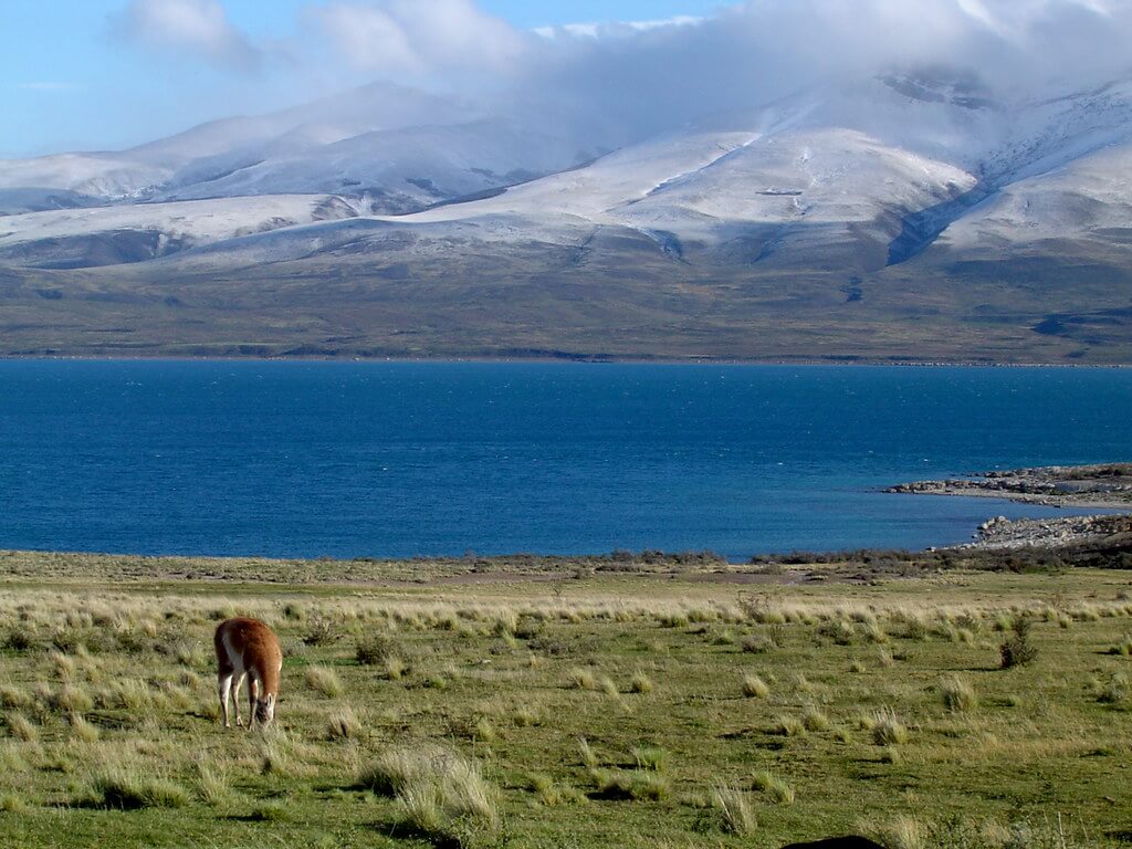
Patagonia's Pacific Realm: Chile's Southern Frontier from Andes to Ocean
Rising from the tempestuous waters of the Drake Passage to the glaciated peaks of the Southern Andes, Chilean Patagonia encompasses one of Earth's most spectacular and pristine wilderness regions. Stretching across approximately 240,000 sq km (92,700 sq mi) of Chile's southernmost territories and home to fewer than 300,000 people, the region extends from the Bío Bío River in the north to Cape Horn in the south, creating a landscape of such dramatic beauty and ecological complexity that it has earned recognition as one of the planet's last great wilderness frontiers. From the labyrinthine fjords of the western archipelago to the towering granite spires of Torres del Paine, Chilean Patagonia presents an unmatched tapestry of natural wonders that continues to captivate scientists, adventurers, and conservationists from around the globe.
Geographic Framework and Natural Boundaries
Chilean Patagonia occupies the western portion of the greater Patagonian region, bounded by the Pacific Ocean to the west and the Andean watershed divide to the east. The region encompasses three administrative divisions: parts of the Araucanía, Los Ríos, and Los Lagos regions in the north, and the complete territories of Aysén del General Carlos Ibáñez del Campo (population approximately 103,000) and Magallanes y de la Antártica Chilena (population approximately 178,000) in the south—together accounting for the great majority of the region's landmass but only a small fraction of its population, most of which is concentrated in Punta Arenas, Coyhaique, and Puerto Natales.
The Andes Mountains form the region's eastern backbone, creating a continental divide that separates Pacific and Atlantic drainage systems. Unlike the rain shadow effect that characterizes eastern Patagonia, the western slopes receive abundant precipitation from Pacific weather systems, creating some of the world's most extensive temperate rainforests and supporting the largest ice fields outside the polar regions.
The coastline extends for over 4,000 km (2,485 mi) when including the countless islands, peninsulas, and fjords that characterize the western archipelago. This intricate geography, carved by glacial action over millions of years, creates a maritime landscape of extraordinary complexity where land and sea intermingle in patterns of stunning natural beauty.
Geological Heritage and Landscape Formation
The Patagonian Andes mark the southern terminus of the Andean orogeny, formed over millions of years as the Nazca and Antarctic plates subduct beneath the South American plate. The Patagonian Batholith, a massive granite intrusion extending over 1,600 km (994 mi) from north to south, underlies many of the region's most iconic landscapes, including the granite towers of Torres del Paine and the Fitz Roy massif.
Volcanic activity has played a crucial role in shaping the northern portions of Chilean Patagonia, where active volcanoes continue to influence local geography and ecology. The Liquiñe-Ofqui fault zone, extending from Valdivia to the Taitao Peninsula, represents one of South America's most significant geological features, controlling the alignment of major lakes, rivers, and volcanic centers throughout the region.
The Northern and Southern Patagonian Ice Fields constitute the largest temperate ice masses in the Southern Hemisphere, covering approximately 16,800 sq km (6,487 sq mi) within Chilean territory. These ice fields feed numerous outlet glaciers that flow both eastward toward Argentina and westward toward the Pacific Ocean, creating some of the world's most spectacular glacial landscapes. The Southern Patagonian Ice Field alone contains 48 major glaciers, including Glaciar Pío XI, the largest glacier in South America outside Antarctica, measuring approximately 64 km (40 mi) in length. These glacial systems continue to actively shape the landscape through erosion, deposition, and isostatic rebound, creating the deep fjords, U-shaped valleys, and hanging valleys that characterize much of Chilean Patagonia.
The western coast presents one of the world's most complex fjord systems, created by glacial carving and subsequent sea-level rise. Major fjords such as the Última Esperanza, Seno Skyring, and Estrecho de Magallanes penetrate deep into the continental landmass, creating protected waterways that support unique marine ecosystems. The archipelago region south of the Taitao Peninsula contains thousands of islands, ranging from substantial landmasses like Isla Grande de Tierra del Fuego to tiny rocky islets exposed only at low tide. The Strait of Magellan, connecting the Atlantic and Pacific oceans, is the region's most significant waterway, providing a protected passage for maritime traffic while supporting rich marine biodiversity.
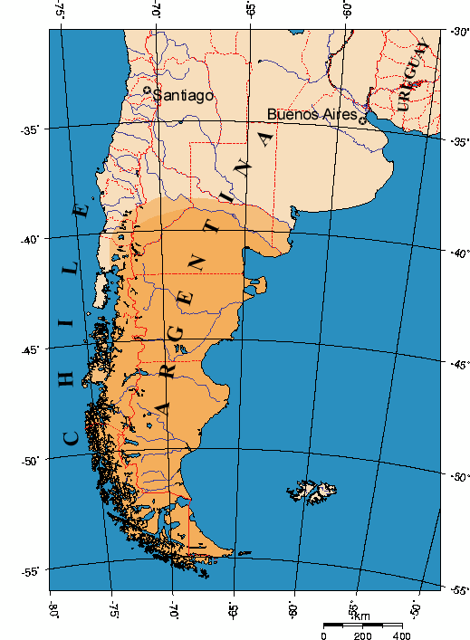
Map of Patagonia.
Climate Systems and Environmental Patterns
Chilean Patagonia experiences some of the most extreme and variable weather conditions on Earth, driven by its position in the path of persistent westerly winds and cyclonic storm systems. The western coastal regions experience a hyperoceanic climate characterized by high precipitation, moderate temperatures, and persistent cloud cover. Annual rainfall along the western slopes of the Andes can exceed 7,000 mm (276 in), creating conditions that support extensive temperate rainforests dominated by southern beech species and endemic conifers. Temperature variations remain relatively moderate due to oceanic influences, with summer maximums rarely exceeding 18°C (64°F) and winter minimums seldom dropping below -5°C (23°F) at sea level. However, wind speeds regularly exceed 100 km/h (62 mph), with recorded gusts over 250 km/h (155 mph) in exposed locations, creating some of the most challenging weather conditions for human activity anywhere on Earth.
Eastern valleys and areas in the rain shadow of the Andes experience a more continental climate, with reduced precipitation and greater temperature extremes, supporting steppe vegetation similar to that of Argentine Patagonia, though these areas remain significantly more humid than their trans-Andean counterparts due to their closer proximity to oceanic moisture sources. This transition occurs over remarkably short distances, with precipitation dropping from over 3,000 mm (118 in) annually to less than 500 mm (20 in) within 100 km (62 mi), creating exceptional ecological diversity within relatively small geographic areas.
Ecosystems and Biodiversity
Chilean Patagonia contains some of the world's most extensive and pristine temperate rainforests, dominated by endemic tree species that have survived since the breakup of the Gondwana supercontinent. The Valdivian temperate rainforest, extending from central Chile into northern Patagonia, supports extraordinary biodiversity and endemism levels comparable to tropical rainforests. Ancient tree species, including the alerce (Fitzroya cupressoides), with some specimens exceeding 3,000 years old, create forest ecosystems of remarkable complexity. These forests provide habitat for numerous endemic and threatened species, including the huemul or South Andean deer (Hippocamelus bisulcus), the world's smallest deer species, the southern pudú (Pudu puda), and the endangered Darwin's fox (Lycalopex fulvipes), found only in a handful of forest fragments in Chile. The understory of these rainforests supports dense populations of ferns, mosses, and epiphytic plants, creating multilayered ecosystems of extraordinary biological richness, and many plant species here remain scientifically undescribed.
Above the treeline, Chilean Patagonia supports alpine and subalpine ecosystems adapted to extreme wind, cold, and short growing seasons—a very different environment from the puna and páramo grasslands found much further north in the central Andes, and home to a distinct set of species. Cushion plants such as Azorella species, hardy alpine grasses, and specialized shrubs dominate these windswept environments. The guanaco (Lama guanicoe), Patagonia's characteristic wild camelid, grazes across both alpine meadows and the steppe below, while the Andean condor (Vultur gryphus) rides the region's fierce winds overhead and the culpeo fox (Lycalopex culpaeus) hunts across the same open ground. These high-elevation zones serve as critical watersheds for major river systems while providing habitat for species adapted to conditions found almost nowhere else on the continent.
The complex fjord systems and coastal waters of Chilean Patagonia support extraordinary marine biodiversity. Cold, nutrient-rich waters upwelling from the deep ocean create highly productive marine ecosystems that support everything from microscopic phytoplankton to massive baleen whales. Blue whales, the largest animals ever to exist on Earth, feed in Chilean Patagonian waters during the summer months, taking advantage of abundant krill populations, while sei whales, fin whales, and southern right whales also utilize these waters for feeding and migration, making Chilean Patagonia one of the world's premier whale-watching destinations. Seabird diversity reaches exceptional levels, with species ranging from tiny storm petrels to massive wandering albatrosses, and the region supports significant breeding populations of Magellanic penguins (Spheniscus magellanicus), cormorants, and various gull species, serving as a critical stopover point for numerous migratory seabirds.
Cultural Heritage and Human Occupation
Chilean Patagonia's human history spans over 10,000 years, beginning with Indigenous groups who developed sophisticated adaptations to the region's challenging maritime environment. The Kawésqar (Alacaluf) and Yahgan (Yámana) peoples dominated the southern archipelago, developing nomadic maritime cultures based on specialized watercraft technology and the exploitation of marine resources. These groups constructed lightweight bark canoes capable of navigating the treacherous waters of the fjord systems while carrying entire families and their possessions, and archaeological evidence suggests they maintained extensive trade networks throughout the archipelago.
The Selk'nam people inhabited the grasslands of Tierra del Fuego, developing terrestrial hunting cultures focused on guanaco exploitation and maintaining complex social structures centered on their relationship with the land. European contact beginning in the 16th century dramatically disrupted these Indigenous societies through disease, cultural suppression, and territorial displacement.
Portuguese navigator Ferdinand Magellan's transit of the strait bearing his name in 1520 initiated European awareness of Chilean Patagonia, though systematic exploration did not begin until the 18th and 19th centuries. The California Gold Rush of 1849 brought increased maritime traffic through the Strait of Magellan, leading to the establishment of Punta Arenas as a crucial resupply port, while the discovery of gold in Tierra del Fuego during the 1880s attracted thousands of prospectors and created boom towns that persisted for decades. European immigration, particularly from Croatia, Scotland, and Germany, established agricultural and pastoral enterprises throughout the region, introducing sheep ranching on a massive scale and creating the economic foundation for modern Patagonian society.
Economic Development and Natural Resources
Sheep ranching became the dominant economic activity throughout much of Chilean Patagonia by the early 20th century, with some estancias covering areas exceeding 100,000 hectares (247,000 acres). Cattle ranching developed in areas with more favorable climate conditions, particularly in northern Patagonia, and modern ranching operations increasingly focus on sustainable land management practices that balance productivity with ecosystem conservation.
Salmon aquaculture has emerged as one of the region's most significant economic sectors, concentrated in the sheltered fjords of Los Lagos, Aysén, and Magallanes. Chile is the world's second-largest salmon producer after Norway. The industry generates substantial regional employment and export revenue, though environmental concerns regarding antibiotic use, farmed-fish escapes that compete with and hybridize native species, and nutrient pollution linked to algal blooms have led to increased regulation and improved management practices in recent years, a tension that runs directly against the same fjord ecosystems that support the region's whale and seabird populations.
The extensive temperate rainforests of Chilean Patagonia contain valuable timber resources, though environmental concerns and protected area designations have limited large-scale commercial exploitation; sustainable forestry operations focus on native species management and ecosystem restoration rather than plantation development, and the ancient alerce forests receive special protection, with commercial harvest prohibited throughout most of their range. Coal mining in the Magallanes region historically provided energy for early settlements and steamship operations. However, production has declined significantly, while hydroelectric potential remains largely undeveloped due to environmental concerns and the technical challenges posed by the region's remote location. Wind energy development shows considerably greater promise, with the same relentless westerlies that make the region so difficult for human habitation offering some of the highest-capacity-factor wind resources anywhere on Earth.
Tourism has grown into an increasingly important pillar of the regional economy: Torres del Paine National Park alone now draws close to 300,000 visitors annually, generating significant revenue for local communities while raising global awareness of conservation needs. Adventure tourism—trekking, mountaineering, kayaking, and wildlife viewing—has created new economic opportunities in remote areas through eco-lodges, expedition services, and outdoor recreation facilities.
Conservation Challenges and Environmental Protection
Chilean Patagonia contains an extensive network of national parks, national reserves, and other protected areas that together cover approximately 51% of the region's total area, including Torres del Paine National Park, Bernardo O'Higgins National Park, and Alberto de Agostini National Park. Much of this network has been unified under the Route of Parks (Ruta de los Parques), a 2,800 km (1,740 mi) conservation corridor running from Puerto Montt to Cape Horn that links 17 national parks and protects approximately 11.8 million hectares (28 million acres). The corridor emerged from the largest private land donation in conservation history, when Tompkins Conservation transferred over 400,000 hectares (1 million acres) of former ranchland to the Chilean state, matched by government contributions of 3.6 million hectares (9 million acres) of additional protected land. In November 2025, Rewilding Chile and Tompkins Conservation donated a further 127,000 hectares (314,000 acres) around the southernmost point of continental South America to establish Cape Froward National Park, the 16th park the organization has helped create.
Even so, the region's protected status has not made it immune to damage. In late 2011 and early 2012, a fire started by a tourist burned roughly 17,000 hectares within Torres del Paine National Park—about 7% of its total area—closing the park for weeks and permanently altering sections of the French Valley and the shores of Lake Pehoé, a reminder that the native Nothofagus forests here recover on a timescale of a century or more, not years. Conservation efforts specifically targeting the huemul, whose population across Chilean Patagonia numbers only in the low thousands, have advanced through the National Huemul Corridor, established in 2024 to reconnect isolated populations across the region and enable the genetic exchange essential to the species' long-term survival; a previously undocumented huemul subpopulation was discovered at Cape Froward in 2025, underscoring how much of the region's biodiversity remains only partially mapped.
Climate change poses further threats to Chilean Patagonian ecosystems, with rising temperatures accelerating glacial retreat throughout the region; the Northern and Southern Patagonian Ice Fields have experienced measurable mass loss over recent decades, contributing to global sea level rise while altering regional hydrology. Changing precipitation patterns affect both natural ecosystems and human communities, and marine ecosystems face additional pressure from ocean acidification and shifting current patterns. International cooperation with Argentina through transboundary conservation initiatives increasingly addresses ecosystem protection needs that cross national boundaries, focusing on species conservation, habitat connectivity, and coordinated management of shared natural resources.
Future Prospects and Regional Development
Chilean Patagonia faces complex challenges as global environmental change interacts with rising economic development pressure and growing international recognition of the region's conservation value. Sustainable tourism development presents significant opportunities for economic growth aligned with conservation objectives. However, infrastructure development must proceed carefully to avoid compromising the pristine conditions that make the region attractive to visitors in the first place. The expansion of renewable energy systems, particularly wind power, could provide economic opportunities while reducing dependence on fossil fuels, and international cooperation and investment in conservation, research, and sustainable development will likely play an increasingly important role in determining the region's trajectory. The successful integration of economic development with environmental stewardship could establish Chilean Patagonia as a global model for sustainable development in pristine natural environments.
Conclusion
Chilean Patagonia represents one of Earth's most extraordinary wilderness regions, combining pristine temperate rainforests, massive ice fields, and complex fjord systems within a landscape of unparalleled natural beauty. Human occupation here reflects remarkable adaptability, from Indigenous maritime cultures that thrived for millennia in challenging conditions to modern communities balancing traditional livelihoods with contemporary economic opportunities, and the region's conservation story—anchored by the Route of Parks and its continued expansion—demonstrates both the scale of what is achievable and how much work remains. The future of Chilean Patagonia depends on the successful integration of conservation with sustainable development, ensuring that its extraordinary natural and cultural resources remain intact for future generations while providing meaningful economic opportunities for those who call it home today.