Latest Entries

Tijuca National Park: Rio's Replanted Forest

Tijuca National Park is a large block of Atlantic Forest rising from central Rio de Janeiro, with granite peaks, waterfalls, old coffee-estate ruins, and the statue of Christ the Redeemer on its slopes. Most of the forest is not original. It was cut for coffee, sugarcane, and fuel in the 18th and early 19th centuries, then deliberately replanted to protect the city's water supply, making it one of the best-known examples of urban forest restoration in the world. Its animals were later lost and are now being returned one species at a time.
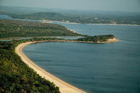
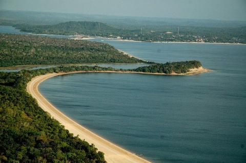
The Tapajós River: A Clearwater Giant Under Pressure

The Tapajós is one of the Amazon's largest tributaries and a major clearwater river. It forms in west-central Brazil where the Juruena and Teles Pires rivers meet, then flows north and northeast to join the Amazon River. Its basin covers the Amazon's southern edge, where ancient crystalline rock, rainforest and the northern margin of the Cerrado meet. The river carries Indigenous homelands, some of the Amazon's most active gold-mining frontier, a rapidly growing soy and corn waterway, and a long list of planned dams.

Alter do Chão and Santarém: Where the Tapajós Meets the Amazon

Alter do Chão is a village in western Pará, where the clear waters of the Tapajós River meet a white-sand shoreline and the Amazon forest. Each dry season, the river retreats, exposing long freshwater beaches that have earned the village the nickname "Amazon Caribbean." It also has deep roots: a Borari settlement before the Portuguese arrived, a Jesuit mission, a river port in the rubber era, and home to the Sairé, one of the Amazon's oldest folk festivals. Today it faces the pressures common to the region, including drought, fire, and land speculation.

The Federal District of Brazil: Capital Territory on the Highland Divide

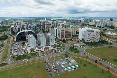
The Federal District (Distrito Federal) surrounds and includes Brasília, and it is unlike any other political unit in Brazil. At 5,760 km², it is the country's smallest federal unit, yet it is home to about 2.8 million people as of the 2022 census, has the highest per-capita income in Brazil, and houses the three branches of the national government. It is neither a state nor a municipality but a hybrid that exercises both powers, set on a Cerrado plateau where the headwaters of three major river basins divide.

Brasília: A Modernist Utopia in the Heart of Brazil

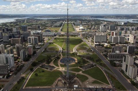
Brasília is Brazil's federal capital and the seat of its government. Founded in 1960 on a high plateau in the Brazilian Highlands, it was built from scratch in just 41 months to move the country's center of power inland from the coast. Designed by Lúcio Costa and Oscar Niemeyer, it is one of the most ambitious planned cities of the twentieth century and has been a UNESCO World Heritage Site since 1987. The capital is the center of the Federal District, home to about 2.8 million people, and is the third-largest city in Brazil.

Rio de Janeiro: Urban Splendor Between Mountain and Sea

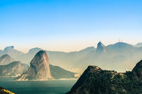
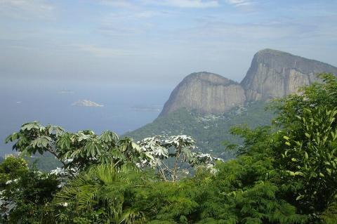
Rio de Janeiro is Brazil's best-known city and the capital of the state that shares its name. It lies on the Atlantic coast at the entrance to Guanabara Bay, where steep granite peaks, tropical forest, and long white beaches meet in a single city of 6.2 million people, with nearly 14 million in its metropolitan area. It was the capital of Portuguese Brazil, the Brazilian Empire, and the Republic until 1960, and it remains the country's second-largest city by population and its leading international destination.

Salvador de Bahia: Brazil's First Capital and the Heart of Afro-Brazilian Culture

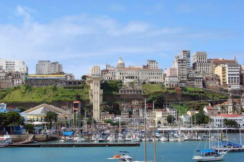
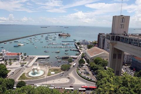
Salvador de Bahia, officially São Salvador da Bahia de Todos os Santos, is Bahia's capital and the cultural heart of Brazil's Northeast. Founded in 1549 on a peninsula between Todos os Santos Bay and the Atlantic Ocean, it was the capital of colonial Brazil for more than two centuries and remains one of the country's largest cities. Its predominantly Afro-Brazilian population gives it a distinctive character, while its historic colonial center is a UNESCO World Heritage Site.

Todos os Santos Bay: Bahia's Island-Studded Inland Sea

Nestled along Brazil's eastern coast, Todos os Santos Bay, also known as All Saints Bay, is a captivating natural harbor that has played a pivotal role in the region's history and development. As Brazil's largest bay, it surrounds the vibrant city of Salvador de Bahia, the capital of the state of Bahia. It serves as both a geographical landmark and a cultural icon. With deep historical roots and rich ecological diversity, this expansive bay remains a central feature of Bahia's coastal landscape.

Lakes Poopó and Uru Uru and the Desaguadero River: Bolivia's Vanishing Waters

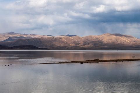
Bolivia's Altiplano, a vast highland plateau surrounded by the towering Andes, once supported a network of important water bodies that sustained ecosystems and communities. Among these were Lake Poopó and Lake Uru Uru, two saline lakes that formed part of an interconnected hydrological system fed by the Desaguadero River. However, recent environmental changes have caused these lakes to shrink or disappear entirely, leaving a landscape marked by ecological decline.

Vicente Pérez Rosales National Park: Chile's Oldest Park Between Volcanoes and Lakes

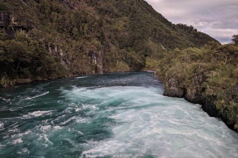
Vicente Pérez Rosales National Park, Chile's first, is named in honor of Vicente Pérez Rosales, a revered Chilean politician and diplomat. It encompasses an expansive area within the Lakes Region of the Chilean Andes and is renowned for its breathtaking and diverse landscapes. It hosts the iconic Lake Todos Los Santos and the Petrohué Waterfalls, surrounded by Valdivian temperate rainforests, a sanctuary for numerous plant and animal species.