
The Patagonian and Fuegian Andes: Spine of the World's End
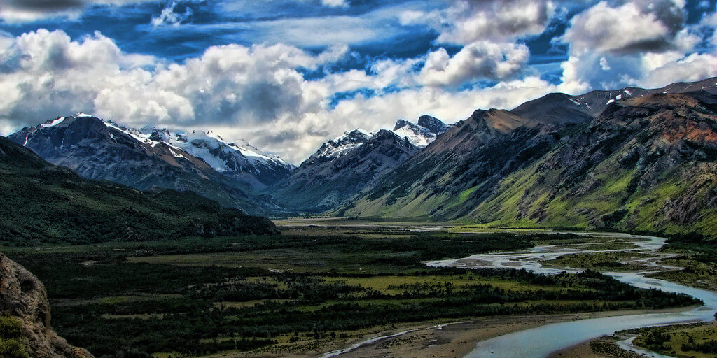
Rising from the steppes of southern Argentina and Chile, the Patagonian and Fuegian Andes form a spectacular and complex mountain system. This southern extension of the Andean chain features dramatic landscapes, towering granite spires, ancient ice fields, and active volcanic peaks.
Where Continents Collide: The Geological Drama of the Southern Andes
Rising from the vast steppes of southern Argentina and Chile like a serrated blade cleaving sky from earth, the Patagonian and Fuegian Andes represent one of the most spectacular and geologically complex mountain systems on the planet. This southern extension of the mighty Andean chain, stretching from approximately 37°S latitude to the very tip of South America at 56°S, encompasses some of the most dramatic landscapes on Earth—towering granite spires, ancient ice fields that rival those of Greenland in scale, and volcanic peaks that continue to reshape the continent through ongoing tectonic activity.
Tectonic Theater: The Nazca Plate's Relentless Advance
The Patagonian and Fuegian Andes owe their existence to the ongoing collision between the Nazca Plate and the South American Plate. Subduction along this margin has occurred in some form for roughly 200 million years, but the dramatic uplift that built the peaks visible today is far younger: the great majority of it occurred over the past 25 to 45 million years, with the most rapid phase of mountain-building concentrated in just the last 10 million years, as the dense oceanic Nazca Plate has plunged into the mantle beneath the lighter continental crust, generating the heat, pressure, and compressive uplift that continue to raise the range today.
The complexity of this tectonic system becomes even more pronounced in the far south, where the Antarctic Plate enters the equation. The Chile Triple Junction, off the coast of southern Chile, marks the point where the Nazca, Antarctic, and South American plates converge. This triple junction has migrated northward over millions of years, leaving behind a trail of geological complexity that helps explain the distinctive character of the Fuegian Andes.
The Patagonian Batholith: A Granite Heart
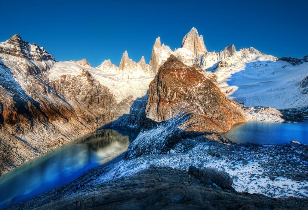
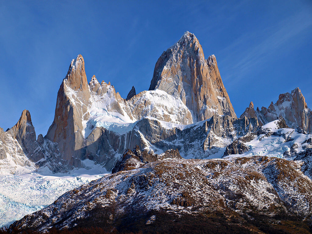
Beneath the peaks and glaciated valleys of the Patagonian Andes lies one of the world's largest granite intrusions—the Patagonian Batholith, extending over 1,800 km (1,118 mi) from north to south. Formation began during the Cretaceous Period, approximately 140 million years ago, as repeated episodes of magma intrusion created vast chambers of molten rock deep beneath the surface. As this magma cooled and crystallized, it formed the granite that now comprises the backbone of the range; subsequent uplift and erosion exposed these granite cores, creating the dramatic spires and walls that characterize peaks like Fitz Roy, Cerro Torre, and the Torres del Paine.
The quality of Patagonian granite has made it legendary among rock climbers and mountaineers worldwide. Its exceptional strength, fine-grain structure, and resistance to weathering create climbing conditions virtually unmatched anywhere else on Earth, while feldspar minerals within the rock give many Patagonian peaks their distinctive orange and pink hues, particularly striking at sunrise and sunset.
Volcanic Landscapes: Fire Mountains of the South
While granite dominates the central Patagonian Andes, volcanic activity has played an equally important role in shaping the region, particularly in the northern Patagonian Andes and the transition zone toward the Fuegian ranges. Volcán Lanín, straddling the Chile-Argentina border, exemplifies this volcanic character: this symmetrical stratovolcano, rising 3,776 m (12,388 ft), has shaped the surrounding landscape through repeated eruptions over the past 600,000 years, its fertile volcanic soils supporting some of the region's most productive forests and agricultural areas.
Further south, the Austral Volcanic Zone, extending from approximately 49°S to 55°S, represents the southernmost active volcanic region in the world. Here, volcanoes such as Monte Burney and Reclus continue to erupt periodically, a reminder that the Patagonian Andes remain a dynamic, evolving mountain system rather than a static geological feature.
The Great Ice: Glacial Sculptors of Stone
The Patagonian Ice Fields: Antarctica's Northern Siblings
The Patagonian Andes contain the largest concentration of ice outside the polar regions. The Northern Patagonian Ice Field (Campo de Hielo Norte) and the Southern Patagonian Ice Field (Campo de Hielo Sur) together cover approximately 17,000 sq km (6,563 sq mi), ranking among the largest ice fields on Earth outside Antarctica and Greenland. These fields are remnants of a much larger ice sheet that covered vast portions of Patagonia during the Pleistocene, extending at its maximum reach far into the modern Argentine pampas and carving the deep valleys and fjords that define the region's topography today.
The Southern Patagonian Ice Field, the larger of the two, stretches approximately 350 km (217 mi) from north to south and reaches widths of up to 80 km (49 mi). This massive ice sheet feeds numerous outlet glaciers flowing both eastward toward Argentina and westward toward the Pacific in Chile, with its highest point, Cerro Argentino at 3,405 m (11,171 ft), serving as the primary collecting area for the snow that ultimately becomes ice and flows outward through the glacier system.
Glacial Dynamics: Rivers of Ice in Motion
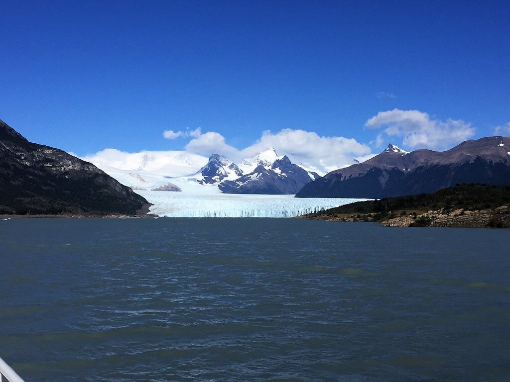
Glaciar Perito Moreno, perhaps the most famous glacier in South America, offers a rare example of relative glacial stability amid regional retreat, flowing from the Southern Patagonian Ice Field into Lago Argentino. Its terminus, rising 70 m (229 ft) above the lake surface with a further 170 m (557 ft) submerged, periodically forms a natural ice dam across the lake's southern arm; the resulting pressure buildup eventually ruptures the dam in a dramatic rupture-and-flood cycle that recurs roughly every four to six years, giving scientists a natural laboratory for studying glacial dynamics.
Other glaciers in the region tell a starker story of retreat. Glaciar Upsala, the largest glacier flowing from the Southern Patagonian Ice Field, has lost approximately 3 km (1.86 mi) of length since 1990, exposing new valleys and creating opportunities for ecological succession as plants and animals colonize newly deglaciated terrain.
The Fuegian Ice Cap: Remnant of Ancient Cold
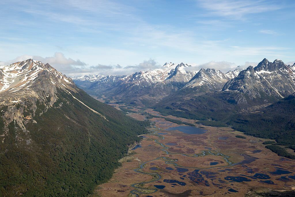
The Fuegian Andes contain their own significant ice masses. The Cordillera Darwin, the primary mountain range of Tierra del Fuego, supports numerous glaciers flowing from interior ice fields toward both the Atlantic and Pacific Oceans. Though smaller than their Patagonian counterparts, many flow directly into the sea as tidewater glaciers, calving icebergs into the region's fjords and channels and creating unique marine environments in the surrounding cold, nutrient-rich waters.
Fuegian glacial retreat over the past century has been particularly dramatic, with many glaciers losing 50% or more of their length since 1900—a faster proportional retreat than most of their Patagonian counterparts further north, likely owing to the Cordillera Darwin's lower average elevation and correspondingly greater sensitivity to rising temperatures.

Topographic map of the Fuegian Andes.
Climate: Where Extremes Converge
The Westerlies: Atmospheric Rivers of the Southern Ocean
The climate of the Patagonian and Fuegian Andes is dominated by the Southern Hemisphere's westerly wind belt, generating some of the most extreme weather conditions on Earth. These persistent westerlies, flowing unobstructed around the Southern Ocean, carry enormous moisture from the Pacific and deposit it on the western slopes of the Andes as rain and snow, producing some of the most dramatic precipitation gradients on the planet: the western slopes receive between 2,000 and 8,000 mm (78 and 315 in) of precipitation annually, while areas just 100 km (62 mi) to the east may receive less than 200 mm (7.8 in). This extreme gradient creates a landscape mosaic in which temperate rainforest gives way to arid steppe within remarkably short distances.
These same winds regularly exceed 100 km/h (62 mph), with gusts approaching 200 km/h (124 mph) during severe storms, sometimes persisting for days at a stretch and making weather prediction notoriously difficult for the region's mountaineers.
Seasonal Extremes and Microclimates
The high latitude of the Patagonian and Fuegian Andes creates dramatic seasonal variation in daylight, with the austral summer bringing up to 18 hours of light and the austral winter reducing daylight to as little as 4 hours in the far south. The extended summer daylight allows southern beech (Nothofagus spp.) forests to thrive at latitudes and elevations where the treeline would typically sit much lower, creating forest ecosystems adapted to the region's extreme light regime.
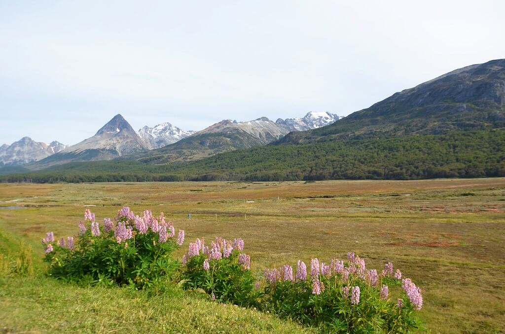
The range's complex topography also produces sharply localized microclimates: protected valleys may experience mild, almost Mediterranean-like conditions, while exposed ridges just a few hundred meters away endure near-arctic wind and snow cover year-round. These variations have real consequences for biodiversity, isolating small populations that have adapted to highly specific local conditions and driving unusually high levels of endemism within a relatively compact geographic area.
Biodiversity: Life at the Limits
The Patagonian and Fuegian Andes display classic vertical zonation, compressing into a single mountainside the kind of ecological transition that elsewhere unfolds over thousands of kilometers of latitude. At the lowest elevations, temperate rainforest dominated by southern beech supports diverse communities of epiphytes, ferns, and understory plants, along with the Magellanic woodpecker (Campephilus magellanicus), the largest woodpecker in South America. With increasing elevation, forest gives way to open woodland, then to wind-stunted krummholz, and finally to alpine tundra dominated by cushion plants, hardy grasses, and specialized wildflowers adapted to intense UV radiation, extreme temperature swings, and near-constant wind.
Geographic isolation and harsh conditions have driven substantial endemism throughout the range. Chuquiraga, a genus of cushion plants, has radiated into numerous species adapted to different elevations and microclimates, exhibiting physiological adaptations that allow photosynthesis at extremely low temperatures and survival through severe winter dehydration. During the Pleistocene glaciations, small ice-free refugia—often in protected valleys or areas with geothermal activity—allowed plant and animal populations to persist through the harshest glacial conditions, and many of the region's endemic species today are thought to descend from populations that survived in exactly these refugia, a pattern that continues to inform how scientists think about where species might find refuge as the climate warms further.
Human Dimensions: Culture in the Shadow of Giants
Indigenous Peoples: First Mountain Dwellers
Long before European explorers reached the Patagonian and Fuegian Andes, Indigenous peoples had developed sophisticated relationships with these mountain environments. The Tehuelche people of the Patagonian steppes used the mountains as seasonal hunting grounds, following guanaco herds along traditional migration routes through mountain passes and valleys. In the Fuegian Andes, the Selk'nam (Ona) people developed hunting cultures adapted to the region's diverse ecosystems, their traditional grounds extending from the steppes of northern Tierra del Fuego to the forested valleys of the Cordillera Darwin. Many peaks held special significance within Indigenous cosmologies, serving as landmarks, sources of spiritual power, and burial sites, much of which was lost or disrupted through European colonization.
Modern Mountaineering: Vertical Pioneers
The Patagonian and Fuegian Andes have become legendary among mountaineers seeking to test themselves against some of the world's most technically demanding peaks. Cerro Fitz Roy, rising 3,405 m (11,171 ft) above the Patagonian steppe, combines vertical granite walls with Patagonia's notoriously violent weather to create one of the ultimate mountaineering challenges in South America; its first ascent in 1952, by French climbers Lionel Terray and Guido Magnone, marked the beginning of serious mountaineering development in the region. Cerro Torre, capped by a distinctive mushroom-shaped summit formed from wind-driven rime ice, presents an even more extreme challenge, and its climbing history has long been shadowed by controversy over disputed early ascents and the ethics of artificial aid on its hardest sections—debates that continue to shape broader conversations within the sport about the line between human ambition and natural limits.
Conservation: A Different Set of Pressures
Formal conservation infrastructure across the Patagonian and Fuegian Andes is markedly uneven. The northern and central Patagonian Andes now benefit from the extensive network of parks and rewilding initiatives detailed in our Chilean Patagonia and Argentine Patagonia articles, including Torres del Paine and Los Glaciares national parks. The Fuegian Andes and the Cordillera Darwin, by contrast, remain far less formally protected, their remoteness and lack of road access having historically served as a de facto safeguard rather than a designed one—an arrangement that leaves them more exposed than their northern counterparts should development pressure or tourism demand ever reach them at scale.
Glacial retreat remains the region's most consistent and best-documented environmental signal: the Northern and Southern Patagonian Ice Fields have together been among the largest single contributors to global sea-level rise from mountain glaciers over the past several decades, a consequence of the sheer volume of ice they hold rather than any unusual local rate of warming, and their continued mass loss provides one of the clearest, most closely monitored records of climate change available in the Southern Hemisphere.
Conclusion
The Patagonian and Fuegian Andes stand as one of the clearest illustrations on Earth of how tectonic collision, glacial sculpting, and evolutionary adaptation combine to build a landscape: granite raised by continental collision, carved by ice into some of the most technically demanding climbing terrain in the world, and populated by species that trace their present-day distribution directly back to where they survived the last ice age. The region's glaciers, meanwhile, offer one of the most direct and closely watched records of a warming climate available anywhere in the Southern Hemisphere. Together, the geology, the ice, and the life they support make this southern extension of the Andes not merely the continent's final mountainous frontier, but one of its most instructive.