The Geography of Bolivia: A Nation of Many Landscapes
Bolivia is one of the most geographically diverse countries in South America. It features extreme differences in elevation, climate, and ecosystems, including the Andes' snow-capped peaks, the Altiplano's high plateaus, the Amazon rainforests, and the Gran Chaco's dry lowlands.
 via Wikimedia Commons")

 via Wikimedia Commons")
 https://www.flickr.com/photos/10816734@N03/8054508371")
 https://www.flickr.com/photos/incacity/4661596601")

Bolivia's Unique Geography: A Journey Through Its Natural Regions
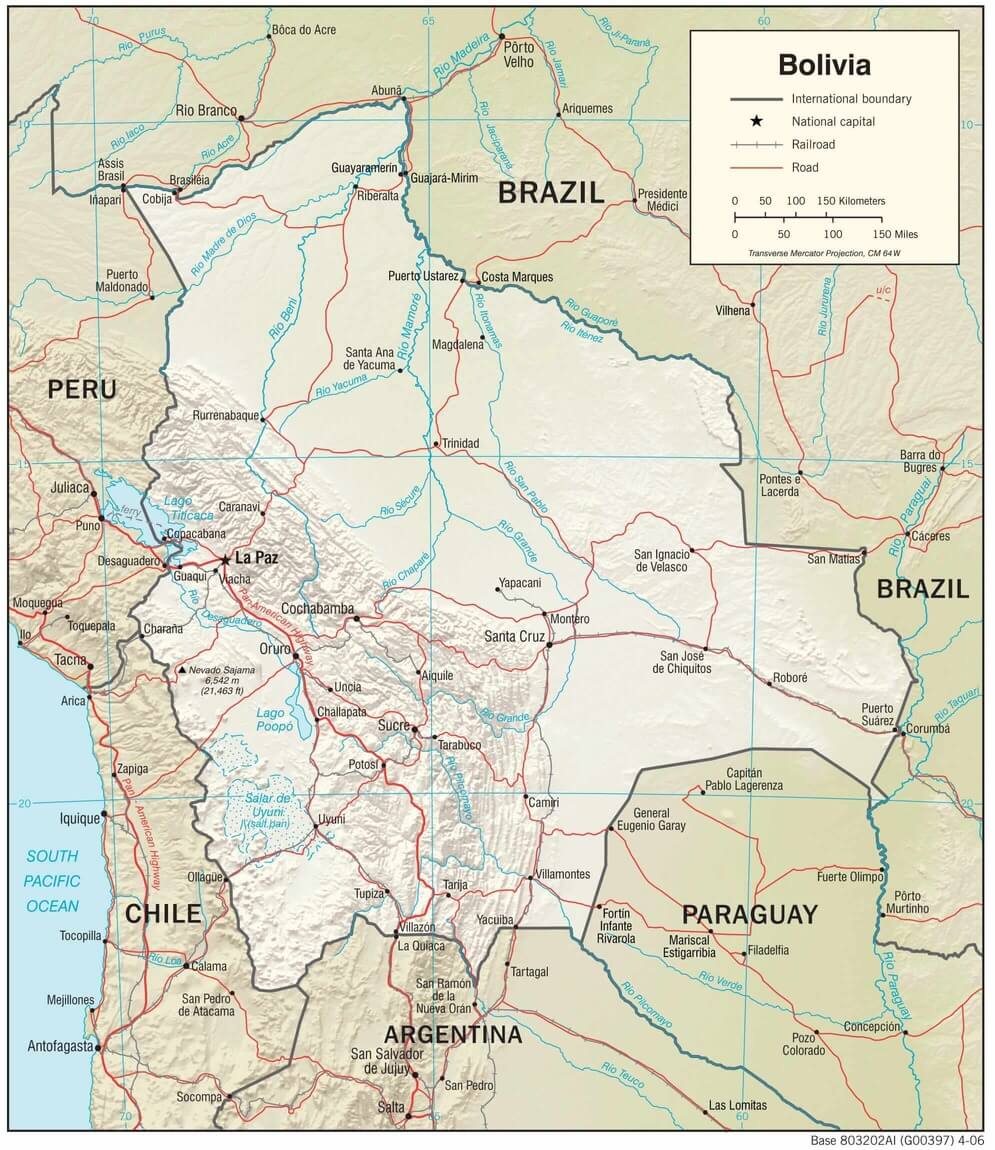
Bolivia, a landlocked country strategically positioned in the heart of South America, stands as one of the most geographically diverse nations on the continent. Spanning approximately 1.1 million square kilometers (424,000 square miles), Bolivia showcases dramatic contrasts in elevation, climate, and ecosystems that rival those of any country in the world. From the snow-capped peaks of the Andes, which soar above 6,000 meters (19,685 feet), and the expansive high-altitude plateaus of the Altiplano to the dense Amazonian rainforests teeming with life and the arid lowlands of the Gran Chaco, Bolivia's varied landscapes have fundamentally shaped its cultural heritage, extraordinary biodiversity, and complex economic development patterns.
Bolivia's remarkable terrain has been sculpted by intricate geological processes spanning millions of years, including ongoing tectonic activity along the Pacific Ring of Fire, extensive glacial sculpting during ice ages, and persistent river erosion that continues to carve new valleys and canyons. The country sits at the convergence of several major geological formations: the ancient Brazilian Shield to the east, the relatively young Andean mountain system to the west, and the sedimentary basins that have filled with deposits from both regions. As a result, Bolivia's geography influences not only its abundant natural resources—including significant deposits of tin, silver, lithium, and natural gas—but also its complex human settlement patterns, diverse agricultural practices adapted to extreme conditions, and ambitious conservation efforts that protect some of the world's most pristine ecosystems.
Understanding Bolivia's landscapes requires a comprehensive examination of its major geographical regions, each possessing unique environmental characteristics, distinct cultural traditions, and specific economic opportunities and challenges.
A physiographic map of Bolivia.
The Andean Highlands: Bolivia's Mountainous Backbone
The westernmost region of Bolivia is dominated by the imposing Andes Mountains, which extend along the country's border with Chile and Peru as part of the world's longest continental mountain range. The Bolivian Andes consist of two major mountain ranges running roughly parallel to each other. The Cordillera Occidental, or Western Range, forms the natural border with Chile and contains several dormant and active volcanoes, including Mount Sajama, Bolivia's highest peak, at 6,542 meters (21,463 feet). This volcanic chain includes notable peaks such as Parinacota, at 6,348 meters (20,827 feet), and Pomerape, at 6,240 meters (20,472 feet), which together form the distinctive twin peaks known as Payachata.
The Cordillera Oriental, or Eastern Range, presents a more geologically complex landscape featuring ancient crystalline rocks, glacial valleys carved by retreating ice sheets, deep canyons cut by rushing rivers, and rugged peaks that challenge even experienced mountaineers. This range includes Illimani at 6,438 meters (21,122 feet), which dominates the skyline of La Paz, and Illampu at 6,368 meters (20,892 feet), both of which are considered sacred mountains by Indigenous communities.
Between these formidable mountain chains lies the Altiplano, a vast high-altitude plateau that averages 3,600 meters (11,800 feet) above sea level and extends for approximately 800 kilometers (500 miles) from north to south. This region, covering roughly 105,000 km² (40,540 mi²), represents the most densely populated area in Bolivia, containing major urban centers such as La Paz (the world's highest capital city at 3,500 meters or 11,500 feet), El Alto (4,150 meters or 13,615 feet above sea level), and the mining city of Oruro. Despite its harsh climate characterized by frigid nights that can drop to -20°C (-4°F), intense solar radiation during the day, and strong winds exceeding 60 km/h (37 mph), the Altiplano supports significant agricultural activity.
The region's agricultural systems have been refined over millennia, particularly the cultivation of native potatoes (with over 200 varieties grown locally), quinoa (which originated in this region), barley, and broad beans. Traditional terracing systems, known as "andenes," maximize arable land on steep slopes while preventing erosion. The Altiplano is also home to domesticated llamas and alpacas, which have been essential to Andean economies for over 4,000 years, providing wool, meat, and serving as pack animals capable of carrying loads up to 30 kilograms (66 pounds) across difficult terrain.
Lake Titicaca, the largest lake in South America by volume, represents one of Bolivia's most significant geographical and cultural features. Located at 3,812 meters (12,507 feet) above sea level, this ancient lake covers 8,372 km² (3,232 mi²) and reaches maximum depths of 281 meters (922 feet), making it the highest navigable lake in the world. The lake holds profound cultural importance for the Indigenous Aymara and Quechua peoples, who consider it the birthplace of their civilization and the sun god Inti. The lake's waters moderate the local climate, creating a unique microenvironment that supports agriculture on its shores and sustains endemic species such as the Titicaca water frog.
Further south, the Salar de Uyuni, the world's largest salt flat, covers 10,582 km² (4,086 mi²) at an elevation of 3,656 meters (11,995 feet). Formed by the evaporation of prehistoric lakes approximately 40,000 years ago, this otherworldly landscape contains an estimated 10 billion tons of salt. It holds roughly 70% of the world's lithium reserves—a resource increasingly vital for battery technology and renewable energy storage. During the rainy season, a thin layer of water transforms the salt flat into a perfect mirror, creating one of the most photographed natural phenomena on Earth.
The Yungas: A Bridge Between Mountains and Rainforests
As the Andes descend eastward into the lowlands, they form the Yungas, a transitional zone of steep forested valleys that serves as a crucial ecological bridge between the high-altitude Altiplano and the tropical Amazon Basin. This region, covering approximately 40,000 km² (15,444 mi²), is characterized by humid, subtropical conditions with frequent rainfall exceeding 1,500 mm (59 inches) annually, creating an extraordinarily lush and biodiverse environment. The dramatic elevation changes—from 4,000 meters (13,123 feet) to 500 meters (1,640 feet) over relatively short distances—create multiple microclimates and ecological niches within a compact area.
The Yungas' cloud forests, perpetually shrouded in mist and fog, are home to numerous endemic plant and animal species, including spectacled bears (South America's only bear species), jaguars, pumas, and the vibrant Andean cock-of-the-rock birds. The region harbors over 3,000 plant species, including numerous orchids, bromeliads, and ferns that have adapted to the constant moisture and filtered sunlight. The forest canopy creates a complex three-dimensional habitat supporting hundreds of bird species, making it a premier destination for ornithologists and ecotourists.
The steep terrain and volcanic soils of the Yungas, enriched by centuries of leaf litter and mineral deposits, have historically supported diverse agricultural systems. Coffee cultivation thrives in the region's ideal conditions, producing beans renowned for their complex flavor profiles. Cocoa plantations benefit from the humid climate and rich soils, while citrus fruits, avocados, and tropical fruits flourish in the warmer valleys. Most notably, coca has been cultivated here for over 3,000 years and remains an integral part of Andean culture, used traditionally for medicinal purposes, religious ceremonies, and as a mild stimulant to combat altitude sickness.
The region's cultural landscape reflects this agricultural diversity, with terraced hillsides, traditional farmsteads, and Indigenous communities maintaining ancestral knowledge of sustainable farming practices. However, the Yungas have also become a focal point of international attention due to debates surrounding coca cultivation and its potential connection to illicit drug production, creating complex social and political tensions that continue to influence regional development policies.
The Amazon Basin: Bolivia's Lush Rainforest
Spanning the northern and northeastern portions of Bolivia, the Amazon Basin encompasses dense rainforests, meandering rivers, extensive wetlands, and some of the most pristine wilderness areas remaining on the planet. This region spans more than 40 percent of the country's total land area—approximately 440,000 km² (169,884 mi²)—making it not only a vital component of Bolivia's ecological landscape but also a crucial part of the global climate system. With a consistently hot and humid climate, where temperatures range from 24°C to 32°C (75°F to 90°F) year-round and annual rainfall exceeds 2,000 mm (79 inches), the Bolivian Amazon sustains some of the highest levels of biodiversity on the planet.
The region supports an estimated 15,000 to 20,000 plant species, representing nearly 20% of all known plant species worldwide. The forest structure consists of multiple layers, ranging from the emergent canopy, which reaches heights of 50 meters (164 feet), to the understory, where specialized plants have adapted to low-light conditions. This vertical complexity creates numerous ecological niches, supporting an extraordinary array of wildlife, including over 1,000 bird species, 300 mammal species, and a vast variety of insects, reptiles, and amphibians.
The region encompasses several world-renowned protected areas, including Madidi National Park, which covers 18,958 km² (7,320 mi²) and is considered one of the most biologically diverse places on Earth. Scientists have documented over 8,000 vascular plant species within the park—more than exist in all of Europe—along with 1,370 vertebrate species. The park's incredible diversity stems from its elevation range, spanning from 180 meters (590 feet) to 6,044 meters (19,829 feet), which creates habitats ranging from tropical rainforests to high-altitude grasslands within a single protected area.
Another jewel of conservation is Noel Kempff Mercado National Park, a UNESCO World Heritage Site spanning 15,234 km² (5,882 mi²). This park features ancient sandstone plateaus, pristine forests, and extensive savannas, showcasing ecosystems that have remained largely unchanged for millions of years. The park's remote location and difficult access have preserved habitats for jaguars, giant otters, harpy eagles, and hundreds of other species, including numerous endemic plants and animals found nowhere else on Earth.
The Pilón-Lajas Biosphere Reserve and Communal Lands represent another significant conservation area, covering 4,000 km² (1,544 mi²) in the transition zone between the Andes and the Amazon lowlands. This unique protected area combines strict conservation zones with traditional Indigenous territories, demonstrating an innovative approach to biodiversity protection that respects Indigenous rights and traditional land management practices. The reserve protects critical habitats for endangered species while supporting the livelihoods of Tsimane and Mosetén communities, who have stewarded these lands for generations.
The region's river systems, dominated by the Mamoré and Beni rivers, serve as vital transportation corridors for both remote communities and wildlife. These rivers, along with numerous tributaries, form a complex network of waterways that flood seasonally, depositing nutrient-rich sediments and creating várzea forests that are adapted to periodic inundation. Traditional riverine communities have developed a sophisticated understanding of flood cycles, fish migration patterns, and sustainable resource management practices that have been passed down through generations.
Many Indigenous groups inhabit the Amazon region, including the Tsimane, Mosetén, and Tacana peoples, who maintain traditional ways of life closely tied to forest ecosystems. These communities possess invaluable knowledge of medicinal plants, sustainable hunting practices, and forest management techniques, which have enabled them to live in harmony with their environment for centuries. However, increasing pressure from deforestation, illegal logging, road construction, and agricultural expansion threatens both the ecological integrity of the region and the cultural survival of Indigenous communities.
The Gran Chaco: Bolivia's Arid Wilderness
In southeastern Bolivia, the Gran Chaco extends as a vast semi-arid plain characterized by dry forests, thorny scrubland, palm savannas, and scattered seasonal wetlands. This region, covering approximately 120,000 km² (46,332 mi²) of Bolivia's territory, is part of the larger Gran Chaco ecosystem that spans four countries and represents one of South America's most challenging yet ecologically important landscapes. The sparsely populated region experiences extreme temperature fluctuations, with summer temperatures regularly exceeding 40°C (104°F) and occasionally reaching 47°C (117°F), while winter nights can drop below 0°C (32°F).
The Chaco's vegetation has adapted to these harsh conditions through various strategies, including thick, waxy leaves to reduce water loss, extensive root systems to access groundwater, and thorny defenses against herbivores. The region's dry forests are dominated by quebracho trees, valued for their extremely hard wood and tannin content, along with various palm species that provide food and materials for local communities. During the brief rainy season, the landscape undergoes a dramatic transformation as ephemeral wetlands fill with water, supporting temporary populations of waterfowl and amphibians.
Despite its harsh climate, the Gran Chaco supports a remarkably diverse array of wildlife, including giant armadillos, Chacoan peccaries (discovered only in 1975), tapirs, jaguars, and pumas. The region serves as a crucial corridor for wildlife movement between the Amazon Basin and the Argentine Pampas, supporting species migration and genetic exchange. Over 500 bird species have been recorded in the Bolivian Chaco, including the endangered blue-throated macaw, found only in this region.
Indigenous communities, particularly the Ayoreo and Guaraní peoples, have demonstrated remarkable adaptation to the Chaco's challenges through sophisticated hunting techniques, knowledge of seasonal resource availability, and small-scale agriculture focused on drought-resistant crops. Traditional practices include the use of palm fruits, honey collection, and the cultivation of crops like corn, beans, and squash in carefully selected microclimates.
However, the region faces increasing pressure from cattle ranching and large-scale soybean cultivation, which have accelerated deforestation rates to among the highest in the world. Between 2000 and 2020, the Gran Chaco lost over 6 million hectares (14.8 million acres) of forest cover, threatening both wildlife habitats and Indigenous territories. Conservation efforts focus on establishing protected areas, promoting sustainable land use practices, and supporting Indigenous land rights as a means of forest protection.
The Pantanal: One of the world's Largest Wetlands
Eastern Bolivia encompasses a substantial portion of the Pantanal, one of the world's largest tropical wetlands, spanning approximately 140,000 square kilometers (54,054 square miles) across Bolivia, Brazil, and Paraguay. The Bolivian section encompasses approximately 15,000 km² (5,792 mi²) and plays a crucial role in regional hydrology, serving as a natural flood control system, a water filtration mechanism, and a biodiversity reservoir. This seasonally flooded ecosystem experiences dramatic annual cycles, with water levels fluctuating by up to 3 meters (10 feet) between wet and dry seasons.
During the rainy season (November to March), vast areas of the Pantanal become submerged under 1-2 meters (3-7 feet) of water, creating an aquatic wonderland that supports enormous populations of fish, caimans, capybaras, and giant otters. The flooding cycles are crucial for fish reproduction and plant growth, with many species synchronizing their life cycles to coincide with water level fluctuations. As waters recede during the dry season, nutrients concentrate in remaining pools, creating ideal conditions for wildlife observation and photography.
The Pantanal's relatively open landscape, in contrast to the dense forests of the Amazon, makes it one of the world's premier destinations for wildlife viewing. Visitors can easily observe jaguars, the largest cats in the Americas, along with hundreds of bird species, including the iconic hyacinth macaw, jabiru storks, and roseate spoonbills. The region supports the highest concentration of crocodilians in the Americas, with populations of both caimans and the rare black caiman.
The ecosystem's unique characteristics have attracted growing interest in ecotourism, providing economic opportunities for local communities while creating incentives for conservation. Traditional ranch operations, known as "fazendas," have begun incorporating wildlife tourism alongside cattle ranching, demonstrating that economic development and conservation can coexist when properly managed.
However, the Pantanal faces significant environmental challenges, including upstream deforestation that increases sediment loads and alters flood patterns, agricultural pollution from pesticides and fertilizers, and the impacts of climate change that may disrupt traditional flooding cycles. Recent severe droughts and unprecedented wildfires have highlighted the ecosystem's vulnerability to environmental changes, emphasizing the urgent need for regional conservation strategies.
Conclusion
Bolivia's geography represents a remarkable tapestry of landscapes, from the towering Andes that reach toward the heavens to the vast high-altitude plateaus where ancient civilizations flourished, and the dense Amazon rainforests that harbor unparalleled biodiversity. The country's arid lowlands, which are well-adapted to extreme conditions, are also a notable feature. These diverse environments have fundamentally shaped the country's complex economy, rich cultural heritage, and extraordinary biodiversity, creating a natural heritage that continues to influence every aspect of daily life for Bolivia's inhabitants.
The interconnections between these regions—through river systems, wildlife corridors, and cultural exchanges—demonstrate that Bolivia's geography functions as an integrated system where changes in one area can have cascading effects throughout the country. Climate change, deforestation, mining activities, and agricultural expansion pose significant challenges to maintaining the delicate balance between human development and environmental preservation.
Preserving Bolivia's unique ecosystems requires comprehensive strategies that address both local needs and global environmental concerns. These strategies include strengthening protected area management, supporting Indigenous land rights and traditional knowledge systems, promoting sustainable economic alternatives, and fostering international cooperation on transboundary conservation issues. The stakes could not be higher: Bolivia's landscapes represent not only national treasures but also crucial components of global climate regulation, biodiversity conservation, and cultural diversity that must be protected for the benefit of current and future generations.