
Lake Titicaca: Ancient Waters of the Andes
Lake Titicaca, at 3,812 m on the Peru-Bolivia border, is South America's largest lake by volume and the highest large lake in the world that carries commercial shipping. It hosts more than 530 aquatic species, many found nowhere else, and was sacred to both the Tiwanaku and the Inca, but record-low water levels and pollution now threaten it.
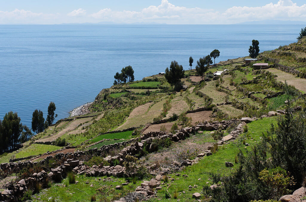
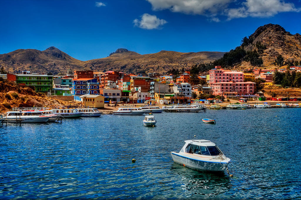
Lake Titicaca: Sacred Waters of the Tiwanaku and Inca, Under Pressure
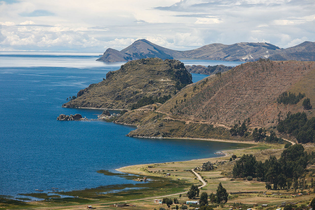
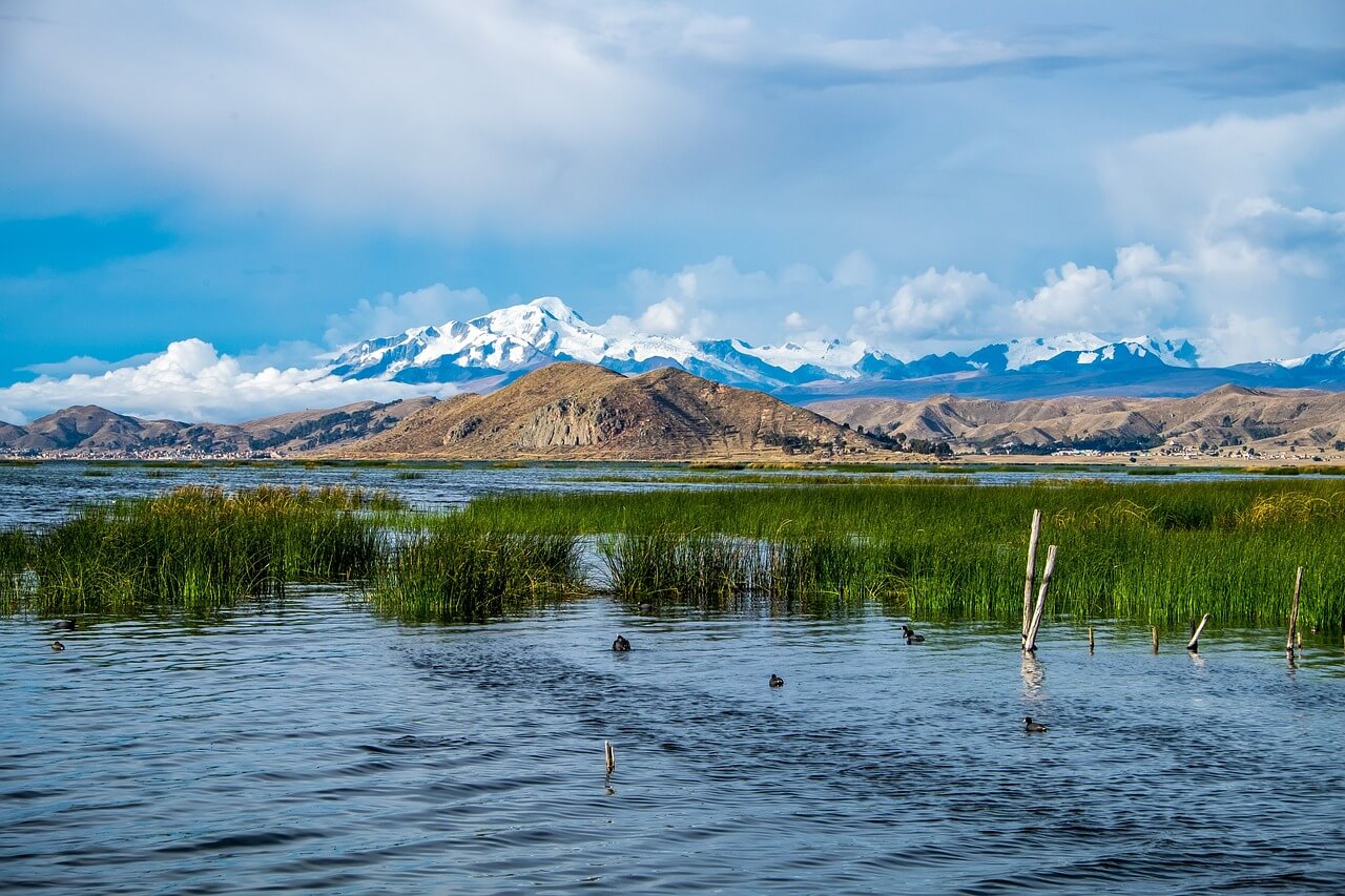
Lake Titicaca lies in the northern Altiplano, between Peru's Puno Region and Bolivia's La Paz Department, within the Central Andean wet puna. It covers 8,372 sq km (3,232 sq mi), stretches about 190 km (118 mi) from northwest to southeast, and is up to 80 km (50 mi) wide. With about 893 cubic km (214 cu mi) of water, it is the largest lake in South America by volume. It is often called the World's highest navigable lake, a title that refers to commercial vessels rather than to altitude alone, and despite its elevation, it never freezes. The Andes that enclose the basin rise on both sides, and the lake itself occupies a tectonic depression.
Two Basins and One Outlet
The narrow Strait of Tiquina divides the lake into two sub-basins. The larger basin, Lago Grande (also called Lago Chucuito or Lago Mayor), has a mean depth of 135 m (443 ft) and a maximum depth of 284 m (932 ft). The smaller Wiñaymarka, known as Lago Pequeño or Lago Menor, averages only 9 m (30 ft) and reaches 40 m (131 ft). The lake as a whole averages 107 m (351 ft) deep and has a maximum depth of 281 m (922 ft). Five major rivers feed it: the Ramis, Coata, Ilave, Huancané, and Suches, along with more than 20 smaller streams, and its catchment covers 58,000 sq km (22,400 sq mi).
The lake has a single surface outlet, the Desaguadero River, which flows south through Bolivia to Lake Poopó but carries away less than 5 percent of the lake's water loss. The rest evaporates under the Altiplano's strong sun and wind, a closed-basin balance that makes the lake sensitive to drought; one estimate puts its water residence time at more than 1,300 years. Rain falls mainly in the summer wet season, about 500 to 700 mm (20 to 28 in) across the Altiplano, and the lake moderates the climate: mean annual temperatures near its shore are about 12 °C (54 °F), compared with about 3 °C (37 °F) near the western mountain range, and intensive agriculture is practiced along its edge.
A Basin With a Long Memory
Lake Titicaca is a remnant of the much larger Pleistocene Lake Ballivián. A 136-m (446-ft) sediment core drilled from its floor in 2001 records about 370,000 years of climate history, spanning four cycles of glacial advance and retreat in the Andes: during ice advances the lake was deeper and fresher, while in dry periods it shrank to a shallow closed basin. The lake was also lower in the recent past, standing about 85 m (280 ft) below its modern level around 3100 BCE and reaching near-modern levels only by about 2000 BCE.
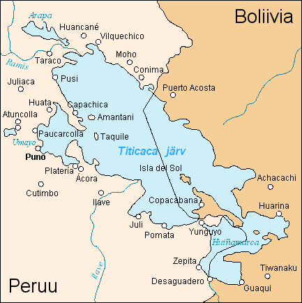
Map depicting the location of Lake Titicaca.
Life in the Reeds
More than 530 aquatic species live in the lake, and about 90 percent of the basin's fish species are endemic, including 23 killifish species of the genus Orestias found only in the lake, along with the catfishes Trichomycterus dispar and Trichomycterus rivulatus. The lake also hosts 24 described freshwater snail species, 15 endemic, and an endemic group of 11 amphipods in the genus Hyalella. Dense beds of totora reed (Schoenoplectus californicus) fringe the shallows and shelter much of this life. The giant Titicaca water frog (Telmatobius culeus), a wholly aquatic species restricted to the basin, is Critically Endangered, and the flightless Titicaca grebe (Rollandia microptera), which nests in the reedbeds and feeds almost entirely on Orestias, is Endangered, with fishing nets a major cause of its deaths. The lake also supports the white-tufted grebe (Rollandia rolland), puna ibis (Plegadis ridgwayi), Chilean flamingo (Phoenicopterus chilensis), Andean coot (Fulica ardesiaca), and many-colored rush tyrant (Tachuris rubrigastra), among more than 100 bird species.
Introduced fish have reshaped the community. Rainbow trout (Oncorhynchus mykiss) were stocked in 1942 and the Argentine silverside, or pejerrey (Odontesthes bonariensis), became established in the early 1950s. The largest killifish, the Titicaca orestias (Orestias cuvieri), was last seen in 1938 and is presumed extinct, and at least one other Orestias species, O. pentlandii, has also disappeared.
Sacred Water of the Tiwanaku and Inca
The lake was a sacred place long before the Inca. The Tiwanaku, who flourished here from roughly 500 to 1100 CE, made offerings at the Khoa Reef near the Island of the Sun, and underwater excavations beginning in 2013 recovered feline incense burners, sacrificed juvenile llamas, and gold, shell, and stone ornaments, offerings that predate the Inca by about five centuries. The Tiwanaku capital stands about 20 km (12 mi) southeast of the lake and was inscribed as a UNESCO World Heritage Site in 2000. The Inca made the lake the center of their origin stories: Spanish chroniclers recorded that the creator god Viracocha caused the sun and moon to emerge from its waters, and that the first Inca, Manco Cápac, and his wife Mama Ocllo appeared at the sacred rock of Titi Qala on the Island of the Sun, which the Inca turned into a pilgrimage center and where they lowered offerings into the lake in stone boxes. In 2000, a Bolivian and Italian-backed expedition, Atahuallpa 2000, reported submerged structures near Copacabana that it interpreted as a temple about 200 m (660 ft) long, with a terrace, a pre-Inca road, and an 800-m (2,600-ft) wall.
Islands of the Lake
Isla del Sol, the largest island, is part of Bolivia and is reached by boat from Copacabana. It covers 14.3 sq km (5.5 sq mi), has no motor vehicles or paved roads, and is home to about 800 families who farm, fish, and host tourists. People have lived there since about 2200 BCE, and it holds more than 80 ruins, most from the Inca period, including Titi Qala, the labyrinth-like Chincana, and the palace of Pilko Kaina, probably built by the emperor Topa Inca Yupanqui. Nearby, Isla de la Luna holds Iñak Uyu, the House of the Virgins of the Sun, a convent where women dedicated themselves to the Inca religion.
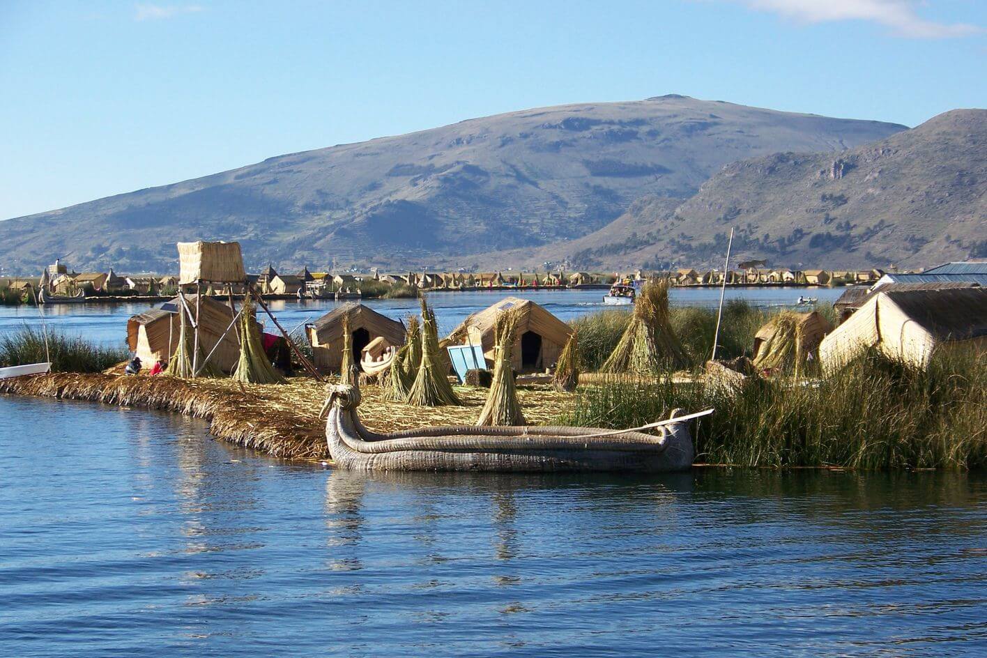
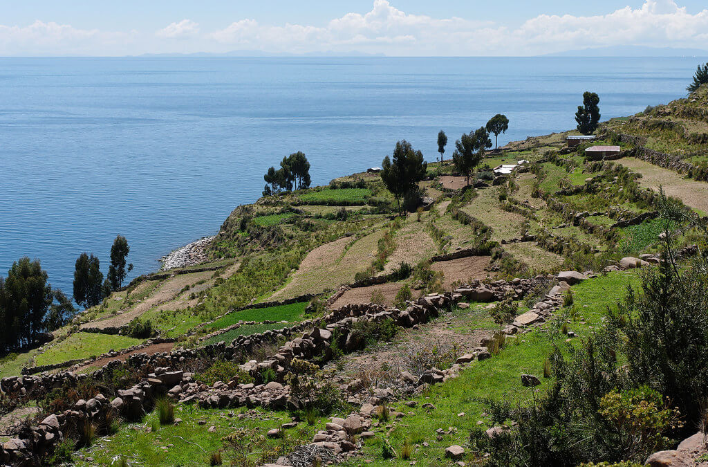
Near Puno, on the Peruvian side, the Uros live on floating islands built from layers of totora reed that need constant renewal, with each island lasting only about 25 years. The number of islands varies from about 60 to more than 100, and about 1,200 people are commonly cited, many of whom now depend on tourism. Amantaní, a nearly circular island of 15 sq km (6 sq mi), is home to about 4,000 Quechua speakers across ten communities, who farm hand-worked terraces on slopes topped by the Pachatata and Pachamama peaks and their ancient ruins.
On Taquile, an island 5.5 km (3.4 mi) long and 1.6 km (1 mi) wide with about 2,200 people, men knit, and the community runs its own tourism; UNESCO recognizes its textiles as intangible cultural heritage. The island served as a prison during the Spanish colonial period and into the 20th century, and has been owned by its residents since 1970. Suriki, in the southeast of the lake, is known for its reed-boat builders, who worked with Thor Heyerdahl on the Ra II and Tigris expeditions.
Protected Areas and Binational Management
Peru created the Titicaca National Reserve on October 31, 1978. It covers 36,180 hectares (89,400 acres) in two physically disconnected sectors: the smaller Ramis sector of 7,030 hectares (17,400 acres) and a larger sector of 29,150 hectares (72,000 acres) near Puno; the surrounding area supports 171 plant species. In 1997, the whole Peruvian side was designated a Ramsar wetland of international importance, and in 1998 Bolivia designated an 800,000-hectare (1.98-million-acre) Ramsar site that includes the 3,792 sq km (1,464 sq mi) lake within its borders. Peru placed the lake on its UNESCO Tentative List in 2005, and Bolivia has also proposed its sector. The two countries manage the lake and the wider Titicaca-Desaguadero-Poopó-Salar de Coipasa system through a joint body, the Autonomous Binational Authority of Lake Titicaca (ALT).
Record Lows and Pollution
Peru's meteorological service has recorded the lake's level since 1974. The record high, 3,811.28 m (12,504 ft), was set in 1986 and the record low, 3,807.39 m (12,491 ft), in 1996, a swing of nearly 4 m (13 ft). The lake has been receding since about 2000, and a severe drought pushed it to new lows in 2023, when Bolivia's gauge at Huatajata read 7 cm (3 in) below the 1996 minimum after a fall of about 79 cm (31 in) at the Peruvian gauge that year. The decline continued in 2024, with the level dropping another 42 cm (17 in) in six months, and Bolivia's weather service recorded a new historical minimum on its own gauge in early January 2025.
The lake has not recovered since. In 2026, it peaked at only 3,808.97 m (12,497 ft) on April 24, about 2.3 m (7.6 ft) below the 1986 record high, and by October 7, Peru's weather service reported 3,808.42 m (12,495 ft), a loss of 55 cm (22 in) in under six months. That is still about 1.0 m (3.4 ft) above the 1996 low, but the decline is expected to continue until late December. Forecasters link the dry conditions to El Niño and expect below-normal rainfall from January to March 2027, along with reduced flows in the Ramis, Huancané, Coata, and Ilave rivers from November through January. In Puno, boat operators have had to move their boarding points as the water pulls back from the tourist waterfront, and farmers and herders in the surrounding highlands report severe stress on potatoes, quinoa, alpacas, and llamas. Where there was once open water, such as Cohana Bay and around Cojata Island, grass now grows, and rivers have run 20 to 50 percent below normal.
Pollution compounds the drought. Sewage from El Alto, Bolivia's second-largest city, flows down the Katari River into Cohana Bay in the shallow Wiñaymarka basin, where eutrophication has been most intense. On the Peruvian side, the Huancané River carries boron, copper, and manganese, and the Ilave River carries aluminum and arsenic, with fecal coliforms in all the main tributaries. Intensive trout farming in the lake adds further pressure, and one Bolivian environmental engineer estimates that the lake receives the wastewater of about 3 million people. The Global Nature Fund and the Living Lakes network named it the Threatened Lake of the Year for 2023.
Conclusion
Lake Titicaca is at once a sacred landscape, a working fishery, and a shrinking closed basin. Its future depends on whether Peru and Bolivia can treat the wastewater flowing into it and manage an ever-scarcer water supply together.