
The Chocó-Darién Moist Forests: A Biodiversity Hotspot
The Chocó-Darién moist forests, running from Panama's Darién Province down Colombia's Pacific coast, are among the wettest places on Earth and host an estimated 8,000-10,000 plant species, about a fifth of which are found nowhere else. They also contain the Darién Gap, where the Pan-American Highway breaks and where a migration route that carried over half a million people in 2023 has since gone nearly silent.
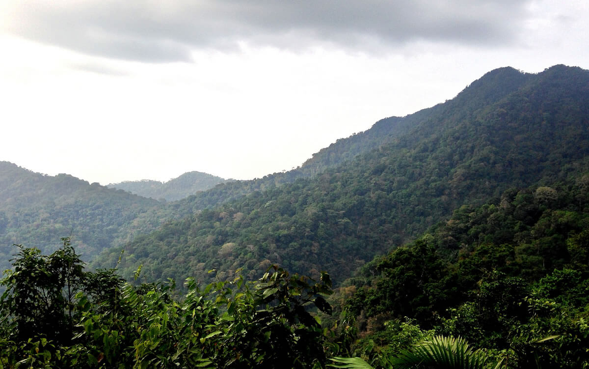
The Chocó-Darién Moist Forests: The World's Rainiest Lowland, and the Gap in the Road
The Chocó-Darién moist forests ecoregion, spanning western Colombia and eastern Panama, is one of the planet's most biologically diverse lowland regions. Situated between the Pacific Ocean and the western range of the Andes, it is renowned for its species richness, extreme rainfall, and endemism, and it remains largely forested in part because it is largely inaccessible.
Geographical Extent and Climate
The ecoregion stretches from the eastern Panamanian province of Darién and the Indigenous region of Guna Yala along nearly the entire Pacific coast of Colombia, encompassing the departments of Chocó, Cauca, Valle del Cauca, and Nariño, and covers roughly 73,600 sq km (28,400 sq mi). It includes a strip of land from sea level to about 1,000 m (3,280 ft) between the Pacific and the western slopes of the Andes.
The climate is hot and extraordinarily wet. Temperatures average about 23.6°C (74.5°F), ranging from a minimum near 18.6°C (65.5°F) to a maximum of about 30°C (86°F). Annual rainfall runs from 4,000 to 9,000 mm (160 to 350 in) across most of the ecoregion, while the central zone can exceed 13,000 mm (510 in) and WWF estimates that the wettest areas receive as much as 16 m (630 in) in a year, which is why the Chocó is often described as the rainiest lowland on Earth. The northern and southern extremes are somewhat drier, with short dry seasons from January to March.
Subregions and Topography
The ecoregion divides into five subregions. The Northern Coast covers the hill country of Darién and Urabá, and the Coastal Zone runs along the Pacific shore, generally below 500 m (1,640 ft). The Central Strip takes in the northern wet forests, the central rainforests, and the San Juan River area, while the Hills of Carmen del Atrato and San José del Palmar form a separate hilly subregion around those towns. The Pacific Slope Jungles climb from 500 to 1,000 m (1,640 to 3,280 ft) along the Andean foothills. Higher ground within the ecoregion includes the western slopes of Colombia's Cordillera Occidental and massifs such as Cerro Torrá, the Serranía del Darién, and the Sierra Llorona de San Blas.
Flora: A Center of Endemism
The Chocó-Darién is one of the world's most active centers of endemism and speciation, with an estimated 8,000 to 10,000 vascular plant species, about 20% of them strictly endemic. Many species have very restricted ranges, which produces extraordinary beta-diversity: the mix of species changes sharply from one subregion to the next. In the northern forests, characteristic trees include the bongo (Cavanillesia platanifolia), wild cashew (Anacardium excelsum), rubber tree (Castilla elastica), and kapok (Ceiba pentandra), while flooded areas are dominated by the cativo (Prioria copaifera). In the south, trees carry multiple layers of lianas and epiphytes.
This ecoregion, together with neighboring ecosystems such as the Baudó moist forests and the Magdalena Valley montane forests, forms part of the Tumbes-Chocó-Magdalena biodiversity hotspot.
Fauna
Close to 600 bird species have been recorded in the ecoregion, along with at least 127 amphibian and 97 reptile species. The largest mammals include the jaguar (Panthera onca), ocelot (Leopardus pardalis), giant anteater (Myrmecophaga tridactyla), and Baird's tapir (Tapirus bairdii), alongside tamarins and other primates, while humpback whales and marine turtles visit the adjacent coast. Endemic and near-endemic birds include Berlepsch's tinamou (Crypturellus berlepschi), the Baudó guan (Penelope ortoni), the gray-and-gold tanager (Tangara palmeri), and the scarlet-and-white tanager (Chrysothlypis salmoni), and the Vulnerable long-wattled umbrellabird (Cephalopterus penduliger) is another Chocó specialty. Among amphibians, the golden poison frog (Phyllobates terribilis), confined to the Saija River basin in the southern Chocó, is one of the most poisonous vertebrates on Earth.
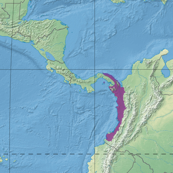
Map illustrating the location of the Chocó-Darién moist forests (in purple).
The Darién Gap
The forests of Darién Province and the adjoining Colombian Chocó contain the Darién Gap, the roadless stretch of swamp, river, and rainforest along the Panama-Colombia border where the Pan-American Highway is interrupted. For most of its history, few outsiders crossed the Gap, but since the early 2020s, it has become one of the busiest and deadliest migration routes in the Western Hemisphere. Panama's National Migration Service recorded 8,594 crossings in 2020, a record 520,085 in 2023, and 302,203 in 2024, most of them Venezuelans, funneled through Indigenous communities such as Bajo Chiquito.
The flow then collapsed. Crossings fell to roughly 3,000 in all of 2025, a decline of about 99%, which Panama's government attributes to tightened border controls and which analysts also link to changes in United States immigration policy. As of September 20, 2026, only 505 people had crossed northward that year, while 6,385 had been recorded moving south through the same jungle, more than 90% of them Venezuelan. The forest itself remains, and the drop in traffic has eased some of the pressure the surge placed on the Indigenous communities and ecosystems along the route.
Peoples of the Chocó
The Chocó-Darién is home to Emberá and Wounaan communities, the Guna of Guna Yala, and, along the Colombian coast and rivers, a large Afro-Colombian population whose settlements and territories are inseparable from the forest. WWF works with these communities on community-based forest management and the creation of protected areas, and their collective territories overlap much of the ecoregion's best-preserved forest.
Protection Status and Threats
Roughly a third of the wider Chocó-Darién region has been cleared or degraded. The northern and southern parts of the ecoregion have been heavily modified, with banana plantations replacing forest in the north and oil palm in the south, alongside ranching and farming. Logging is a major driver: the Chocó holds only about one-sixth of Colombia's forest but has supplied more than half of the country's timber. Other sources of degradation include uncontrolled gold mining, coca growing, and a naval base at Málaga Bay. The central part of the ecoregion, by contrast, remains relatively intact, with minimal fragmentation and high connectivity.
Protection varies between the two countries. In Panama, older assessments suggest about 30% of the ecoregion's area within the country is somewhat protected, anchored by Darién National Park, a UNESCO World Heritage Site. In Colombia, protection was estimated at under 3%, with parks including Los Katíos National Park, Utría National Park, Sanquianga National Park, and Gorgona Island National Park playing crucial roles. The northern Colombian coast is covered further in our Darién Norte Chocoano article.
Conservation Efforts
Conservation here involves governments, non-governmental organizations, local communities, and research institutions, and it centers on expanding protected areas, promoting sustainable land management, and developing ecotourism as an alternative livelihood. Research and monitoring programs continue to document the ecoregion's biodiversity, and community-based forest management, led by Indigenous and Afro-Colombian communities, is increasingly central to protecting the intact central forests from the pressures on either side.
Conclusion
The Chocó-Darién moist forests combine extremes found almost nowhere else: some of the heaviest rainfall on Earth, a plant flora with roughly a fifth of its species found nowhere else, and one of the hemisphere's most notorious roadless gaps. Its central forests remain largely intact, but its northern and southern edges show what agriculture, logging, and mining can do, and the region's future will depend on whether the intact core can be secured, above all through the communities who live within it.