
The Federal District of Brazil: Capital Territory on the Highland Divide
Brazil's smallest federal unit, the Federal District, contains Brasília and 34 other administrative regions on a Cerrado plateau where three major river basins meet. It has no municipalities, the country's highest per-capita income, deep inequality between the center and the periphery, and a water supply that nearly failed in 2017.


The Federal District of Brazil: Capital Territory on the Highland Divide
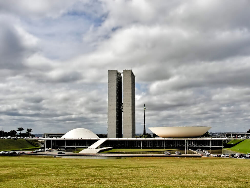
The Federal District (Distrito Federal) surrounds and includes Brasília, and it is unlike any other political unit in Brazil. At 5,760 km² (2,224 sq mi), it is the country's smallest federal unit, yet it is home to about 2.8 million people as of the 2022 census, has the highest per-capita income in Brazil, and houses the three branches of the national government. It is neither a state nor a municipality but a hybrid that exercises both powers, set on a Cerrado plateau where the headwaters of three major river basins divide. This article looks at the territory itself: how it was defined by law, how it is governed and settled, where its water comes from, and how it has spilled beyond its boundary into neighboring Goiás. For the Pilot Plan, the architecture and the World Heritage listing, see Brasília.
A Territory Defined Before the City Existed
The idea of a capital in the interior predates the Republic's capital in Rio de Janeiro. Brazil's first republican constitution, in 1891, reserved a 14,400 km² (5,560 sq mi) zone on the central plateau for a future federal capital. In 1892, the astronomer Luiz Cruls, director of the Rio de Janeiro Astronomical Observatory, left the coast by train with 22 men, then by mule, to survey the region. Over the next two years, the expedition mapped the region's climate, topography, rivers, plants, and animals, and corrected a long-standing exaggeration by measuring the Pireneus peak at 1,385 m (4,544 ft) rather than the 2,932 m (9,619 ft) previously claimed.
Nothing more happened for six decades. The project revived with Juscelino Kubitschek's 1955 campaign promise, and Brasília was inaugurated on April 21, 1960. The territory now known as the Federal District covers roughly 40 percent of the zone Cruls surveyed, and it is bounded almost entirely by the state of Goiás, with a short border with Minas Gerais along the Preto River and the Descoberto River, which form much of the western limit.
Land, Divides and Rivers
The district lies on the Brazilian Highlands at elevations of roughly 600 to 1,100 m (1,970 to 3,600 ft). Its highest point is Pico do Roncador in the Serra do Sobradinho. Because it sits on high ground, it has no large river of its own. Instead, streams rise here and flow away in three directions, toward the Tocantins-Araguaia, São Francisco, and Paraná basins. That position is a blessing for a capital far from floods, but it means water is scarce and must be managed carefully.
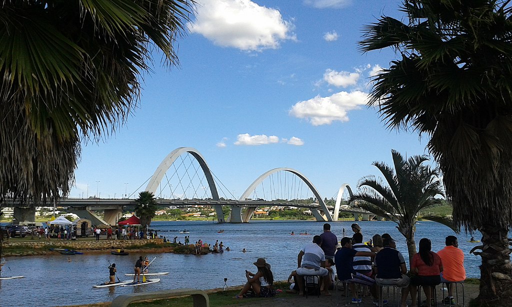
The largest body of water is Lake Paranoá, an artificial reservoir created by damming the Paranoá River during the city's construction. Sources estimate its area at 40-48 km² (15-19 sq mi), and it serves as a scenic and recreational center and, increasingly, as a source of drinking water. The Cruls expedition also recorded the Águas Emendadas springs, where headwaters of two different basins rise almost side by side, a feature still protected today within the district.
Climate and the Cerrado
The climate is tropical savanna (Köppen Aw), not semi-arid as the previous version of this article claimed in one place and contradicted in another. The rainy season runs from October to April, and the dry season runs from May to September, when humidity can fall below 30 percent. Maximum temperatures stay between about 25 and 28 °C (77 to 82 °F) year-round, and Brasília averages 21.4 °C (70.5 °F), with a record low of 1.6 °C (34.9 °F) in 1975.
The vegetation is the Cerrado, a mosaic of open savanna, scrub and gallery forest along streams, with buriti palms (Mauritia flexuosa) marking the wet valley bottoms; the government's seat, the Buriti Palace, takes its name from them. Brasília National Park, created in 1961 and covering about 420 km² (162 sq mi), protects a large block of this habitat inside the territory. Its fauna includes the maned wolf (Chrysocyon brachyurus), the giant anteater (Myrmecophaga tridactyla), the pampas deer (Ozotoceros bezoarticus), the red-legged seriema (Cariama cristata), and the toco toucan (Ramphastos toco). The park also protects the Santa Maria and Torto river catchments that help supply the city. Farther afield, Chapada dos Veadeiros and the other reserves described in Cerrado Protected Areas show the biome at a larger scale.
The 2016–2018 Water Crisis
The district depends mainly on two reservoirs, Descoberto and Santa Maria, with Descoberto supplying about 65 percent of the population. Below-average rainfall in 2016 pushed both to low levels. Rationing began in January 2017 and affected roughly 1.6 million people served by Descoberto and another 558,000 served by Santa Maria, generally with one day a week without water. In November 2017, Descoberto fell to 5.3 percent of capacity and Santa Maria to 21.6 percent.
A Chamber of Deputies study attributed the crisis to three overlapping causes: weak rainfall, naturally low water availability on the plateau, and rapid demand growth. The population had risen from about 2.57 million in 2010 to roughly 3.04 million in 2017, and consumption of about 184 liters (49 US gallons) per person per day was well above the national average of about 150 liters (40 US gallons). Paved surfaces from urban sprawl, illegal occupation of protected areas and untreated sewage also degraded the catchments. The response combined tariffs for heavy users, new intakes at Lake Paranoá and a link to the Corumbá IV reservoir in Goiás. Rationing eased in 2018, though the episode showed how little margin a capital built on headwaters actually has.
One Territory, Thirty-Five Regions
The 2022 census counted 2,817,381 residents, up 9.6 percent from 2010, with a density of 489 people per km² (1,267 per sq mi), the highest in Brazil. IBGE estimates the population at about 3.01 million in 2026. The territory is divided into 35 administrative regions, each run by an administrator appointed by the governor. Brasília proper, the Plano Piloto, is only one of them, and not the largest. Ceilândia is the most populous, Samambaia is second, and the Plano Piloto is third, while Águas Claras is the densest, followed by Cruzeiro and Varjão.
This pattern reflects deliberate planning. The Pilot Plan was designed for a limited population, and as workers arrived to build the capital, the government moved them to satellite towns. Ceilândia was founded on March 27, 1971, under the Campaign for the Eradication of Invasions (CEI), when more than 80,000 residents of informal settlements near the center were relocated there. Its very name comes from the campaign's initials. The result is a polycentric territory in which the symbolic center is small, wealthy, and carefully preserved, and most residents live in dense regions at a distance from it.
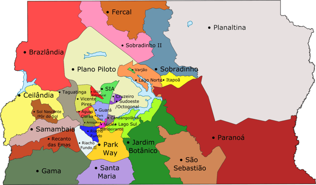
Map depicting the Federal District of Brazil.
Governance Without Municipalities
Under the 1988 Constitution, the Federal District cannot be divided into municipalities, so it is the only unit in Brazil without any. It is governed by an organic law rather than a state constitution. It elects a governor and a 24-seat Legislative Chamber, and it also elects federal deputies and senators like any state. Its administrative regions are not municipalities; they have no mayors or councils.
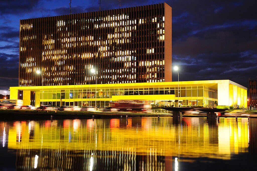
The seat of government is the Buriti Palace. Ibaneis Rocha resigned as governor on March 28, 2026, to run for the Senate, and Celina Leão took office on March 30. In the first round of the October 4, 2026 election, she led with 49.93 percent of valid votes against 34.47 percent for Leandro Grass, and a runoff was scheduled for October 25. This paragraph should be updated once that result is known.
Beyond the Boundary: The Entorno and the RIDE
The legal boundary has never matched the real city. Because land inside the district is expensive and tightly regulated, growth has spilled into neighboring Goiás and Minas Gerais. The Integrated Development Region of the Federal District and Surrounding Areas (RIDE-DF) groups the district with 34 neighboring municipalities. In the 2022 census, it counted 4,483,006 people, 62.8 percent of whom lived in the district itself. The RIDE grew 14.6 percent between 2010 and 2022, compared with 9.6 percent for the district alone; the metropolitan periphery in the Entorno grew fastest, at about 2.2 percent per year.
The largest Entorno municipalities are Águas Lindas de Goiás (225,671 people), Luziânia (208,725), Valparaíso de Goiás (198,861), Formosa (115,669) and Planaltina de Goiás (105,031), which should not be confused with the district's own Planaltina. Many residents commute daily into the district for work, and the pressure falls on transport, health services, and policing that sit under three different governments.
Economy and Income
The district's per-capita GDP was R$129,790 in 2023, about 2.4 times the national figure of R$53,887 and the highest of any federal unit, ahead of São Paulo. The reason is structural: public administration, including federal ministries, the judiciary, Congress, and state-owned bodies, accounts for around half of local output, with services making up most of the rest and industry and agriculture very small. Average monthly household income per person was R$4,538 in 2025. These figures conceal sharp internal differences, since incomes in Plano Piloto and the lakeside neighborhoods are many times higher than in the outer regions and the Entorno.
Pressures and Outlook
Three problems recur across the territory. First, water: the 2017 crisis showed that a growing population on a headwater plateau needs new sources and stricter protection of its catchments. Second, the pull of the metropolitan edge, where growth outpaces the services and transport that serve it. The third is the need to protect the Cerrado itself, which is steadily being cleared across central Brazil for farming and housing. The district's protected areas are among the biome's best-preserved, but they are islands within an expanding urban and agricultural landscape.
Conclusion
The Federal District is a deliberate invention: a territory carved from the Cerrado by a nineteenth-century constitution, filled by a twentieth-century capital, and now struggling with the ordinary problems of a large metropolis that its founders never intended. Its income, density, and political weight are exceptional, and so are its tensions between center and periphery, state and city, and plateau and thirst. Understanding it is essential to understanding how Brazil is governed from the highlands rather than from the coast.