Latest Entries

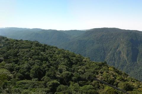
Serra da Mantiqueira: Southeastern Brazil's Mountain Water Tower

The Serra da Mantiqueira runs roughly 320 kilometers northeast from the Paraíba do Sul valley through São Paulo, Minas Gerais, and Rio de Janeiro. A 2004 survey confirmed Pedra da Mina, at 2,798 meters, as its highest peak, just above Pico das Agulhas Negras. Itatiaia National Park, Brazil's oldest, is a 421,804-hectare protected area that shelters Atlantic Forest, Araucaria woodland, and highland grasslands whose springs feed the Paraíba do Sul and Grande rivers. Trails and cool winters draw visitors.
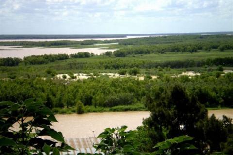
Delta del Paraná Biosphere Reserve: Island Wetlands Beside Buenos Aires

Delta del Paraná Biosphere Reserve covers 88,724 hectares of the Lower Paraná Delta in San Fernando, about 50 km from Buenos Aires. UNESCO designated it in 2000 and expanded it in 2007, and it is divided into a 10,694-hectare core, a buffer zone, and a transition zone. Tidal freshwater wetlands, floating islands, and gallery forest shelter marsh deer, capybaras, and river otters, while about 3,000 residents live from fishing, forestry, and tourism amid pressure from diking, fires, and dredging.

Itaipú Dam and Reservoir: Binational Hydropower on the Paraná River

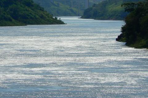
Itaipú is a binational hydroelectric dam on the Paraná River, where Brazil and Paraguay share a 14,000 MW plant fed by a 1,350 km² reservoir. Its first unit began running in 1984, and it now supplies roughly 90 percent of Paraguay's power and 10 percent of Brazil's. The 1973 treaty is under renegotiation as a fixed tariff expires at the end of 2026. The reservoir flooded Guaíra Falls and Guaraní lands, while forests along its shores now form part of a UNESCO biosphere reserve.

The Paraná River: South America’s Great Waterway of Dams, Wetlands, and Grain

The Paraná River is South America's second-longest, rising in the Brazilian highlands and flowing about 4,880 km through Brazil, Paraguay, and Argentina to the Río de la Plata. Its basin covers roughly 2.6 million km² and holds Itaipú, one of the world's largest hydroelectric plants, while the lower river carries most of Argentina's grain exports. Below Diamante, it splits into a delta of about 14,000 km², a wetland of islands, marsh deer, and capybaras, where dredging, diking, and low water raise concern.

Pilón-Lajas Biosphere Reserve: Where Indigenous Communities Guard Bolivia’s Foothill Rainforest

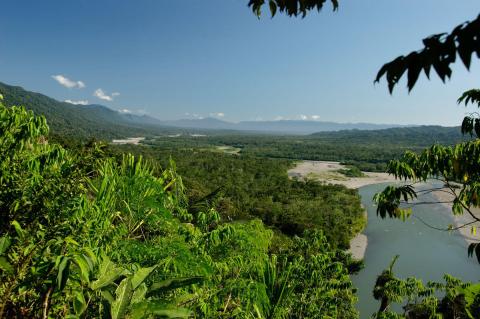
Pilón-Lajas Biosphere Reserve and Communal Lands covers about 4,000 km² in the La Paz and Beni departments of Bolivia, beside the Beni River and across from Madidi National Park. Recognized by UNESCO in 1977 and decreed an Indigenous territory in 1992, it is co-managed by the national parks service and a council of Tsimane', Mosetén, and Tacana communities. Jaguars, spider monkeys, and harpy eagles live in its forests, while mining requests, mercury pollution, and the proposed Chepete dam raise concern.

Madidi National Park: Bolivia's Most Biodiverse Protected Area

Madidi National Park lies in the La Paz department of northwestern Bolivia, where the Andes fall away to the Amazon lowlands across about 19,000 km². Created in 1995, it was surveyed by the Identidad Madidi expedition from 2015 to 2018, which recorded more than 1,000 bird species and over 5,500 plants and flagged 124 candidate new species. Tacana, Ese Ejja, Tsimané, and Mosetén communities live in and around it, while illegal gold mining on the Tuichi River and the proposed Chepete-El Bala dams threaten it.

Bahuaja-Sonene National Park: Where Andean Foothills Meet Peru's Tropical Savanna

Bahuaja-Sonene National Park covers about 10,900 km² of southeastern Peru, spanning the Madre de Dios and Puno regions and adjoining Tambopata National Reserve and Bolivia's Madidi. Established in 1996 and enlarged in 2000, it climbs from lowland rainforest at about 500 m to cloud forest above 2,000 m and includes the Pampas del Heath, Peru's only tropical savanna. Maned wolves, giant otters, jaguars, and harpy eagles live here, while illegal gold mining and coca growing press on its borders.

Tambopata National Reserve: Peru's Rainforest Refuge on the Bolivian Frontier

Created on September 4, 2000, Tambopata National Reserve covers 274,690 hectares of lowland rainforest, oxbow lakes, and palm swamps along the Tambopata River in southeastern Peru, next to Bahuaja-Sonene National Park. It is known for macaw clay licks, giant otters, jaguars, and about 1,200 butterfly species, and Ese Eja communities run lodges on its edges. Illegal gold mining, which Operation Mercury had driven back in 2019, cleared more than 500 hectares inside the reserve in 2025 and early 2026.

Manú National Park: Peru’s Great Reserve of Rainforest and Cloud Forest

Created in 1973 and covering 1,716,295 hectares (17,163 km²), Manú National Park spans Cusco and Madre de Dios, protecting an entire Amazonian watershed from Andean grassland to floodplain forest. It is a UNESCO Biosphere Reserve and World Heritage Site known for jaguars, giant otters, and exceptional bird diversity, and it is home to Indigenous peoples, some living in voluntary isolation. Its Cocha Cashu research station has drawn scientists since 1969, and roads, gas, mining, and logging press on its edges.

Puerto Maldonado: Gateway to Peru's Southern Amazon

Founded on July 10, 1902, where the Tambopata meets the Madre de Dios, Puerto Maldonado grew from a rubber-era river station into the capital of Madre de Dios. The Interoceanic Highway and its 723 m Continental Bridge gave the city a paved road to the Andes in 2011, and the region now counts about 209,000 residents. Today, the city anchors Brazil nut harvesting, ecotourism, and a gold economy beside three of Peru's major protected areas, and rivers remain the main roads into the forest.