
The Chilean Coastal Range and Central Valley: Chile's Geographic Foundation
Chile's Coastal Range and Central Valley run in parallel for more than a thousand kilometers, shaping the country's climate, farmland, and cities. The range shelters relict forests and the endangered Chilean wine palm, while the valley holds most of Chile's people and its wine country.
From Coastal Peaks to Wine Valleys: Chile's Defining Landscapes
The Chilean Coastal Range and Central Valley form two distinctive features that run parallel along Chile's extraordinary length, shaping the nation's climate, agriculture, and urban life. The Coastal Range rises as a barrier between the Pacific Ocean and the interior, while the Central Valley lies between these coastal mountains and the towering Andes, forming Chile's most fertile and populated corridor. Together with the Andes, they record the long subduction of the Nazca Plate beneath South America, and they define where rain falls, where forests grow, where crops flourish, and where cities rise.
The Coastal Range: An Ancient Western Wall
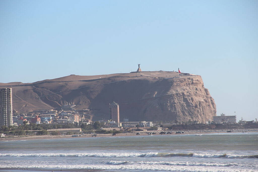
The Chilean Coastal Range (Cordillera de la Costa) stretches roughly 3,000 km (1,860 mi) along the Pacific coast, from Morro de Arica in the north to the Taitao Peninsula in the south. Unlike the young, volcanic Andes, the range is built of much older rock, including metamorphic basement, granitic intrusions, and volcanic sequences hundreds of millions of years old. It reaches its highest point at Cerro Vicuña Mackenna, in the Sierra Vicuña Mackenna of the Antofagasta Region, at 3,114 m (10,217 ft), and then generally declines southward, with central sections typically between 600 and 1,200 m and the southern range breaking into lower hills and islands.
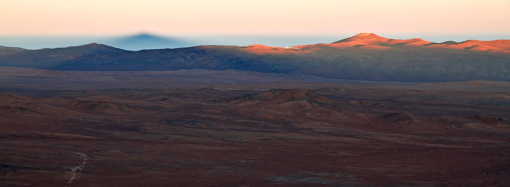
In Chile's hyperarid north, the range rises steeply from the sea in dramatic coastal cliffs, and its great height there helps shape the driest parts of the Atacama Desert, which lie in its rain shadow. Coastal fog, known as camanchaca, sustains fog-dependent plant communities on the western slopes, protected in parks such as Pan de Azúcar and Llanos de Challe. Between the Copiapó and Aconcagua rivers, in the Norte Chico, the Coastal Range merges with the Andes and the valley between them disappears altogether, the two ranges separating again near Santiago.
Mediterranean Slopes and a Palm in Retreat
In central Chile, the range is lower but ecologically rich, covered by the Mediterranean matorral described in our Chilean matorral article, a sclerophyll scrub and woodland of species such as boldo (Peumus boldus), litre (Lithraea caustica), and peumo (Cryptocarya alba). The Chilean wine palm (Jubaea chilensis) also grows here, a massive-trunked palm found only in the coastal mountains of central Chile, between about La Serena and the Maule Region. It is listed as Endangered by the IUCN: centuries of felling, including for the sweet sap tapped to make palm syrup and wine, and of grazing have reduced it to roughly fifteen localities, and many stands contain mostly old trees with few young ones to replace them, partly because the seeds depend on the degu (Octodon degus), a rodent that scatter-hoards them. Most surviving trees are protected in La Campana National Park and Las Palmas de Cocalán National Park.
La Campana National Park, about 8,000 hectares of the central Coastal Range, was created in 1967 and designated a UNESCO Biosphere Reserve with Lago Peñuelas in the mid-1980s; it is also where Charles Darwin, on August 17, 1834, climbed Cerro La Campana and, from its summit, saw both the Andes and the Pacific. The park's relict stands of roble beech (Nothofagus obliqua) and its palms are discussed in our La Campana-Peñuelas article. Farther north, in the semiarid zone near 30°S, the Bosque de Fray Jorge preserves an isolated relict forest sustained by coastal fog, a remnant of wetter times in a landscape that is now mostly dry.
The Southern Range: Nahuelbuta and the Valdivian Coast
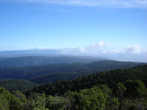
South of the Biobío River, the range becomes increasingly fragmented. The Nahuelbuta Range, protected in Nahuelbuta National Park, whose highest summit, Alto Nahuelbuta, reaches 1,565 m (5,135 ft), shelters stands of monkey puzzle trees (Araucaria araucana), a species better known from the Andes. Farther south, the Valdivian Coast Range, including the Cordillera de Oncol and the Cordillera Pelada, has long been geographically isolated and is a refuge for endemic and rare species such as the pudú (Pudu puda), the smallest deer in the world, the marine otter (Lontra felina), and the monito del monte (Dromiciops gliroides), a marsupial. Alerce Costero National Park protects ancient alerce (Fitzroya cupressoides) forest on these coastal heights, within the wider Valdivian temperate forests. Beyond Puerto Montt, the range breaks up into the coastal archipelago, including Chiloé Island and the Chonos Archipelago.
Climate Maker and Human Footprint
The Coastal Range is Chile's first line of defense against Pacific weather. Moist westerly air rises over the western slopes and drops its rain, so the wetter southern sections of the range, such as Nahuelbuta and the Valdivian coast, are lush, while the leeward side lies in a rain shadow, and in the north the Coastal Range and Andes together produce the extreme aridity of the Atacama.
The range remains thinly populated compared with the coastal plains and the valley. Mining of copper, iron, and gold dominates the arid north, while central sections support forestry, including native forests and pine and eucalyptus plantations, along with valley agriculture and expanding coastal cities; the south retains more native forest and growing conservation and ecotourism.
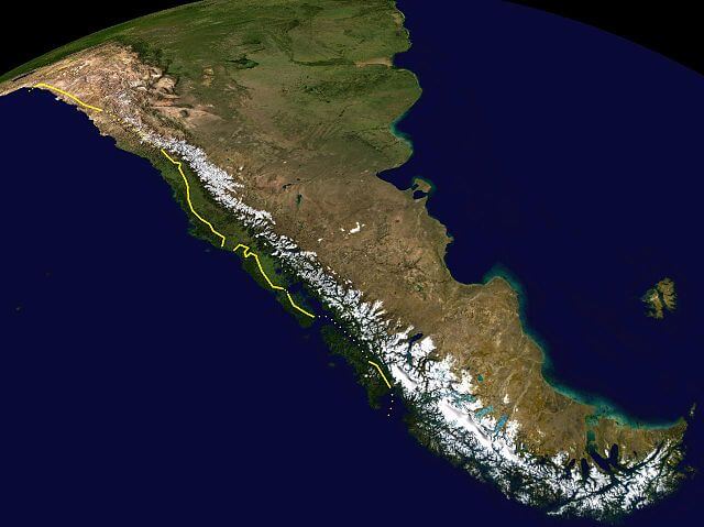
The eastern border of the Chilean Coastal Range is marked in yellow, and uncertain boundaries are marked with dots.
The Central Valley: A Great Longitudinal Basin
The Central Valley (Valle Central or Depresión Intermedia) is a long structural basin between the Coastal Range and the Andes, filled over millions of years with volcanic debris and sediments eroded from the rising Andes. These deposits, enriched with volcanic ash, make the soils exceptionally fertile. The valley, as a geographic feature, extends well beyond its populated core, interrupted by the transverse ranges of the Norte Chico between about 27°S and 33°S and continuing south of Puerto Montt as drowned marine basins; its main agricultural and urban stretch, however, runs roughly 1,000 km (620 mi) from Santiago to Puerto Montt.
Its character changes from north to south. Near Santiago, where the city sits at roughly 570 m (1,870 ft), the valley is a broad trough 40 to 80 km (25 to 50 mi) wide, crossed by rivers flowing from the Andes, including the Maipo, Maule, and Biobío, that deposit rich alluvial soils and supply irrigation water. South of the Biobío, the valley narrows and descends through the Lake District, with Lago Villarrica, Lago Llanquihue, and numerous smaller glacial lakes, and by Puerto Montt, at about 41°S, it reaches sea level.
The climate shifts accordingly, from semiarid Mediterranean near Santiago, with about 300 mm (12 in) of rain a year and a pronounced dry summer that makes irrigation essential, to a cool temperate oceanic climate at Puerto Montt, where annual rainfall is well over 1,500 mm (59 in). Water for the central valley comes mainly from Andean snowmelt, which climate change is steadily reducing.
Agricultural Powerhouse and Urban Core
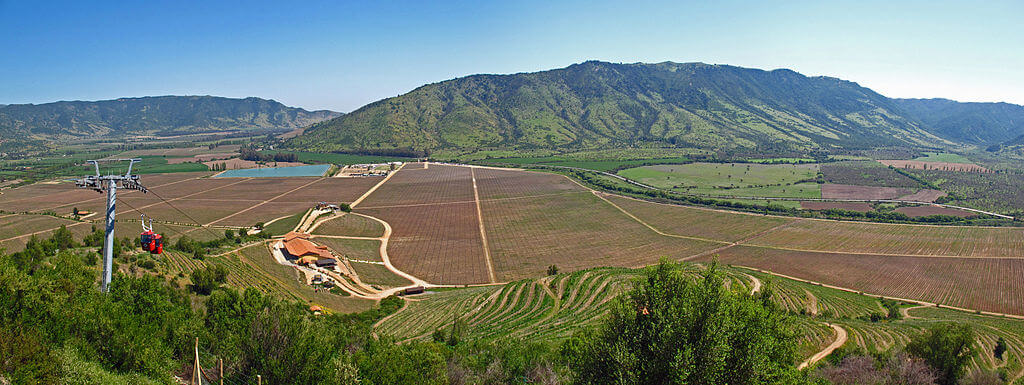
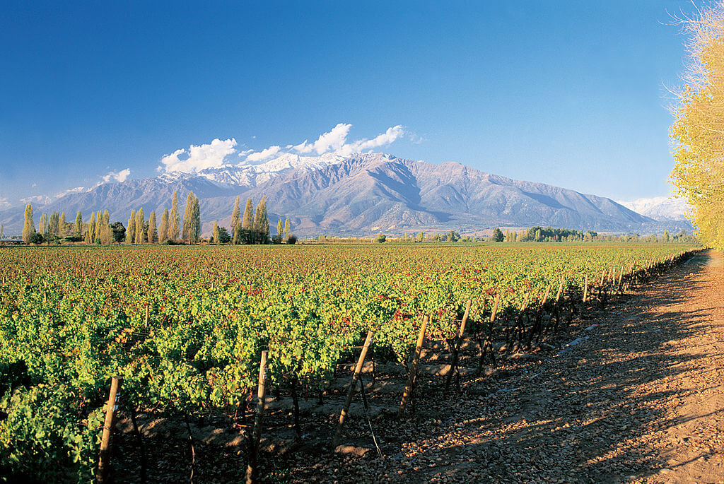
The Central Valley produces most of Chile's agricultural exports, thanks to fertile volcanic soil, reliable irrigation, a Mediterranean climate, and flat terrain. The valley between Santiago and Chillán hosts Chile's famous wine regions, including Maipo, Colchagua, Curicó, and Maule, where warm, dry summers and cool nights preserve grape acidity and develop complex flavors, alongside table grapes, apples, pears, cherries, wheat, corn, and sugar beets. Farther south, the Los Lagos Region becomes Chile's dairy heartland, where abundant rainfall supports year-round pasture but also raises concerns about forest conversion and water pollution.
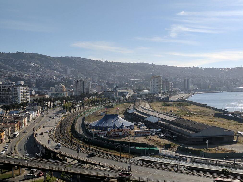
A large majority of Chileans live in the central part of the country, with Greater Santiago alone home to more than 7 million people, over a third of the national population, in a basin between the Coastal Range and the Andes. Other major cities include Rancagua, in the copper country; Talca, an agricultural hub; Chillán, known for nearby ski resorts; Concepción, one of Chile's largest metropolitan areas; and Temuco, capital of the Araucanía Region and a center of Mapuche culture. Our Zona Central article covers this core region in more depth.
Environmental Challenges
Centuries of intensive use have transformed the valley. Its original Mediterranean woodlands survive only in small fragments; wetlands and riparian forests have largely disappeared, and soil degradation, water over-extraction, and pollution affect large areas. Santiago's air quality frequently exceeds health standards because vehicle emissions and winter wood smoke are trapped by temperature inversions, and conservation remains limited in the country's most productive region.
Two Landscapes, One Story
The Coastal Range and Central Valley are intimately connected. Where the range is high enough, it shapes the rain that falls on both its flanks, and the valley's Mediterranean climate, Andean water, and volcanic soils make it one of South America's most productive farming regions, while the range's own slopes shelter relict forests and species, such as the Chilean wine palm, found nowhere else. Together they have shaped where Chileans live, what they grow, and how they use the land, from the mines of the arid north to the wine valleys of the center and the dairy farms and forests of the south.