
Lauca National Park and Biosphere Reserve: A Symphony of Nature
Lauca National Park and Biosphere Reserve protect about 358,000 hectares of high Andean puna in Chile's far north, where a collapsed volcano dammed one of the world's highest large lakes, a river that rises in Chile and ends in Bolivia triggered a diplomatic rupture in 1962, and the vicuña was brought back from the brink.
Lauca National Park and Biosphere Reserve: Volcanoes, a Disputed River, and the Vicuña's Comeback
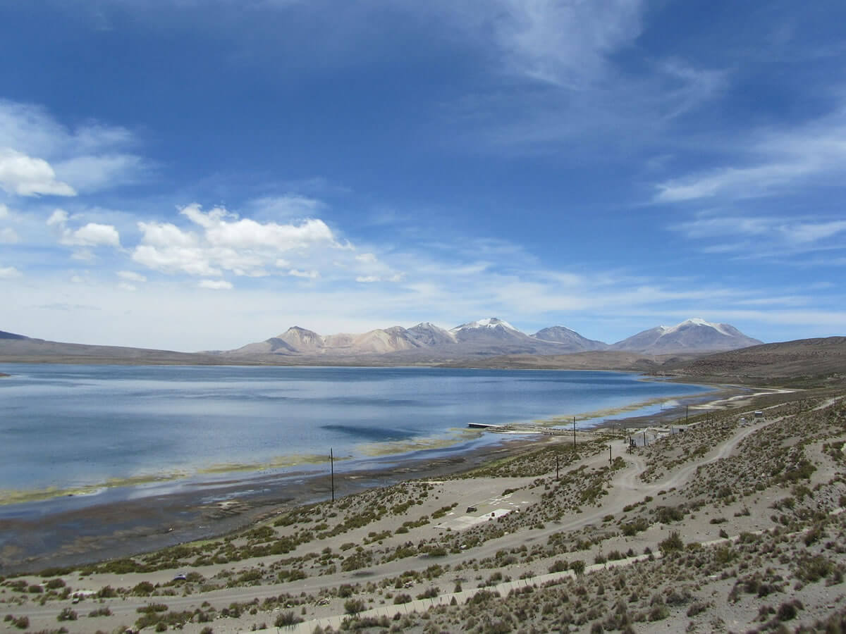
Lauca National Park lies in the northernmost Chilean Andes, in the commune of Putre in the Arica y Parinacota Region, along the Bolivian border. It covers 137,883 hectares (1,379 sq km, or 532 sq mi) of the Altiplano and the surrounding mountains, and adjoins Bolivia's Sajama National Park. Together with Las Vicuñas National Reserve and the Salar de Surire Natural Monument, it forms the Lauca Biosphere Reserve, recognized by UNESCO in 1981 and covering about 358,000 hectares (885,000 acres). The landscape belongs to the Central Andean dry puna, and Chile's Route 11 from Arica, via Putre, climbs into the park along the same corridor that links Chile with La Paz.
A Park Redrawn in 1983
Protection came in stages. The area was set aside in 1965 as the Lauca Forest Reserve, covering 271,300 hectares (about 670,400 acres), and in 1970 it was redefined and enlarged as a national tourism park. On March 8, 1983, a decree redrew the boundaries, cutting the park from roughly 520,000 hectares (1.28 million acres) to its present 137,883 hectares and re-designating part of the removed land as the 209,131-hectare (about 516,800-acre) Las Vicuñas National Reserve and the 11,298-hectare (about 27,900-acre) Salar de Surire Natural Monument. The result is a biosphere reserve split into three units with three different levels of legal protection.
Volcanoes and a Lake Dammed by a Landslide
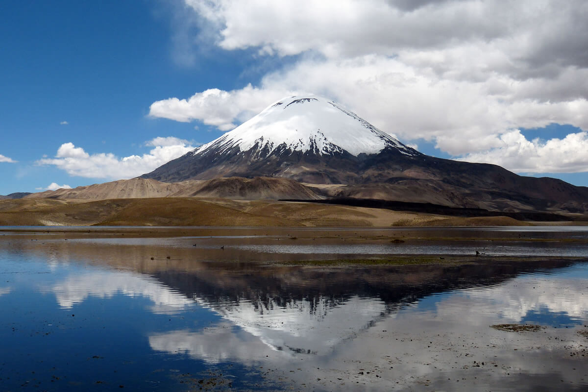
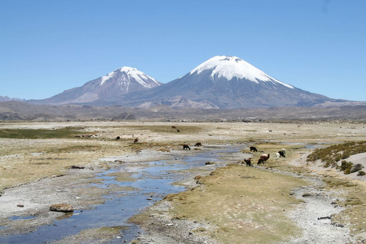
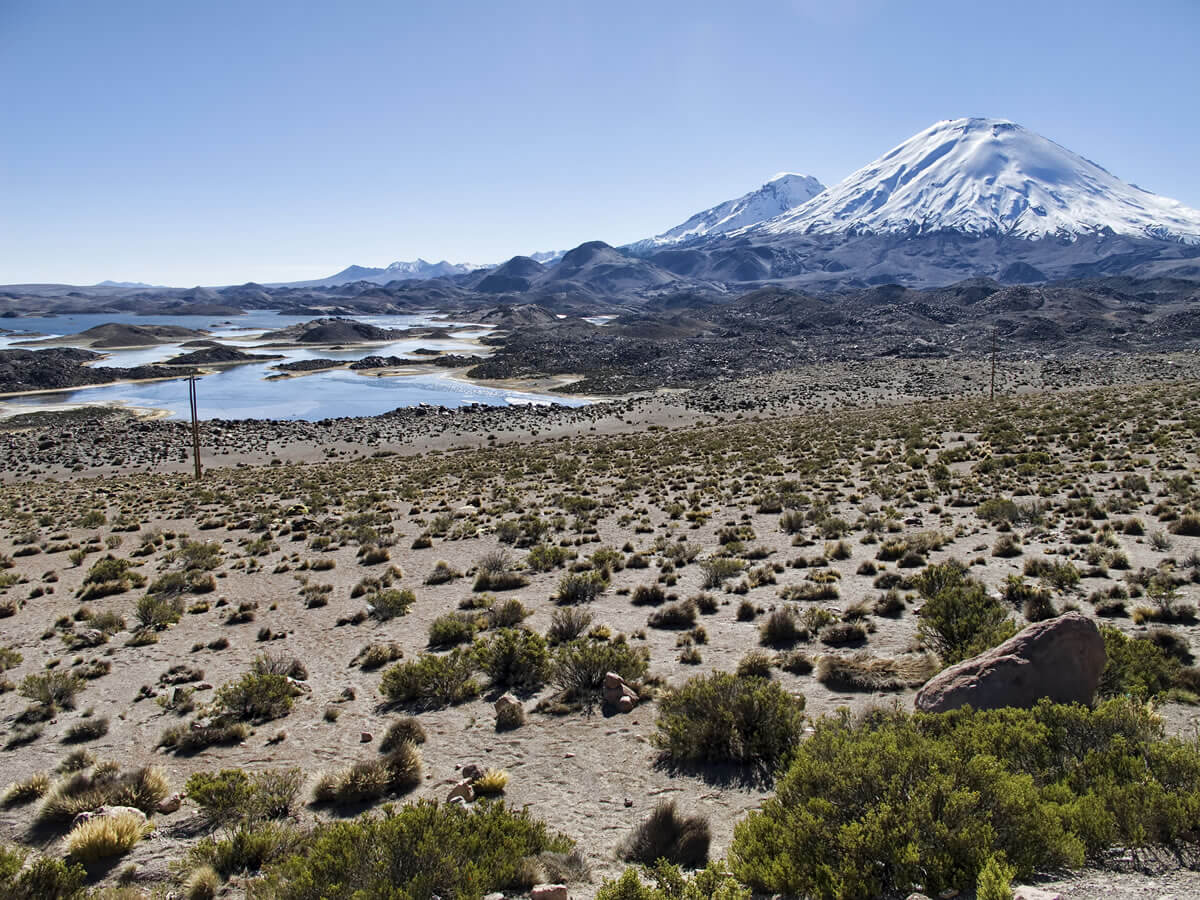
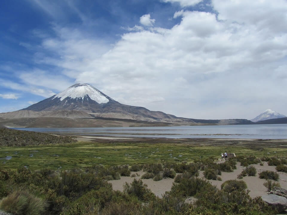
Lauca lies in the northern Lauca Basin, the westernmost in a chain of lake basins that stretches more than 800 km (500 mi) from Lake Titicaca across the Bolivian Altiplano to the Salar de Uyuni, a setting described in our Altiplano article. Around the basin rise the twin Payachata volcanoes, Parinacota, 6,342 m (20,807 ft), and Pomerape, about 6,240 m (20,470 ft), on the Bolivian border, along with the Nevados de Putre, whose Cerro Taapaca reaches 5,775 m (18,950 ft). Farther south, in Las Vicuñas, Guallatiri, 6,071 m (19,918 ft), one of Chile's most active volcanoes, dominates the skyline.
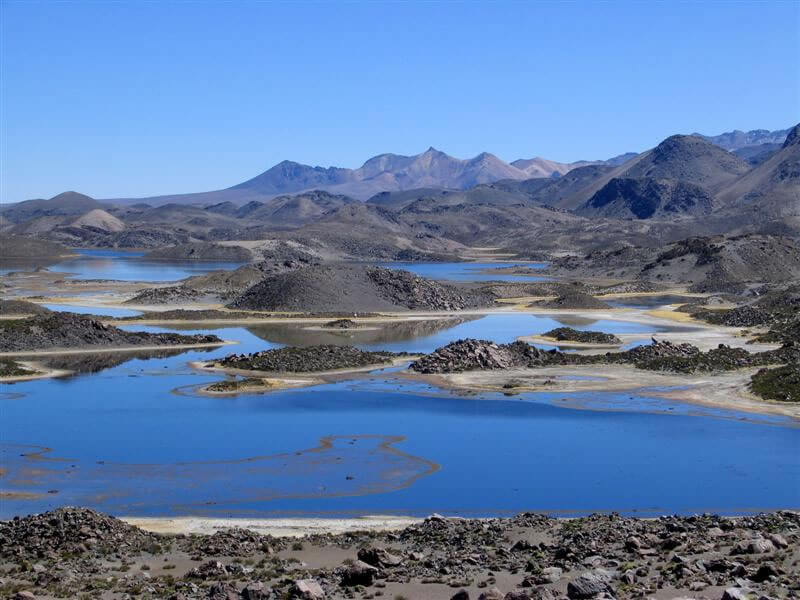
Chungará Lake, at 4,517 m (14,820 ft), is one of the world's highest large lakes. It covers about 22 sq km (8.5 sq mi) and is 26 to 40 m (85 to 130 ft) deep, and it exists because Parinacota collapsed: between roughly 8,000 and 17,000 years ago (estimates vary), a landslide of about 6 cubic km (1.4 cu mi) of rock spread debris across some 140 sq km (54 sq mi) and dammed the Lauca River. About 4 km (2.5 mi) to the northwest, the Cotacotani lagoons, linked to the lake by underground seepage, lie at the foot of the volcano.
A River Shared with Bolivia
The Lauca River rises in the bofedales around Parinacota, flows about 75 km (47 mi) through Chile, and then crosses into Bolivia for another 150 km (93 mi) before ending in the salt lake of Coipasa. In 1939, Chile began studying the river to irrigate the Azapa Valley near Arica, and in April 1962 it diverted part of the flow, prompting Bolivia to break diplomatic relations on April 14 and take the case to the Organization of American States. Chile has maintained that it uses only a portion of the Parinacota wetlands' waters and has not altered the river's natural course, while a Bolivian foreign-ministry calculation holds that Bolivia has lost about 1 billion cubic meters (264 billion gallons) of water since 1962. The dispute has resurfaced in bilateral talks ever since without a settlement. In the 1970s, water was also pumped from Chungará toward Azapa through a canal, but pumping stopped quickly as the lake level dropped; plants and animals suffered, and a later diversion plan was abandoned after a Chilean Supreme Court decision.
Plants of the High Puna
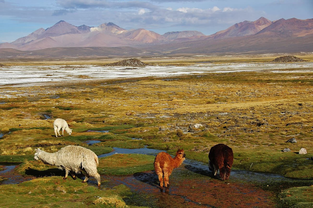
The park holds more than 400 species of vascular plants. Above about 3,800 m (12,470 ft), the vegetation divides into dry grassland and the wet meadows called bofedales, which are critical habitat because they supply food and water for wild and domestic animals alike. On the rockiest high slopes, cushion plants such as llareta (Azorella compacta) grow among bunchgrasses like Festuca orthophylla, and queñoa (Polylepis tarapacana) forms woodlands on north-facing slopes at 4,400 to 4,900 m (14,440 to 16,080 ft), among the highest forests on Earth, with trees 3 to 4 m (10 to 13 ft) tall and more than 40 cm (16 in) across. In ravines and on lower slopes, a second queñoa species (Polylepis rugulosa) forms woodlands, and a tolar, a scrubland of resinous shrubs, covers the lower plateau.
Birds and Mammals
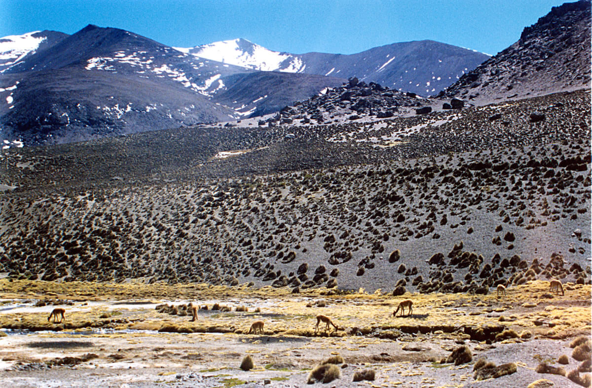
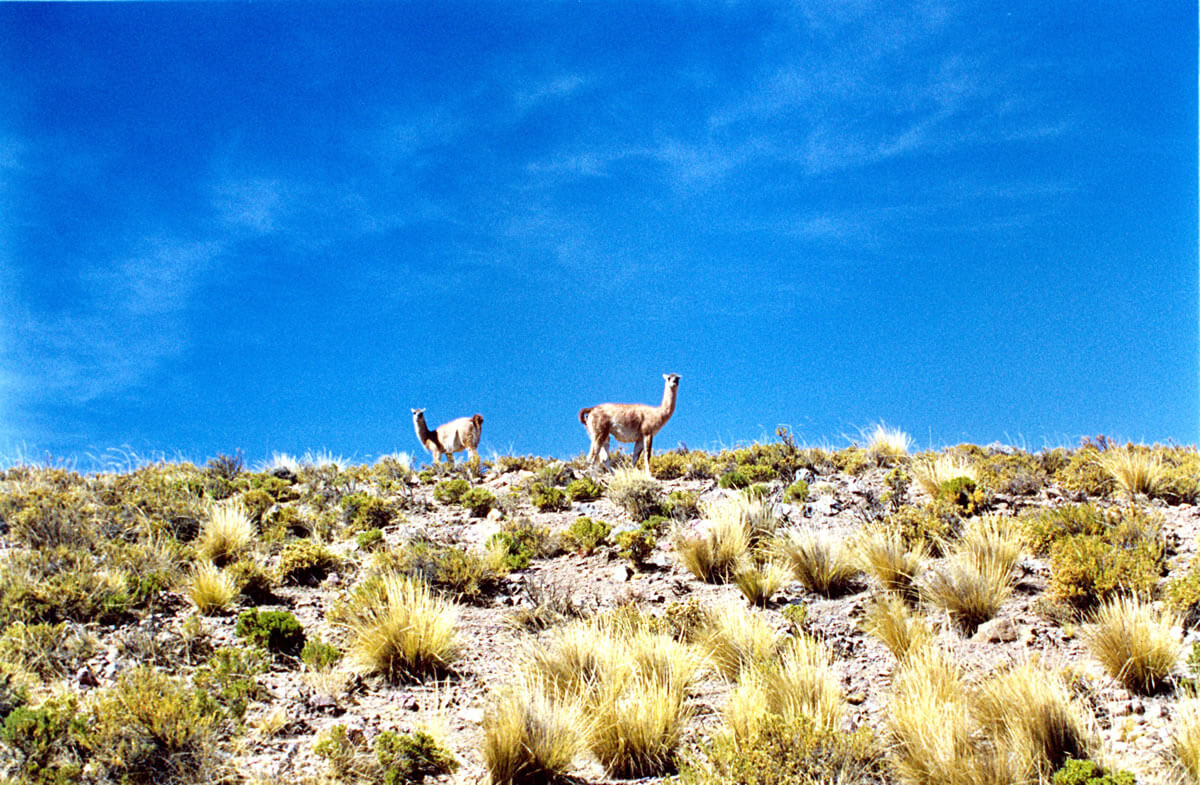
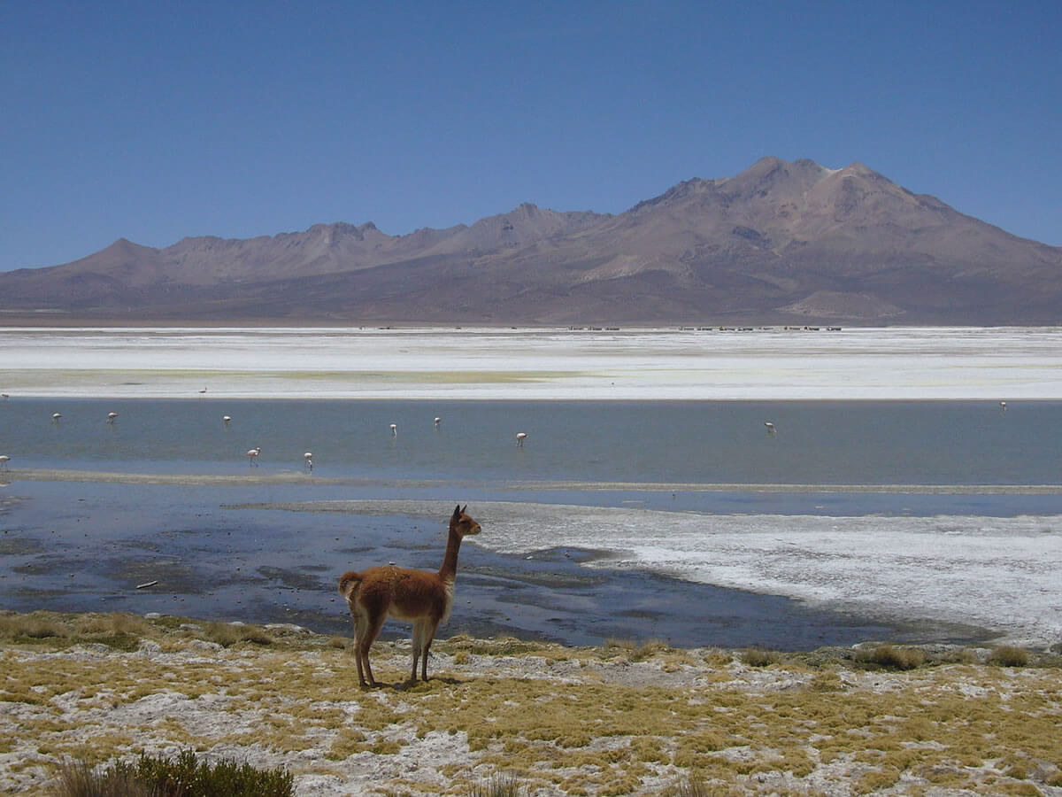
More than 140 bird species, about a third of Chile's total, have been recorded in the park, many of them wetland birds. They include the puna ibis (Plegadis ridgwayi), the Andean goose (Chloephaga melanoptera), the giant coot (Fulica gigantea), the puna tinamou (Tinamotis pentlandii), the silvery grebe (Podiceps occipitalis), the crested duck (Lophonetta specularioides), the puna teal (Spatula puna), the Andean condor (Vultur gryphus), the Chilean flamingo (Phoenicopterus chilensis), and Darwin's rhea, or suri (Rhea pennata). Vicuñas (Vicugna vicugna) graze beside the herds of domestic llamas (Lama glama) and alpacas (Vicugna pacos) kept by local herders, and the taruca (Hippocamelus antisensis), a deer of the high Andes, the puma (Puma concolor), and mountain vizcachas (genus Lagidium) live in the rockier ground.
The Vicuña's Comeback
Lauca is the center of one of South America's best-documented conservation successes. Unregulated hunting for the vicuña's fine fleece brought the species close to extinction in Chile in the 1960s. After Peru and Bolivia signed a protection agreement in 1969 and Chile joined it in the early 1970s, CONAF began a conservation program and annual censuses in 1975. Chile's vicuña population recovered from fewer than 2,500 animals in 1975 to roughly 22,000 to 26,000 by 1990, depending on the census method, before declining to about 15,000 by 2003, and an IUCN tally in 2012 counted about 17,000 in Chile. The vicuñas of this northern altiplano are the northern subspecies, Vicugna vicugna mensalis, and our Puna article tells the full story of their recovery.
People and Heritage
The park is also an Aymara homeland. The hamlet of Parinacota, at about 4,400 m (14,400 ft), is a national monument with a colonial church, and the village of Chucuyo and the herding estancias of Chungará, Ajata, and Cruzane are home to Aymara families who graze llamas and alpacas on the bofedales. The park also protects archaeological sites, lava fields, and volcanic calderas, and its three ranger stations, at Las Cuevas, Parinacota, and Lake Chungará, are managed from the town of Putre.
Las Vicuñas National Reserve
Las Vicuñas National Reserve, created in 1983 to protect vicuñas being overexploited mainly for their fur, lies immediately south of Lauca and covers 209,131 hectares (about 516,800 acres) of the dry puna. Much of it is open Andean steppe cut by rivers and quebradas, with the Lauca River as the main watercourse, and its major peaks, Arintika and Pukintika, rise above vegetation of pajonal grassland, tolar, and llareta cushion plants. It shares the skyline with Guallatiri volcano and borders the Salar de Surire to the south.
Salar de Surire Natural Monument
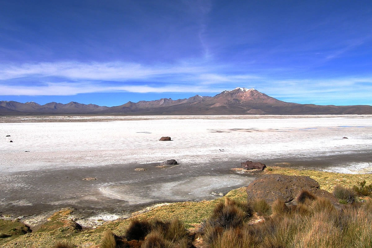
The Salar de Surire, a salt flat of 11,298 hectares (about 27,900 acres) at about 4,250 m (13,950 ft), lies beneath the Arintica volcano and has been a Ramsar wetland since 1996. It is one of the best places to see all three South American flamingo species together: the Chilean flamingo, the Andean flamingo (Phoenicoparrus andinus), and James's flamingo (Phoenicoparrus jamesi), and BirdLife International counted about 400 breeding Andean flamingos and 2,000 resident James's flamingos there in 2008. Vicuñas and rheas graze the surrounding steppe.
Surire has also been the reserve's most contested corner. In 1989, the outgoing military government reportedly granted the borax company Quiborax a concession of 45.6 sq km (17.6 sq mi) in the salar; borax extraction has continued, and BirdLife lists mining as a threat to its flamingos. A campaign backed by Patagonia and Fundación Relaves, built around the documentary Lawqa, has called for merging the three units into a single national park with uniform protection.
Conclusion
Lauca is a place where geology, hydrology, and politics are unusually intertwined: a landslide made the lake, a river made a diplomatic crisis, and protection made the vicuña's recovery. Its future depends on keeping its wetlands and flamingo lagoons intact and on whether Chile's three-part protection system is ever consolidated.