
The Brazilian Highlands: Geological Foundation of a Continental Giant
The Brazilian Highlands (Planalto Brasileiro) constitute South America's most extensive plateau system and serve as Brazil's geological backbone. This ancient landform influences weather patterns, harbors biodiversity hotspots, and provides the foundation for Brazil's agricultural and mining economy.
The Planalto Brasileiro: Water, Wildlife, and Economic Wealth in South America's Heartland
Rising from Brazil's interior like a vast continental table, the Brazilian Highlands (Planalto Brasileiro) are among Earth's most significant plateau systems. This geological marvel spans eight Brazilian states, profoundly shaping not only Brazil's physical geography but also its climate, hydrology, and ecological diversity. From the mineral-rich mountains of Minas Gerais to the agricultural heartland of the Central Plateau, these highlands serve multiple critical functions: they act as continental watersheds feeding major river systems, create diverse microclimates that support various biomes, and provide the geological foundation for Brazil's emergence as a global agricultural and mining powerhouse.
The highlands' influence extends far beyond Brazil's borders, affecting precipitation patterns across South America and serving as a crucial link between the Amazon Basin and the Atlantic Ocean. Understanding this region is essential for comprehending Brazil's role in global climate systems, biodiversity conservation, and the challenges of sustainable development.
Geological Formation and Ancient Origins
The Brazilian Highlands emerged from one of Earth's most ancient geological processes, with crystalline basement rocks dating back over 2 billion years to the Precambrian era. These formations represent remnants of the supercontinent Gondwana and provide insight into Earth's early geological evolution.
During the Mesozoic era (approximately 200-65 million years ago), massive basaltic lava flows covered portions of the region, forming the thick volcanic sequences visible today in areas such as the Paraná Plateau. These flows, among the largest continental volcanic events in Earth's history, deposited basalt layers that now contribute to the region's agricultural fertility.
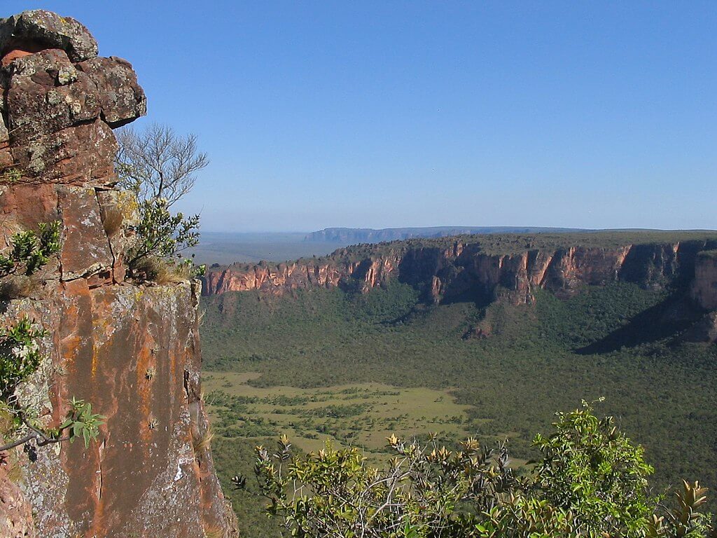
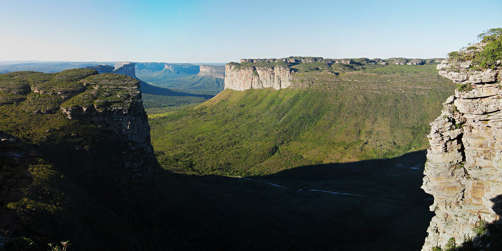
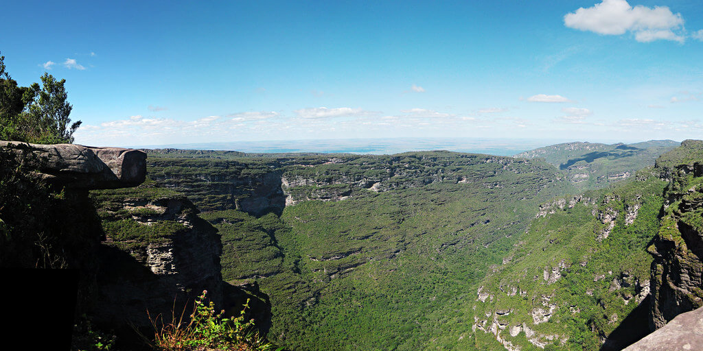
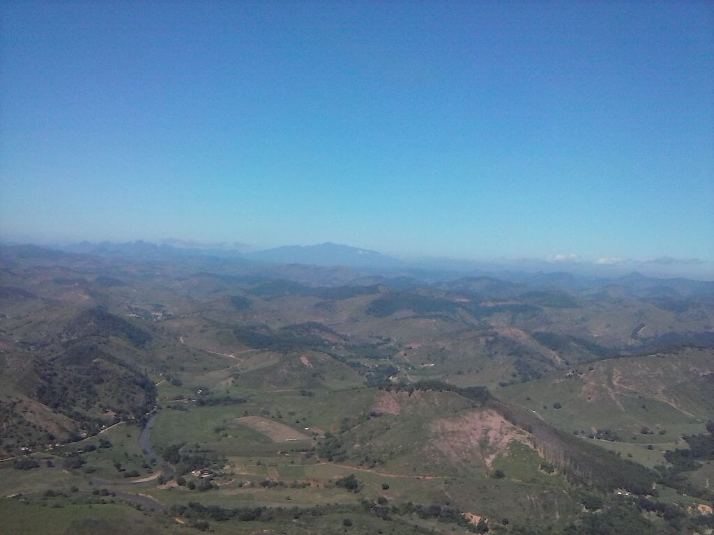
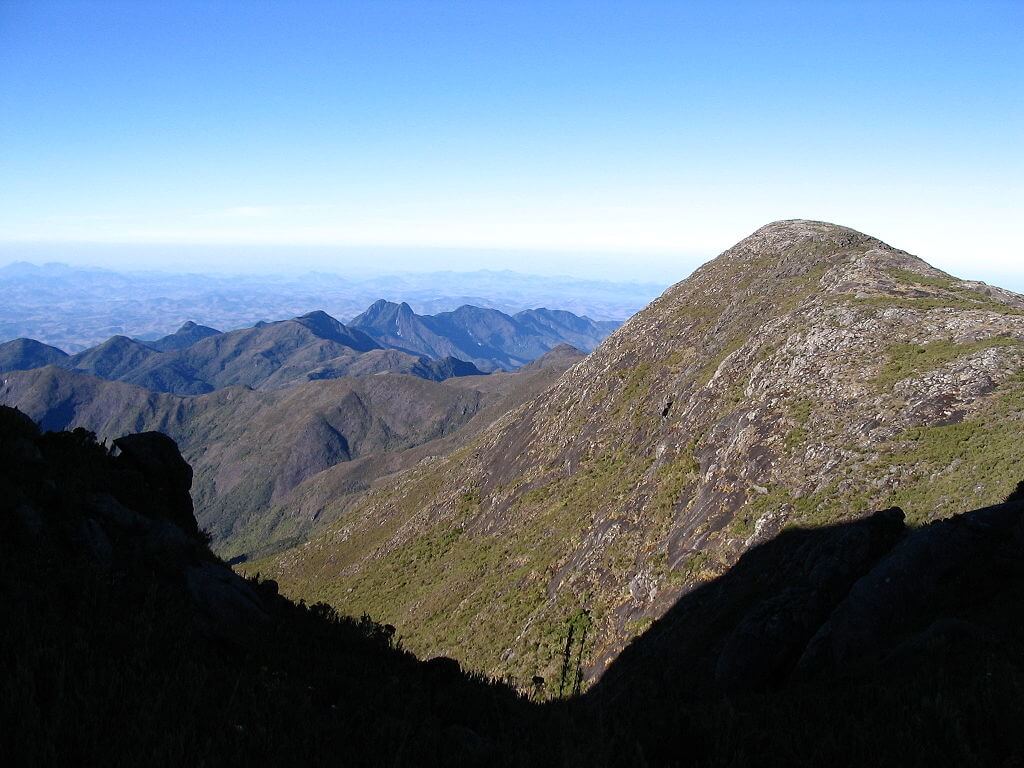
Over millions of years, weathering and erosion have carved the highlands into their current configuration. The eastern margin is defined by the Serra do Mar. This dramatic escarpment rises abruptly from the coastal plains near São Paulo and Rio de Janeiro to elevations exceeding 2,000 m (6,560 ft) in places, while the interior displays gentler, rolling topography. This differential erosion created the complex landscape of flat-topped mesas, deep valleys, and exposed linear outcrops that characterize the region today. Erosional processes continue to shape the landscape, creating extensive sedimentary deposits in river valleys and contributing to ongoing soil formation across the plateau.
Geographic Extent and Physiographic Relationships
The highlands' boundaries blend seamlessly with surrounding physiographic regions, creating transitional zones of exceptional ecological importance. To the north and northwest, the plateau gradually descends into the Amazon Basin through a series of stepped terraces, influencing drainage patterns and creating unique savanna-forest transition zones.
The western boundary abuts the Pantanal wetlands, where highland drainage forms the world's largest tropical wetland system. This relationship demonstrates the highlands' crucial role as a continental watershed, collecting precipitation and channeling it through major river systems.
Elevations across the highlands vary dramatically, from 300 m (984 ft) in transitional zones to peaks exceeding 2,800 m (9,186 ft). The highest elevations occur along two primary axes: the eastern escarpment system, which runs parallel to the Atlantic coast through the Serra do Mar and its inland companion range, the Serra da Mantiqueira, and an interior highland zone extending through central Brazil toward Brasília.
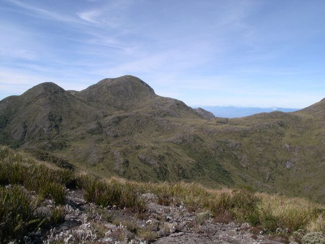
The Pico da Bandeira, reaching 2,891 m (9,485 ft) in the Serra do Caparaó, represents the highlands' highest point and exemplifies the region's topographic extremes. These elevation gradients create diverse microclimates and support distinct vegetation zones from tropical forests to alpine grasslands.
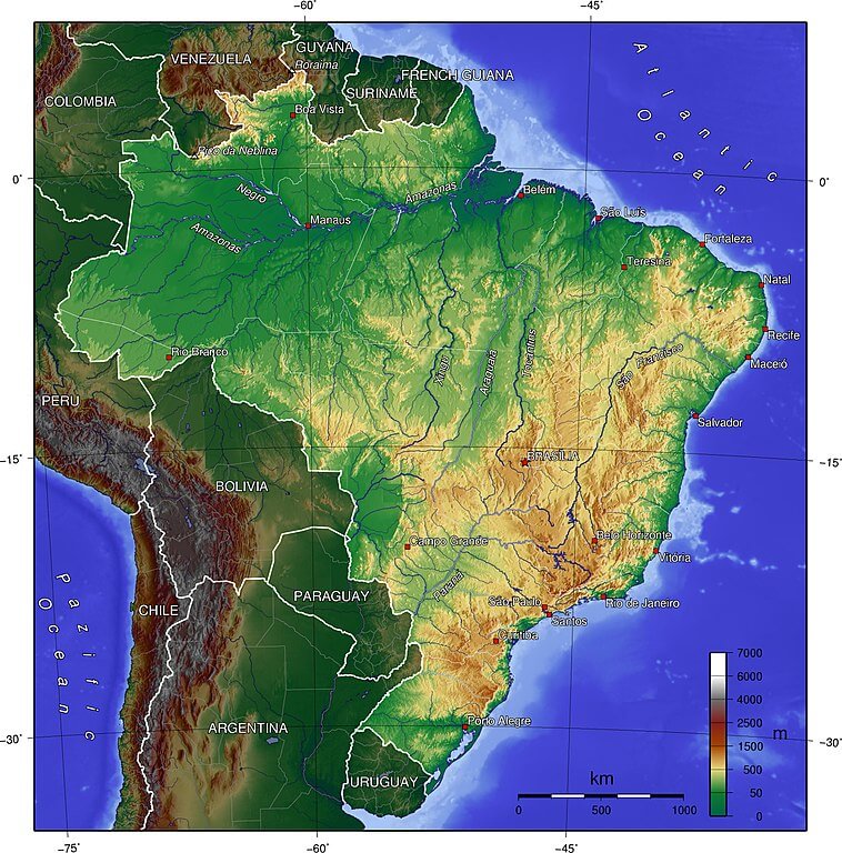
Topographical map of Brazil. The Brazilian Highlands/Plateau is the large yellowish and brown area in the east, south, and center of the country.
Climate Systems and Atmospheric Influence
The highlands fundamentally alter South American climate patterns through orographic effects. The eastern escarpment intercepts moisture-laden Atlantic trade winds, forcing air masses upward and creating heavy orographic precipitation on windward slopes, an effect visible in the dense cloud forest that clings to the upper reaches of the Serra dos Órgãos above Rio de Janeiro. This process supports the Atlantic Forest's remnant fragments while creating rain shadows in interior valleys.
The region experiences distinct seasonal patterns, with wet summers (October-March) and dry winters (April-September). However, elevation and geographic position create significant local variations. Higher elevations experience cooler temperatures year-round, while interior plateaus exhibit more continental characteristics with greater temperature ranges.
The highlands' role as a heat island during dry seasons influences regional atmospheric circulation, contributing to the formation of convective systems that affect precipitation across central Brazil. Current climate research indicates the highlands are experiencing shifts in precipitation timing and intensity, with implications for water resources, agricultural productivity, and ecosystem stability.
The Plateau Systems: Ecological Diversity
The Atlantic Plateau extends along Brazil's eastern seaboard, encompassing the nation's most populous regions and the twin escarpment ranges of the Serra do Mar and the Serra dos Órgãos. This area originally supported the Atlantic Forest (Mata Atlântica), one of Earth's most biodiverse ecosystems. Today, urban expansion and agricultural conversion have reduced this forest to approximately 12% of its original extent, existing primarily in fragmented patches.
Despite intense human pressure, the Atlantic Plateau harbors exceptional biodiversity in protected areas and urban forest fragments. The region supports over 20,000 plant species, 40% of which are endemic, along with iconic fauna including golden lion tamarins (Leontopithecus rosalia), jaguars (Panthera onca), and hundreds of bird species. Conservation efforts focus on connecting forest fragments through ecological corridors and protecting watershed areas that supply water to major metropolitan areas, including São Paulo and Rio de Janeiro.
The Central Plateau represents Brazil's agricultural heartland, where vast areas of Cerrado savanna have been converted to crop production. This transformation, which has occurred primarily since the 1970s, has made Brazil a global leader in soybean, corn, and cotton production. In the past decade, the agricultural frontier has pushed further into the region's northern reaches, particularly the so-called MATOPIBA area spanning parts of Maranhão, Tocantins, Piauí, and Bahia, now one of the fastest-expanding zones of Cerrado conversion in the country.
The original Cerrado ecosystem covered approximately 2 million sq km (772,200 sq mi) and represented the world's most biodiverse savanna. Characterized by fire-adapted vegetation with deep root systems, the Cerrado supported over 10,000 plant species and served as a crucial watershed for major river systems, including the Amazon, Paraná, and São Francisco, the last of which rises in the Serra da Canastra in southwestern Minas Gerais. Current conservation challenges include protecting the remaining 50% of native Cerrado vegetation while maintaining agricultural productivity; sustainable intensification practices and integrated crop-livestock systems offer potential solutions for balancing conservation with economic development.
The Southern Plateau combines elements of Atlantic Forest, Araucaria highland forest, and Cerrado grasslands, its dramatic edge marked by the basalt cliffs of the Serra Geral, creating a mosaic of ecosystems that support diverse agricultural activities. This region has become renowned for its wine production, capitalizing on its higher elevations and temperate climate. The Araucaria angustifolia (Brazilian pine) forests once covered extensive areas but now exist primarily in protected areas and fragments, including within São Joaquim National Park along the Serra Geral escarpment. These unique ecosystems support specialized fauna, including several endemic bird species, and represent important carbon storage systems.
A fourth, often overlooked highland zone lies in Brazil's semi-arid Northeast: the Borborema Plateau, which rises abruptly from the surrounding caatinga scrubland across Paraíba, Pernambuco, and Rio Grande do Norte, and the Serra do Espinhaço, whose northern reaches form the Chapada Diamantina in Bahia. Both ranges act as isolated, cooler, wetter refugia within an otherwise arid landscape, supporting relict pockets of forest and high levels of plant endemism found nowhere else in the highland system.
Biodiversity Hotspots and Conservation Priorities
The highlands' diverse elevational gradients and climatic conditions have created centers of endemism rivaling any global biodiversity hotspot. The Atlantic Forest portion alone contains more tree species per hectare than the entire North American continent, while the Cerrado harbors unique plant communities adapted to nutrient-poor soils and regular fire cycles.
Each biome within the highlands has evolved distinct endemic communities shaped by specific environmental pressures. The Atlantic Forest's fragmented canopies shelter the golden lion tamarin (Leontopithecus rosalia) and muriqui monkey (Brachyteles arachnoides) alongside hundreds of orchid species found nowhere else on Earth. In the fire-adapted Cerrado, the maned wolf (Chrysocyon brachyurus) roams savannas dotted with unique palm species and grasses that have developed specialized root systems extending up to 15 m (49 ft) deep. The highland forests showcase evolutionary marvels such as the towering Araucaria trees, living fossils that have survived since the age of dinosaurs, while specialized bromeliad communities create aerial gardens in the forest canopy, each supporting miniature ecosystems of insects, amphibians, and other small creatures.
Current conservation efforts encompass approximately 334 federal conservation units covering 18% of the highland territory. However, protection levels vary significantly among biomes, with the Atlantic Forest having higher protection percentages than the Cerrado. The private reserve network system (RPPN) has engaged thousands of landowners in voluntary conservation, protecting over 700,000 hectares (1.73 million acres) of highland ecosystems, while payment-for-ecosystem-services programs such as Brazil's Produtor de Água (Water Producer) initiative now compensate landowners in highland watersheds for maintaining forest cover that protects downstream water supplies. Indigenous territories provide some of the most effective long-term protection for highland ecosystems, and sustainable-use reserves demonstrate how communities can maintain traditional livelihoods while protecting biodiversity.
Economic Significance and Resource Wealth
The highlands contain some of the world's largest mineral deposits, including iron ore, gold, manganese, and gemstones, concentrated above all in the Quadrilátero Ferrífero ("Iron Quadrangle") of Minas Gerais, a mineral-rich zone at the southern end of the Serra do Espinhaço system. The Carajás region alone contains an estimated 18 billion tons of iron ore, making it one of the world's most valuable mineral provinces. Mining activities contribute significantly to Brazil's export economy but pose environmental challenges, including habitat fragmentation, water pollution, and landscape modification; sustainable mining practices and restoration programs are becoming increasingly important for balancing economic benefits and environmental protection.
The Central Plateau has emerged as a global agricultural powerhouse through technological innovation and adapted farming practices. Brazilian researchers developed tropical soybean varieties and no-till farming systems that revolutionized agriculture in previously unsuitable areas. Agricultural production statistics demonstrate the region's global significance: Brazil now produces roughly 40% of the world's soybeans, with the Cerrado region contributing about 60% of the nation's total grain production across more than 60 million hectares (148.3 million acres) of highland cultivation, one of the most rapid agricultural expansions in human history.
The highlands' elevation gradients and river systems also provide exceptional hydroelectric potential. Major facilities include the Itaipu Dam, the world's second-largest hydroelectric facility by installed capacity, along with numerous smaller installations throughout the region. Hydroelectric development faces challenges, including environmental impacts on river ecosystems, community displacement, and altered flow regimes that affect downstream areas, including the Pantanal wetlands.
Urban Development and Population Centers
The highlands support Brazil's largest metropolitan areas, home to well over 150 million people across the eight states the plateau spans. The São Paulo metropolitan area alone contains over 22 million inhabitants, making it one of the world's largest urban agglomerations.
Urban settlement patterns across the highlands reflect the region's geographic advantages, from the moderate climate found at higher elevations to the abundant freshwater resources flowing from highland watersheds. Major cities developed along transportation corridors that follow river valleys, taking advantage of natural routes through otherwise challenging terrain while maintaining proximity to both mineral deposits and agricultural resources.
The scale of urban development creates cascading infrastructure demands that test the limits of highland resources. Water supply systems must capture and transport water from highland watersheds over vast distances and through significant elevation changes to reach metropolitan populations; São Paulo's Cantareira system, which draws on highland reservoirs, came close to collapse during the severe 2014-2015 drought, illustrating how directly the megacities depend on highland hydrology. Transportation networks require extensive engineering solutions to cross the region's dramatic topography, while housing expansion increasingly encroaches onto steep slopes prone to erosion and landslides, a risk made starkly clear by fatal landslides in the hillside communities above Rio de Janeiro and Petrópolis in recent years.
Water Resources and Hydrological Importance
The highlands serve as the source region for South America's major river systems, including tributaries to the Amazon, Paraná, and São Francisco rivers. This watershed function makes the region crucial for continental water security and the health of its aquatic ecosystems. Highland springs and streams provide water to over 70% of Brazil's population, underscoring the critical importance of watershed protection and sustainable land-use practices.
Extensive groundwater systems underlie highland areas, including portions of the Guarani Aquifer, one of the world's largest freshwater reserves, spanning parts of Brazil, Argentina, Paraguay, and Uruguay. These aquifers provide backup water supplies during dry periods and support base flows in rivers during seasonal low-water periods, and their management requires careful attention to protecting recharge areas and to sustainable extraction rates to maintain long-term water security.
Current Conservation Challenges and Future Outlook
Climate projections indicate the highlands will experience increased temperature variability and altered precipitation patterns, creating interconnected challenges across multiple systems. Agricultural productivity faces pressure from both shifting rainfall patterns and more frequent extreme weather events, while water resources must adapt to more variable precipitation timing and intensity, as São Paulo's own near-miss with the Cantareira system demonstrated. These hydrological changes threaten the stability of ecosystems already stressed by habitat fragmentation, potentially forcing species distributions to shift faster than natural adaptation can accommodate, and protecting high-elevation refugia such as the Serra da Mantiqueira. The Espinhaço range becomes crucial for climate-sensitive species that may have no other suitable habitat as temperatures rise.
Balancing conservation with economic development increasingly relies on mechanisms that treat ecosystem services as economic assets rather than externalities: expanding programs like Produtor de Água, sustainable intensification of agriculture on already-cleared land rather than further Cerrado conversion,