
The Andes: Spine of a Continent, Home to Its Peoples
The Andes Mountains form a continuous highland along South America's western coast. The Andean Region extends from Caribbean Venezuela south to Cape Horn, encompassing extraordinary geological, ecological, and human diversity across seven nations.
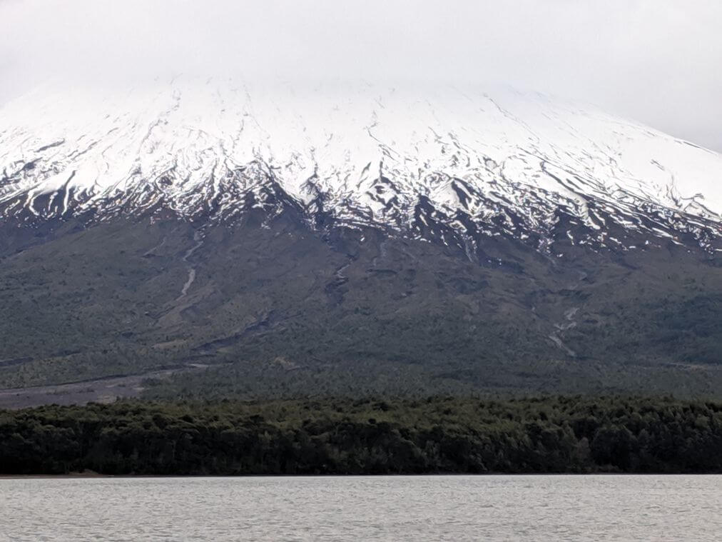
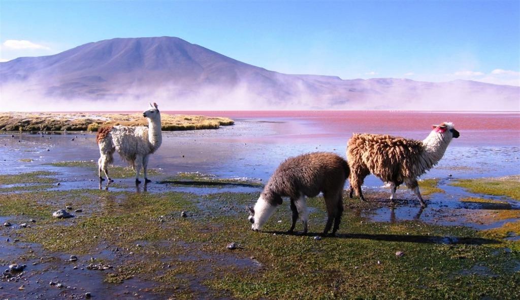
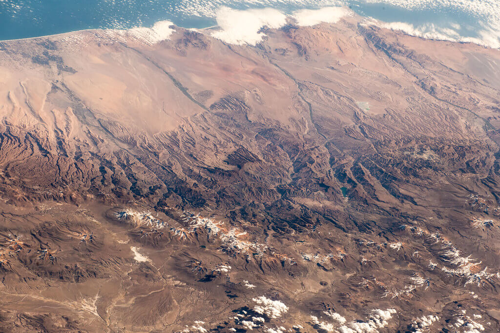
The Andes Mountains and the Andean Region: A Comprehensive Exploration
The Andes Mountains, or Cordillera de los Andes, stand as the most extensive continental mountain range on Earth, tracing a majestic path along the western coast of South America for over 7,000 km (4,350 mi). This geographical marvel not only separates a narrow western coastal region from the rest of the continent but also forms the highest mountain range outside Asia. Beyond its geological scale, the Andes have shaped human civilization in South America for millennia, giving rise to some of the pre-Columbian world's most sophisticated societies and remaining home today to tens of millions of people who live, farm, and build cities at altitudes found almost nowhere else on Earth.
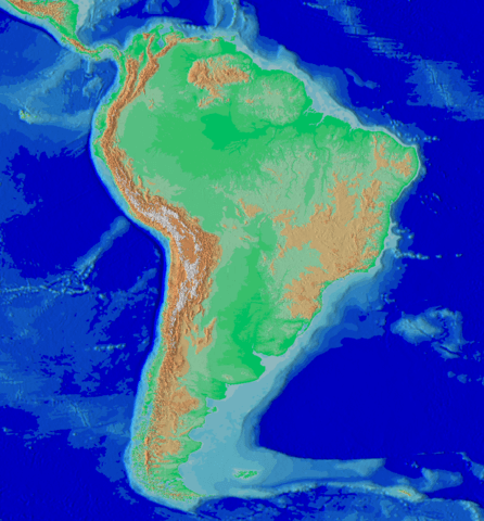
South America topographic map, showing the Andes system along the western coast.
Geology of the Andes
The Andes are a product of Mesozoic-era orogenesis, forming an imposing belt of mountains along the Pacific Ring of Fire. Plate tectonics, specifically the subduction of oceanic crust beneath the South American Plate, plays a pivotal role in shaping this extraordinary landscape. The convergence of the Nazca and South American plates at the Peru-Chile oceanic trench is a defining feature, driving the ongoing orogenic processes responsible for the Andes' continued uplift and its frequent, sometimes devastating, seismic activity. Further south, the compression of the continent's western margin from the subduction of both the Nazca Plate and the Antarctic Plate continues the same mountain-building process, making the entire range one of the most tectonically active regions on Earth.
The Andes claim some of the world's highest volcanoes. Ojos del Salado, on the Chile-Argentina border, reaches 6,893 m (22,615 ft), making it the highest volcano on Earth. Cotopaxi, Ecuador's second-highest summit at 5,897 m (19,347 ft), ranks among the highest continuously active volcanoes anywhere in the world, its periodic eruptions a direct and ongoing hazard for the roughly 2 million people living in and around Quito, just 50 km (31 mi) to its north.
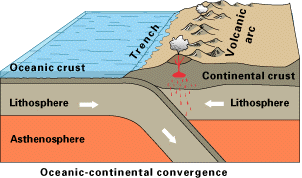
Simplified sketch of the tectonic forces along most of the Andes.
Geography of the Andes: Extensive Reach and Continental Backbone
Extending through seven countries—Venezuela, Colombia, Ecuador, Peru, Bolivia, Chile, and Argentina—the Andes Mountains play a crucial role in shaping the topography of South America. The islands of Aruba, Bonaire, and Curaçao in the Caribbean Sea are considered submerged peaks representing the extreme northern edge of the Andes range, and some geologists have proposed that the Antarctandes, the Antarctic Peninsula's mountain spine, represents the range's southernmost continuation across the Drake Passage into Antarctica.
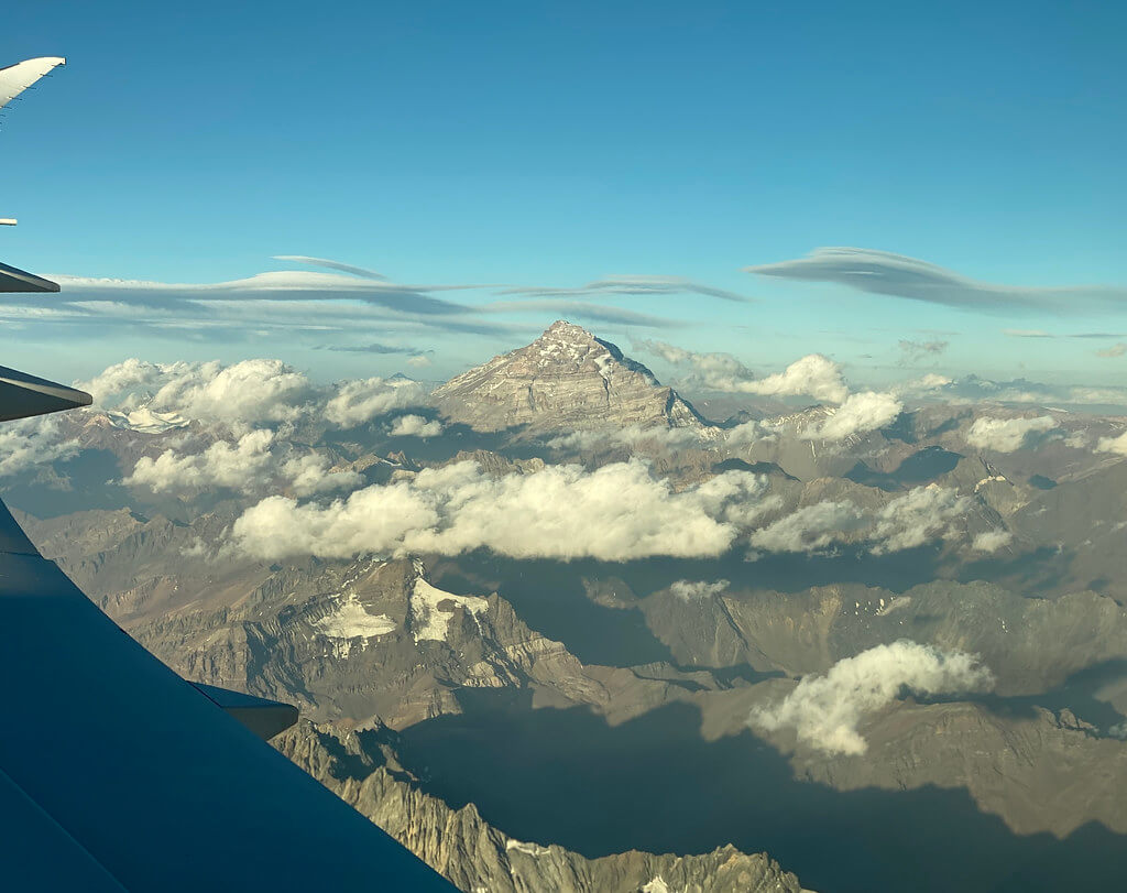
The Andes are integral to the American Cordillera, forming the western "backbone" of North America, Central America, South America, and Antarctica. A vast series of plateaus crowned by towering peaks characterizes this extraordinary mountain range. Mount Aconcagua, standing at 6,961 m (22,838 ft) according to Argentina's most recent official survey, claims the title of the highest mountain outside Asia, proudly marking the Argentina-Chile border.
The equatorial bulge is most evident at Mount Chimborazo in the Ecuadorian Andes, whose summit, owing to the Earth's equatorial bulge, is the single point on the planet's surface farthest from its center—farther even than the summit of Everest.
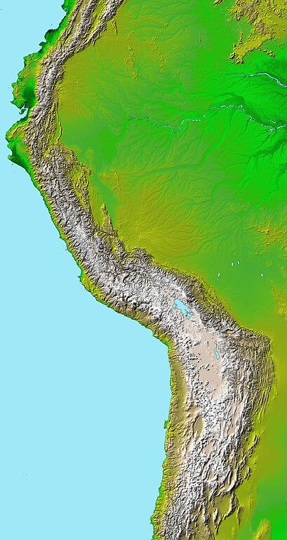
Topography of the Andes from a Digital Elevation Model.
Northern Andes
The Venezuelan Andes, comprising the Cordillera de Mérida and the smaller Serranía del Perijá along the Venezuela-Colombia border, mark the range's northern terminus, presenting a landscape that transitions from tropical lowland into permanently snow-capped peaks over a remarkably short distance.
The Colombian Andes split into three parallel mountain chains—the Cordillera Occidental, Central, and Oriental—generally trending north to south and enclosing the fertile inter-Andean valleys of the Cauca and Magdalena rivers, home to the great majority of Colombia's population, including the capital, Bogotá, itself perched at roughly 2,640 m (8,660 ft).
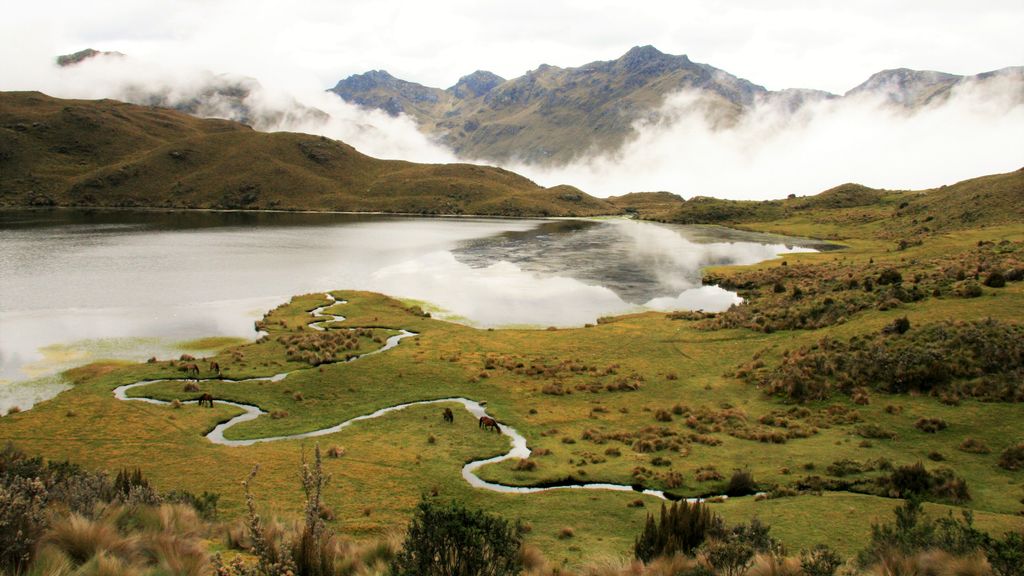
The Ecuadorian Andes narrow into a roughly 600 km (375 mi) plateau flanked by parallel volcanic chains, a landscape so densely studded with volcanic summits that 19th-century German geographer and explorer Alexander von Humboldt famously dubbed it the "Avenue of the Volcanoes." Transversal mountain spurs known as nudos periodically divide this plateau into a chain of high, enclosed basins, several of which host major cities, including Quito.
Central Andes
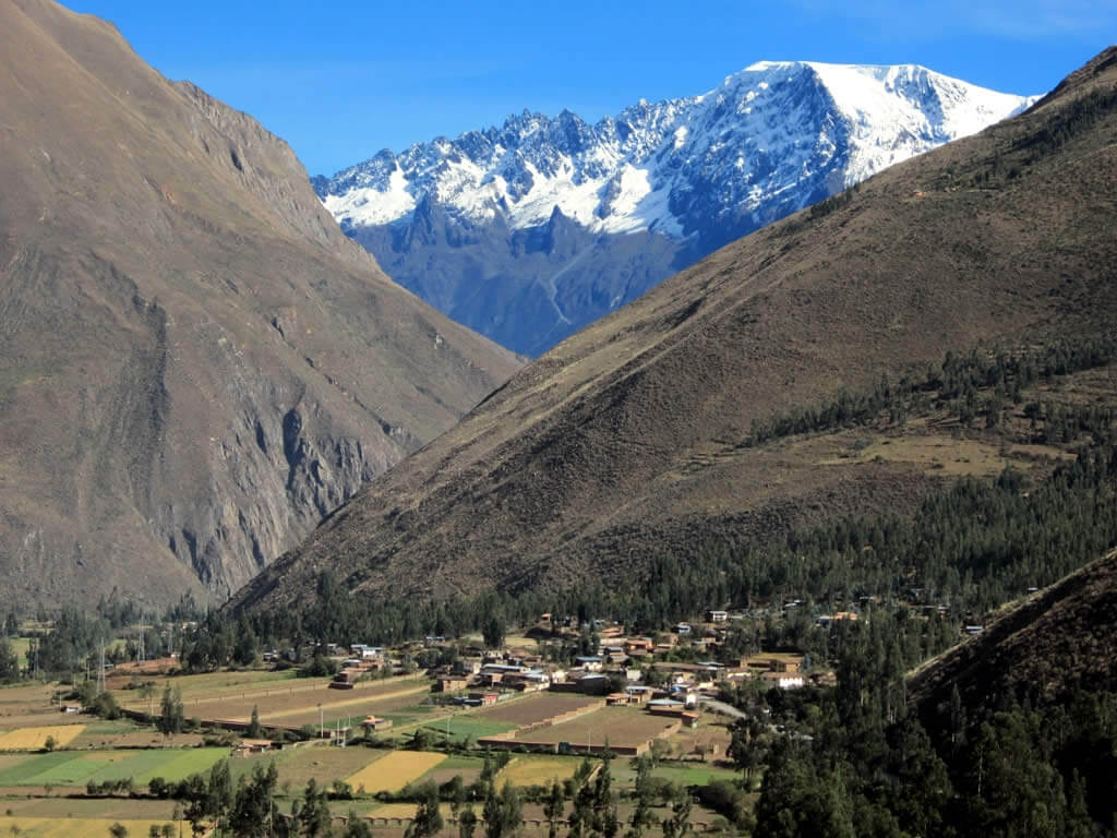
The Peruvian Andes broaden into three distinct mountain ranges, creating a landscape of fertile river valleys, high plains, and deep canyons, including the Colca and Cotahuasi canyons, among the deepest in the world. This is also the historical heartland of the Inca Empire, whose road network and terraced agriculture remain visible throughout the region today.
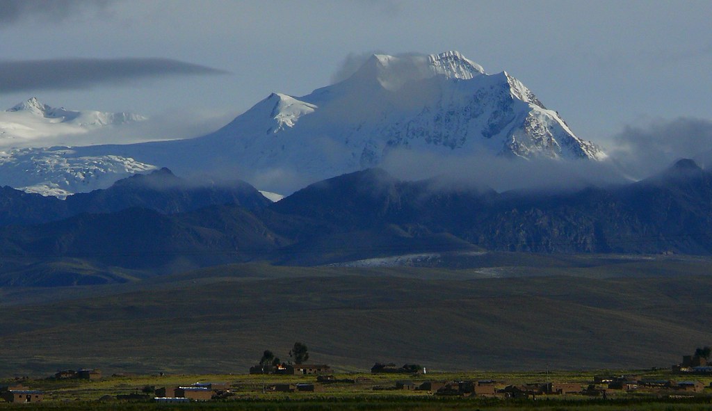
The Bolivian Andes split into the volcanically active Cordillera Occidental, which forms the natural border with Chile, and the considerably older Cordillera Oriental, which extends southeastward toward the Argentine border. Between these two ranges lies the Altiplano, the second-largest high plateau on Earth after Tibet, and the seat of La Paz, which at over 3,600 m (11,800 ft) is the highest administrative capital in the world.
Southern Andes
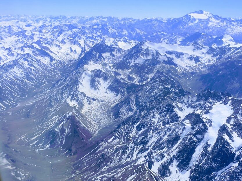
South of the Bolivian border, the Chilean and Argentine Andes form the border between the two countries and contain the range's highest and most continuous section, including Aconcagua and Ojos del Salado. Further south still, past roughly 40°S, the range continues as the Patagonian and Fuegian Andes, a lower, glacier-draped extension of the same mountain system that runs all the way to Cape Horn.
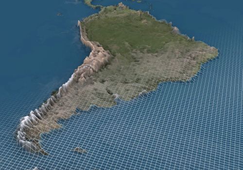
3D map depicting South America and the Andes Mountain range.
A Note on Andean Classifications
The Andes are described on this site, and elsewhere, through two different frameworks that address different questions rather than competing with one another. The country-based Northern, Central, and Southern Andes divisions used above describe where each stretch of the range physically lies and which nation governs it. The climate-based Tropical, Dry, and Wet Andes divisions described below describe a different thing entirely: the ecological and climatic character of a given stretch of mountains, which does not respect national borders. The Tropical Andes broadly corresponds to the Northern Andes plus Peru and Bolivia; the Dry Andes corresponds to the northern portion of the Chilean-Argentine Andes; and the Wet Andes corresponds to their southern portion together with the Patagonian and Fuegian Andes further south. Both frameworks describe the same mountain range—one by geography and governance, the other by climate and ecology.
Andean Peoples and Civilizations
Long before European contact, the Andes gave rise to some of the Americas' most sophisticated civilizations, adapted to an environment where altitude, rather than latitude, was the primary force shaping where and how people lived. The Tiwanaku civilization, centered near Lake Titicaca on the Bolivian Altiplano, flourished from roughly 500 to 1000 CE, developing raised-field agriculture that remains in limited use today. Its successor, the Inca Empire, expanded by the early 16th century to become the largest pre-Columbian state in the Americas, administering a territory stretching from present-day Colombia to central Chile through an extensive road network, the Qhapaq Ñan, sections of which remain walkable today and are recognized collectively as a UNESCO World Heritage Site.
Andean agriculture pioneered the domestication of the potato, now the world's fourth most important food crop by production, along with quinoa and dozens of other Andean staples, developed through millennia of adaptation to extreme altitude, cold, and thin soils; Peru's Potato Park near Cusco today maintains over 1,300 native potato varieties as a living seed bank and a model of Indigenous-led conservation. Quechua and Aymara, the two most widely spoken Indigenous language families of the Andes, remain living languages today, spoken by a combined total of roughly 10 million people across Peru, Bolivia, Ecuador, and neighboring countries, and both hold official status alongside Spanish in Peru and Bolivia. The Andean highlands today are home to tens of millions of people, including the populations of La Paz, Quito, and Bogotá, three of the highest-altitude national capitals on Earth, whose residents live and work at elevations that would cause altitude sickness in most unacclimatized visitors.
Biodiversity: Flora and Fauna
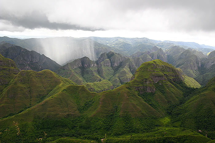
The Andean region is a biodiversity hotspot, housing an estimated 30,000 species of vascular plants, roughly half of which are endemic—a level of diversity that surpasses any other biodiversity hotspot on Earth. In Bolivia alone, the flora includes an estimated 1,950-2,500 tree species, 1,200 moss species, 1,500 fern species, and roughly 11,000 flowering plant species.
The fauna of the Andean region is equally varied, with approximately two-thirds of species considered endemic. The region supports almost 600 mammal species, over 1,700 bird species, more than 600 reptile species, and nearly 400 fish species.
The vicuña (Vicugna vicugna) and guanaco (Lama guanicoe) roam the high Altiplano, while their domesticated relatives, the llama (Lama glama) and alpaca (Vicugna pacos), remain central to Andean livelihoods for meat, wool, and transport, much as they have for thousands of years. The puma (Puma concolor), symbolically significant throughout Andean cultures both ancient and modern, coexists with these camelid herds as the region's principal predator, while the nocturnal chinchilla (Chinchilla chinchilla), once hunted to near-extinction for its fur, persists in small, scattered populations across the high alpine zone. The Andean cloud forests, including the Yungas and parts of the Chocó, harbor threatened species including the mountain tapir (Tapirus pinchaque), spectacled bear (Tremarctos ornatus), and yellow-tailed woolly monkey (Lagothrix flavicauda).
The Andean condor (Vultur gryphus), the largest flying land bird in the Western Hemisphere, with a wingspan reaching up to 3.3 m (10.8 ft), soars above the range's highest ridgelines. Numerous other birds, ranging from tinamous and Andean geese to torrent ducks (Merganetta armata) and several flamingo species, find habitats in the region's lakes, rivers, and hypersaline salt flats.
Climate Variations
The Andes exhibit diverse climates, conventionally classified into three major divisions based on latitude.
The Tropical Andes, spanning Venezuela, Colombia, Ecuador, Peru, and Bolivia, encompass a remarkable range of climates within a narrow latitudinal band, largely as a function of elevation rather than season, and hold the great majority of the world's remaining tropical glaciers—more than 95% of them, most concentrated in Peru's Cordillera Blanca. These glaciers, along with the broader Tropical Andes' snowpack, are retreating faster than nearly any other glaciated region on Earth, a trend with direct consequences for the dry-season water supply of cities including La Paz and Lima, both of which depend heavily on glacial and highland runoff during the months when rainfall is scarce.
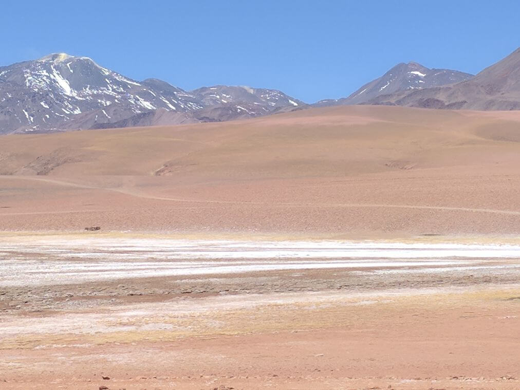
The Dry Andes extend from the Atacama Desert in northern Chile and northwestern Argentina south to roughly 35°S, showcasing arid conditions and dramatic diurnal temperature swings. This same arid high-altitude zone contains the "lithium triangle," where the salt flats of Bolivia's Salar de Uyuni, Chile's Salar de Atacama, and Argentina's Salar del Hombre Muerto together hold more than half of the world's known lithium reserves. This resource has drawn intensifying international investment as global demand for battery materials accelerates, even as it raises concerns over the brine-rich groundwater these arid ecosystems and local communities depend on.
The Wet Andes stretch from roughly 35°S south to Cape Horn at 56°S. Here the permanent snow line drops steadily with increasing latitude, giving rise to active volcanoes, vast temperate ice fields, and numerous glacial lakes that feed fertile valleys known as vegas, while dense, largely impenetrable forest cloaks both flanks of the cordillera.
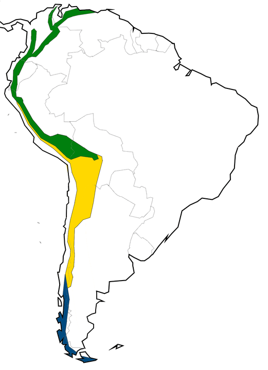
Map depicting the climatic regions of the Andes: Dry Andes in yellow, Wet Andes in blue, and Tropical Andes in green.
Conclusion
The Andes Mountains and the Andean region reveal geological marvels, diverse topography, and rich biodiversity that define this extraordinary part of the world—but they are, just as fundamentally, a human landscape, home to civilizations that mastered high-altitude living millennia before it became a subject of modern scientific curiosity, and to tens of millions of people today whose water security, economies, and cultural identity remain as tied to these mountains as ever. From Mount Aconcagua's towering peaks to the retreating glaciers of the Cordillera Blanca and the lithium-rich salt flats of the Dry Andes, the Andes showcase the intricate interplay of geological forces, climate, human history, and the pressing resource questions of the present day.
The Northern, Central, and Southern Andes each present distinct physical characters, while the Tropical, Dry, and Wet Andes offer a complementary way of understanding the same range through its climate and ecology rather than its borders. Together, these overlapping lenses reveal the Andes as both a geological wonder and a cradle of civilization—an invitation to explore each of its constituent regions and the peoples who call them home in greater depth.