
Lakes Poopó and Uru Uru and the Desaguadero River: Bolivia's Vanishing Waters
Lake Poopó and Lake Uru Uru are shallow, salty lakes on Bolivia's Altiplano, fed mainly by the Desaguadero River from Lake Titicaca. Both have dried almost completely in recent decades, taking fish, flamingos, and the livelihoods of the Uru Murato people with them, and both remain fragile as drought, irrigation, mining, and pollution continue.

The Disappearing Waters of Bolivia: Lakes Poopó, Uru Uru and the Desaguadero River
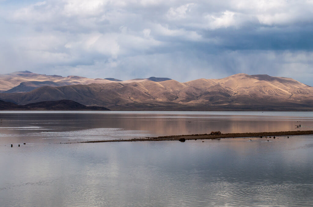
Lake Poopó and Lake Uru Uru are shallow, salty lakes on Bolivia's Altiplano, fed mainly by the Desaguadero River, which carries water south from Lake Titicaca. Together they form a Ramsar-listed wetland that once held more than 100,000 flamingos, and both have dried almost completely more than once in recent decades. Rainfall, irrigation, mining, and the level of Titicaca all affect them, and the people who fished their waters, notably the Uru Murato, have borne the cost. The lakes sit in a closed basin high in the Bolivian Andes, in Oruro Department.
Lake Poopó: A Lost Giant of the Altiplano
Poopó lies at about 3,686 m (12,093 ft) and was once Bolivia's second-largest lake after Titicaca. It was about 90 km (56 mi) long and 32 km (20 mi) wide, and in wet years covered roughly 3,000 to 3,500 km² (1,200 to 1,350 sq mi). Its basin is endorheic, meaning no river carries water to the sea and the lake loses water only by evaporation, which is why it is salty, averaging about 25 grams of salt per liter. Because it is also very shallow, usually less than 3 m (10 ft) deep, a small change in volume causes a large change in surface area, and the shoreline has always moved across the flat plain with the rains.
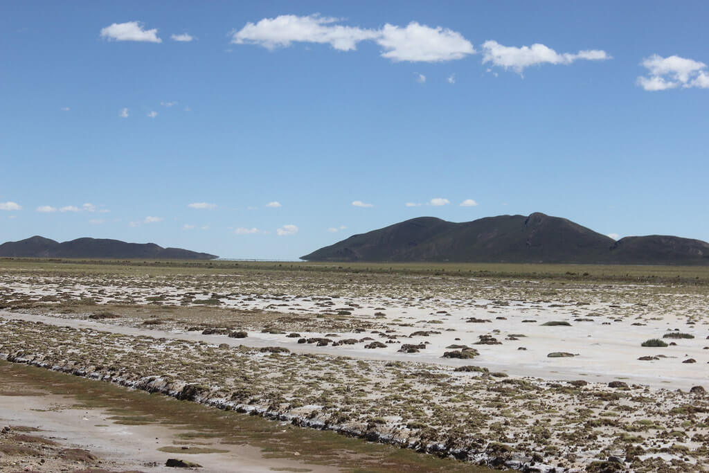
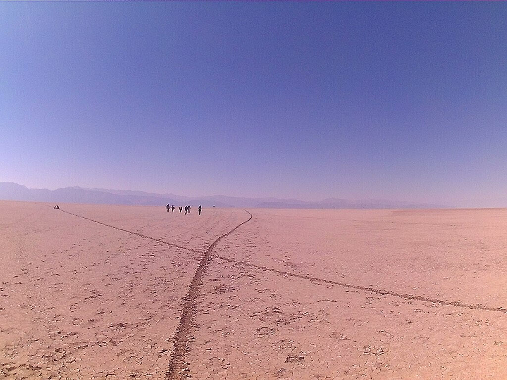
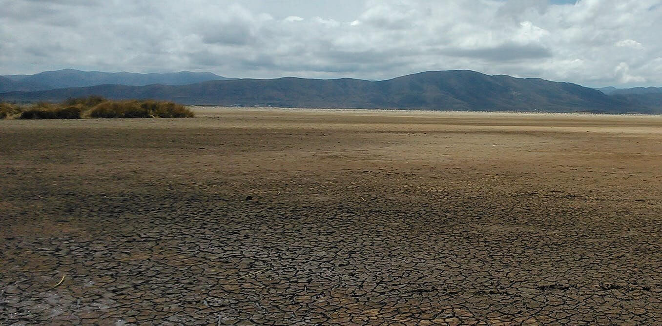
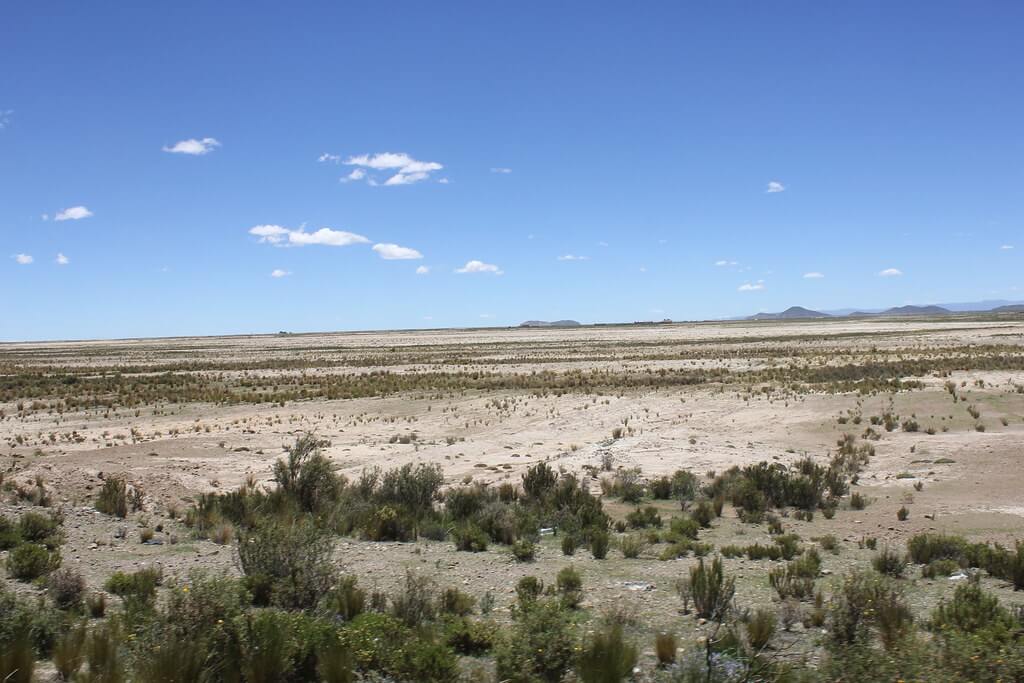
The lake has dried before. Its area shrank after 1986, and it vanished in 1994; by December 2015, it had dried again, leaving only a few marshy patches. Bolivia declared the area a disaster zone in January 2016. Rains in 2017 refilled part of it, and by early 2018 the governor reported about 1,300 km² (500 sq mi) of water, although fish had not returned and totora reed beds were expected to take 15 to 20 years to regenerate. In October 2023, Oruro officials again declared the lake dry and declared a departmental catastrophe. Rain in early 2025 raised the covered area, but local reports describe the recovery as short-lived; by August 2026, water covered only about 30 percent of the lakebed, in places just 50 to 70 cm (20 to 28 in) deep. Reports differ about exactly when and how completely the lake emptied (2014, 2015, 2018, 2021 and 2023 are all cited), so the dates above are the best-documented ones.
Several causes combine. Warming at high altitude has raised evaporation, glaciers that once fed the headwaters have retreated, and rain in the basin has become more erratic, with a shorter rainy season but heavier storms. Upstream, water is diverted for irrigation, partly to expand quinoa farming, and for mining and the city of Oruro, so less reaches the lake. A study of satellite data argued that poor water management matters at least as much as climate variability. Sediment has also built up on the lake floor, flattening the bed so that rain spreads thinly over a wide plain and evaporates quickly.
Lake Uru Uru: A Smaller Neighbor Facing Similar Perils
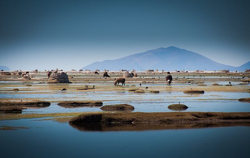
Lake Uru Uru lies a few kilometers south of the city of Oruro, also at about 3,686 m (12,093 ft). It is far smaller than Poopó, about 214 km² (83 sq mi) in a full year, and shallow, usually no more than about 1.5 m (5 ft) deep. Local activists date its origin to an overflow of the Desaguadero in the mid-twentieth century. It has shrunk dramatically: municipal figures reported by journalists put its water surface at roughly 20 km² (8 sq mi) in 2021, and Oruro officials said only about 10 km² (4 sq mi) of water remained in October 2023.
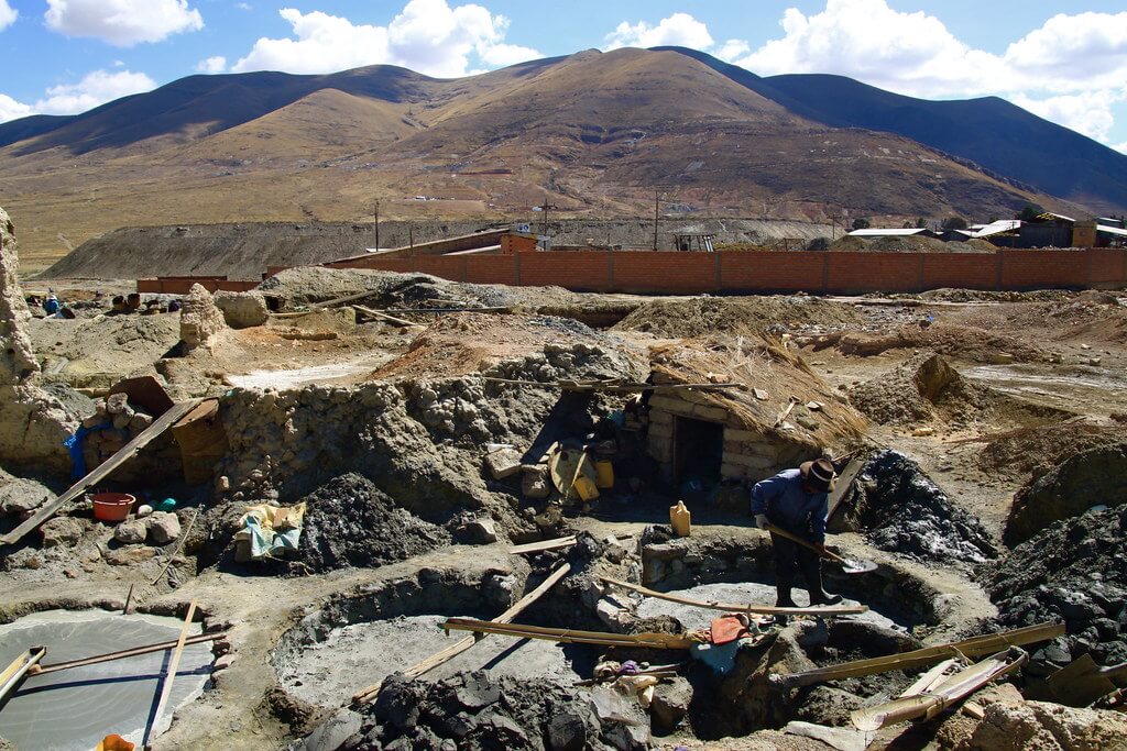
Uru Uru is also the more polluted of the two. Oruro's sewage enters at the mouth of the Tagarete canal, and plastic waste and garbage have piled up along the shore. Acidic runoff from nearby mines carries heavy metals such as cadmium, zinc, arsenic, lead, and mercury, and the Ramsar record notes contaminated water reaching the lake from the Huanuni tin mine through the Sora Sora River since 1995. Fish stocked over the decades, notably pejerrey (Odontesthes bonariensis), supported fishing cooperatives, but catches have fallen and the eastern side of the lake, divided by a railway line, is considered the most contaminated.
The Desaguadero River: A Lifeline in Decline
The Desaguadero River leaves the southern end of Titicaca at the town of Desaguadero, on the Peru-Bolivia border, at about 3,811 m (12,503 ft), and runs roughly 320 km (200 mi) south to Uru Uru and Poopó. Its average flow, measured at Ulloma, is about 78 m³/s (2,750 cu ft/s), but it varies widely, from about 28 m³/s (990 cu ft/s) at minimum to about 282 m³/s (10,000 cu ft/s) at maximum. The river is navigable only by small craft and supplies irrigation water in La Paz and Oruro departments, but it carries only a small share of Titicaca's water, since most of that lake's water leaves by evaporation.
Desaguadero delivers roughly 80 to 90 percent of the water entering Poopó, depending on the source, so the lake depends on the river's health and ultimately on Titicaca's level. That level is now falling. Peru's weather service SENAMHI reported on 6 October 2026 that Titicaca had dropped about 53 cm (21 in) since 1 May, with a possible loss of 70 cm (28 in) by late November. It warned that El Niño conditions could last until March 2027, with Puno rainfall up to 40 percent below normal. A lower Titicaca means a weaker Desaguadero, and a weaker Desaguadero means less water for downstream lakes.
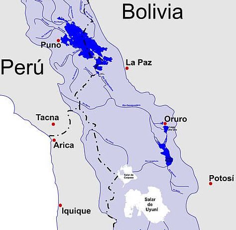
Map depicting Lake Titicaca, Rio Desaguadero, Lago Poopó, Lago Uru Uru, and the Salar de Uyuni basin.
Wildlife and Protected Status
The two lakes were designated as the Ramsar site "Lagos Poopó y Uru Uru" on 11 July 2002, covering 967,607 ha (9,676 km², or 3,736 sq mi). At the time, researchers had recorded about 76 bird species, including three flamingo species: the Chilean flamingo (Phoenicopterus chilensis), the Andean flamingo (Phoenicoparrus andinus), and James's flamingo (Phoenicoparrus jamesi), with aerial counts in the 1990s of 75,000 to 120,000 birds. Other water birds include the horned coot (Fulica cornuta), the white-winged grebe (Rollandia microptera), which is found only in the Titicaca-Poopó basin, and the puna teal (Anas puna). Native fishes include pupfishes of the genus Orestias, such as Orestias agassizii, and small catfishes of the genus Trichomycterus, while introduced rainbow trout (Oncorhynchus mykiss) and pejerrey are also present. Aquatic and shoreline plants include totora reeds (Schoenoplectus californicus), and thola shrubs (Parastrephia) are heavily harvested for fuel. When the water disappears, so do the birds, and flamingo numbers, along with the fish catch, have fallen sharply since the lakes began to dry.
Environmental and Socioeconomic Impact
The Uru Murato, one of the oldest peoples of the Andes, have lived by fishing, hunting waterfowl, and gathering flamingo eggs on these shores for centuries. With the water gone, many families have left for Oruro, other Bolivian cities, Chile, and Argentina, and those who stayed, in villages such as Llapallapani, Puñaca Tinta María, and Villanique, face nightly frost that damages quinoa and potato crops. The World Food Programme has supported the remaining families with rainwater harvesting, irrigation, greenhouses and fishing ponds. Aymara fishing communities such as Untavi are affected in the same way. In October 2023, representatives of about 700 communities met national and regional authorities to approve an action plan for the Poopó basin.
Recovery proposals are modest in scale. In August 2026, Limbert Sánchez Choque of the Centro de Ecología y Pueblos Andinos (CEPA) proposed a master plan to recover at least 50 percent of the lake, using dredging and hydraulic works, structures to hold water, regulation of Desaguadero water use, and reforestation. Experts also point to storing wet-season water, controlling irrigation, and cleaning up the pollution entering Uru Uru.
Conclusion
Poopó and Uru Uru show how fragile a shallow lake can be at 3,700 m. A few meters of water, a river fed by Titicaca, and a dry season that is getting hotter and harder to predict can decide whether a lake exists at all. Without careful water management in the Desaguadero basin, regular drying may be the norm rather than the exception, and the communities that depend on the lakes will keep paying the price.