
Chapada Diamantina: Exploring Nature's Masterpiece in the Brazilian Highlands
Chapada Diamantina, the "Diamond Plateau" of central Bahia, takes its name from an 1844 diamond rush that transformed a scattering of remote prospector camps into Lençóis, once Bahia's third-largest city — a mining boom whose collapse a century ago left behind the national park, waterfalls, and karst landscapes that now draw visitors in its place.



Chapada Diamantina: The Diamond Rush That Named a Plateau
Nestled in the northeastern reaches of Brazil, Chapada Diamantina unfolds as a vibrant region of extraordinary landscapes and rugged mountainous terrain. Geographically diverse and culturally rich, the region spans approximately 38,000 sq km (14,600 sq mi) within the Brazilian Highlands.
Chapada Diamantina, an extension of the Serra do Espinhaço, commands attention with its vast expanse covering 58 municipalities. Located on the Atlantic Plateau in central Bahia state, this region has an altitude ranging from 500 to 1,000 m (1,600 to 3,200 ft). The plateau acts as a natural watershed, directing its flow into the São Francisco River, De Contas River, and Paraguaçu River.
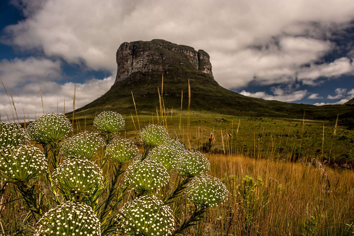
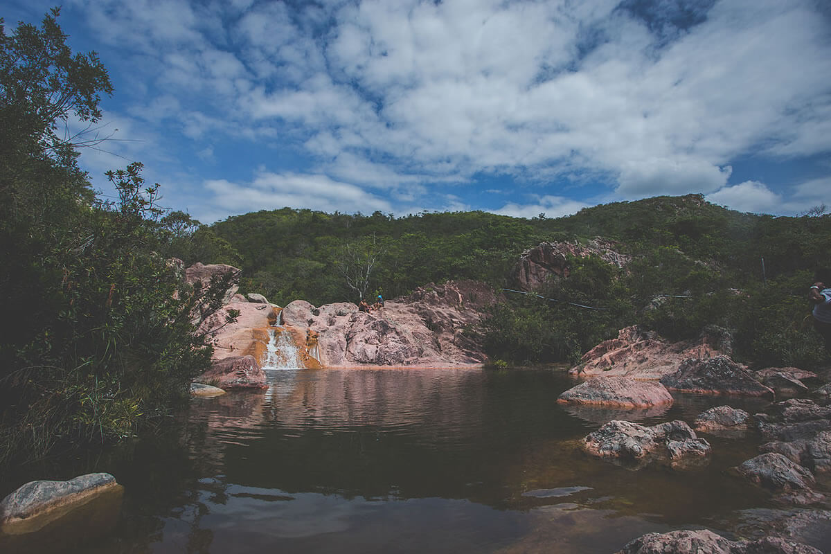
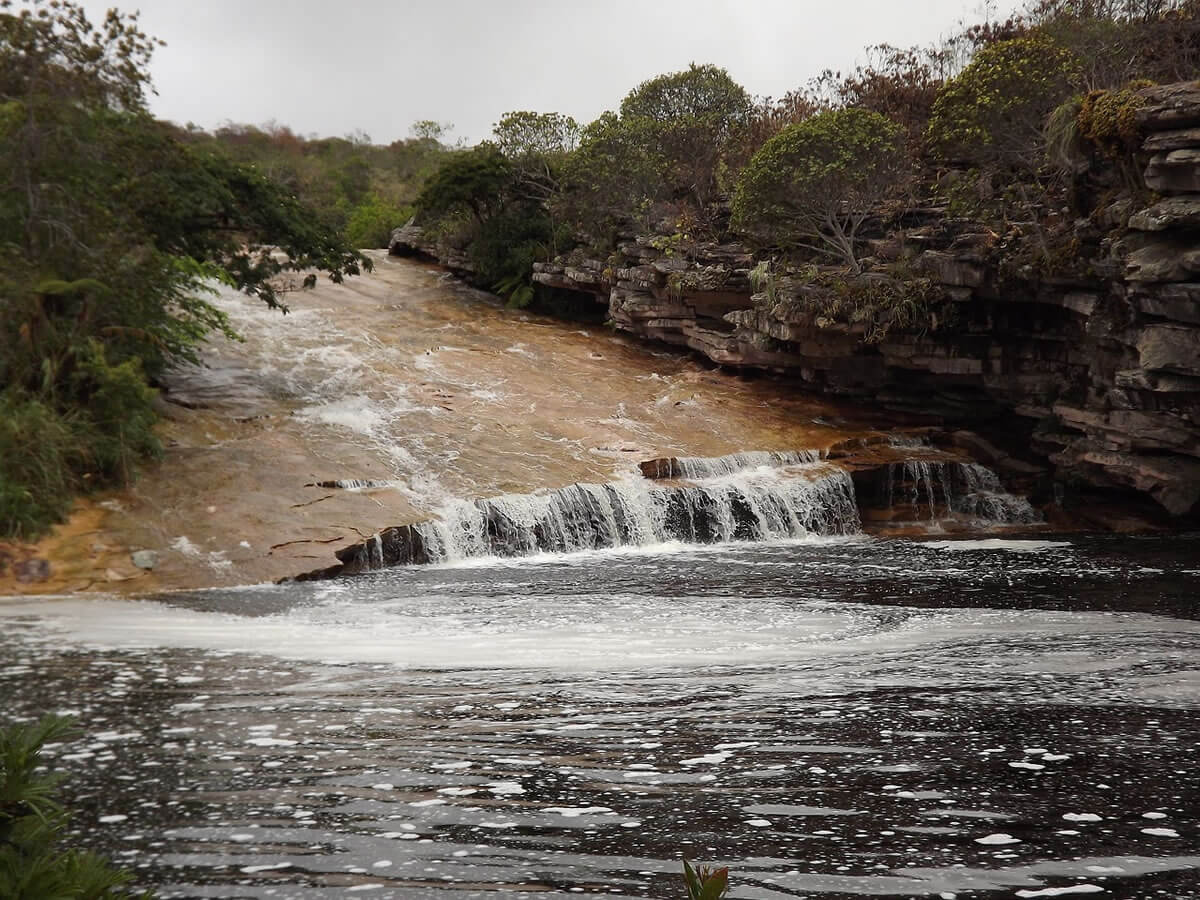
The region encompasses several mountain groups, each contributing to its allure. The Serra do Sincorá, home to the iconic Morro do Pai Inácio, offers panoramic views that draw tourists and nature enthusiasts from around the world. The Serra da Chapadinha, characterized by rocky cliffs and canyons, is home to the Cachoeira da Fumaça, one of Brazil's tallest waterfalls at approximately 340 m (1,115 ft). The Serra do Candombá is known for its picturesque valleys, caves, and crystal-clear blue water pools such as Poço Encantado and Poço Azul. The Serra das Paridas features a mix of valleys, waterfalls, and unique rock formations, including the Ribeirão do Meio waterfall and Pai Inácio Cave. And the Serra do Ramalho, in the region's southwestern reaches, showcases rugged landscapes, canyons, and the Rio de Contas.
The 1844 Diamond Rush That Gave the Plateau Its Name
Long before it became a hiking and ecotourism destination, Chapada Diamantina was the site of one of Brazil's great mineral rushes, and the region's very name, Portuguese for "Diamond Plateau," is a direct legacy of it. Gold had already drawn prospectors, known as garimpeiros, to the area around Rio de Contas as early as the early 18th century, but the discovery that transformed the region came in 1844, when diamonds were found along the Mucugê River, a tributary of the Paraguaçu. Word spread quickly, and garimpeiros poured in from as far away as Minas Gerais, Mato Grosso, and Goiás, alongside enslaved Africans forced to work the region's mines and riverbeds, part of the broader system of enslaved labor that underpinned Brazil's mining economy throughout the colonial and imperial periods.
The town of Lençóis, founded amid this rush in 1845, grew within decades into the diamond trade's principal hub and, at its peak, the third most important city in the entire state of Bahia, behind only Salvador and Feira de Santana; its merchants exported diamonds directly to European markets, bypassing Rio de Janeiro entirely. The boom lasted roughly a quarter-century before beginning to decline after 1871, as the most accessible deposits were exhausted and, later in the century, competition from newly discovered South African diamond fields undercut the market entirely. Lençóis was declared a Brazilian National Heritage Site in 1973 in recognition of the well-preserved 19th-century architecture the diamond era left behind. Since the 1990s, tourism has replaced mining as the region's economic mainstay. However, small-scale artisanal diamond and gold prospecting continues in places like Rio de Contas and Mucugê. Some estimates suggest that as little as 12% of the plateau's total diamond deposits were ever actually extracted.
Chapada Diamantina National Park
Chapada Diamantina National Park, an integral part of the Chapada Diamantina region, is a testament to the region's ecological importance. Administered by the Chico Mendes Institute for Biodiversity Conservation, the park covers 152,142 hectares (375,950 acres) in the rugged Serra do Sincorá. The highest point in Bahia, Pico do Barbado, at 2,036 m (6,680 ft), resides within its boundaries.
The park's elongated range influences moist air currents, resulting in higher rainfall, particularly in the eastern part. This unique climate nurtures diverse ecosystems within the park. Within its boundaries, the Vale do Pati (Pati Valley) is one of the park's most celebrated destinations, a remote, deep valley reachable only on foot or horseback, home to small rural communities descended from the region's original garimpeiro settlers and considered by many hikers one of the most spectacular multi-day trekking routes in Brazil.
Cave systems, formed by the region's rivers, house prehistoric archaeological sites with rock paintings from the pre-Columbian period. These sites offer glimpses into the rich history and cultural heritage of the Chapada Diamantina, long predating the diamond era.
Flora and Fauna
The National Park hosts a mosaic of unique vegetation types, combining elements from the Caatinga, Cerrado, and Atlantic Forest biomes. From Caatinga xerophytic formations at lower altitudes to Atlantic Forest vegetation along watercourses, the park's diverse landscapes support a wide range of plant life.
Rupestrian fields, covering two-thirds of the park, showcase endemic species such as Hippeastrum solandriflorum, Alcantarea nahoumii, and Cryptanthus diamantinensis, among others. These unique ecosystems contribute to the park's rich biodiversity.
The park is a haven for avian and mammalian species, including the endemic hooded visorbearer (Augastes lumachella), a hummingbird found nowhere outside this exact plateau. Protected birds like the white-necked hawk (Buteogallus lacernulatus), Bahia tyrannulet (Phylloscartes beckeri), and ochre-marked parakeet (Pyrrhura cruentata) find refuge here, while mammals like the cougar (Puma concolor), jaguar (Panthera onca), and giant armadillo (Priodontes maximus) roam its diverse landscapes.
Conservation Challenges and Significance
While Chapada Diamantina dazzles with its natural wonders, it faces genuine conservation challenges, several of which trace directly back to its mining history. Illegal artisanal mining persists in parts of the region despite the industry's overall decline, disturbing riverbeds and cave systems that are also archaeologically and ecologically significant. Uncontrolled fire, often set to clear land for cattle grazing on the park's margins, threatens the rupestrian fields' slow-growing endemic plant communities, many of which can take decades to recover from a single burn. Growing tourism, now the region's economic backbone, brings its own pressures: trail erosion, increased water demand in gateway towns like Lençóis, and disturbance to wildlife in the park's most heavily visited areas. Conservation initiatives, working alongside the same communities whose ancestors once mined this land, strive to protect individual species and safeguard the intricate web of life woven within the Chapada Diamantina region and its National Park.
Conclusion
In the heart of northeastern Brazil, Chapada Diamantina unfolds as a captivating narrative of geological wonders, mineral wealth, and biodiversity. From the rugged peaks and waterfalls to the ancient rock paintings and the 19th-century streets of Lençóis, each facet contributes to the region's unique character. Delving into the secrets of Chapada Diamantina reveals not just a geographical landscape but a living record of a diamond rush that built and then abandoned a boomtown, and of the resilience of the communities and ecosystems that have endured long after the last great mining era came to an end.